Time for a treasure hunt! Can you guess where this photograph, related to a historical story in the Grand Traverse Region, was taken? Come back for next month’s issue and check your answer!
Ready to submit a mystery photo from your community? Send it to the editors of the Journal at gtjeditor@tadl.org. Remember to include the answer to your photograph in your email!
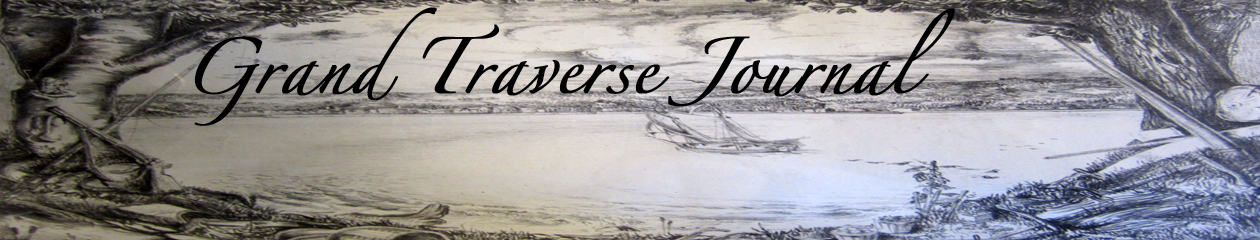
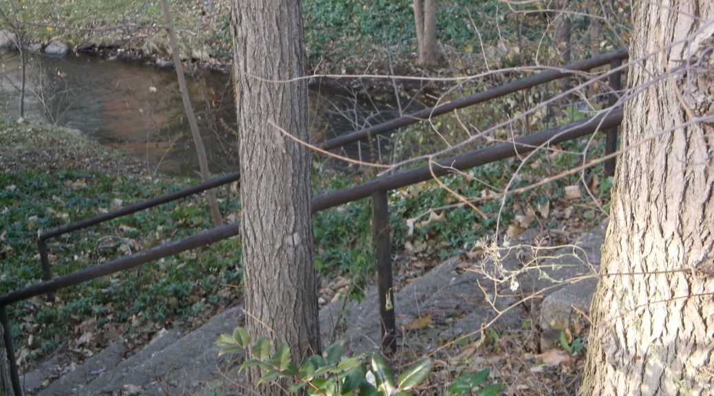
This stairway is all that remains of a formerly well-known nightclub in Traverse City that operated from the 1930’s up to 1970. It is located where Maple Street crosses over Kid’s Creek. What was the name of that nightclub? (Hint–the Kid’s Creek name might suggest the answer!)
Newspaper clipping from the Traverse City Record-Eagle, undated.
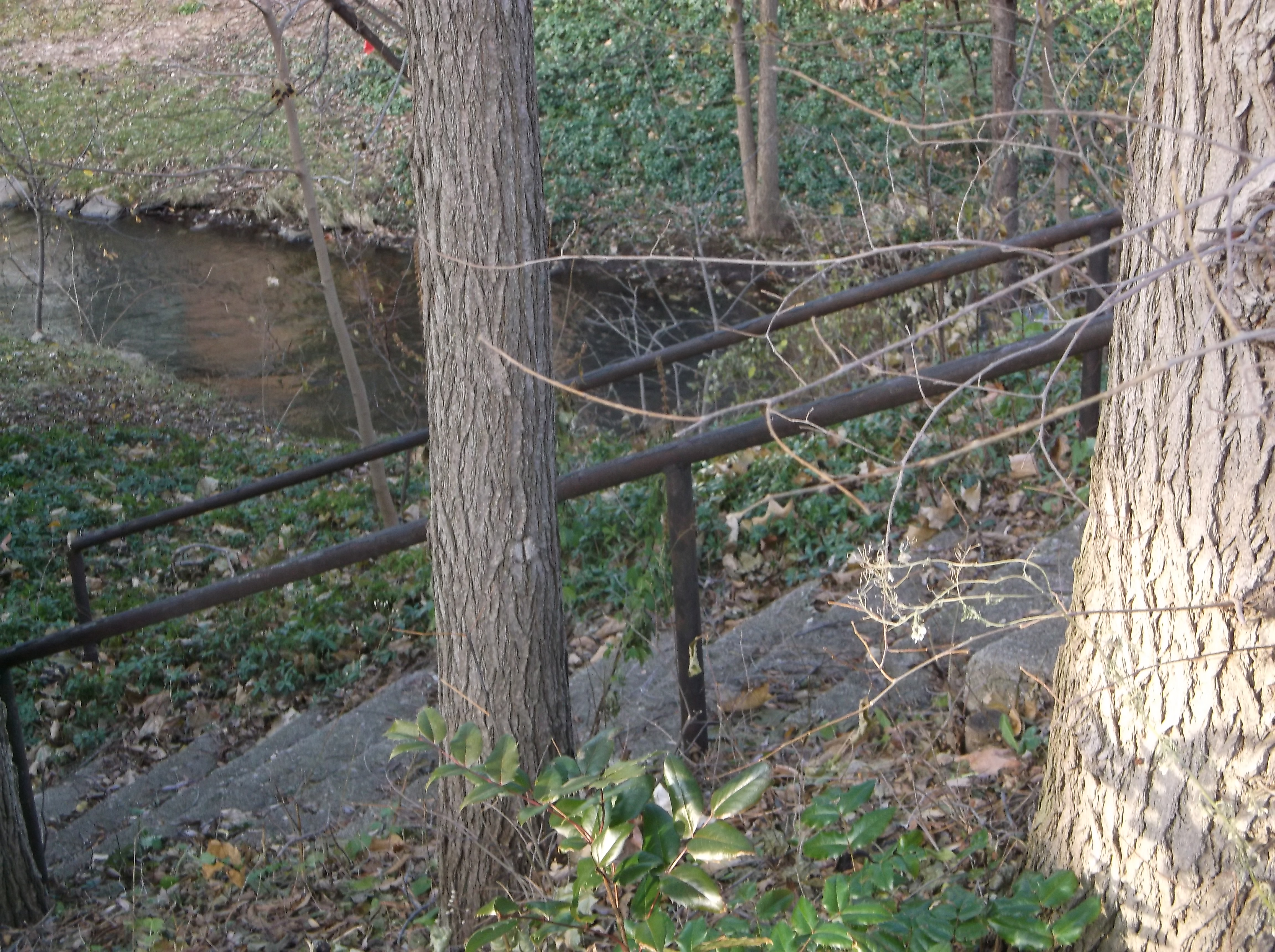
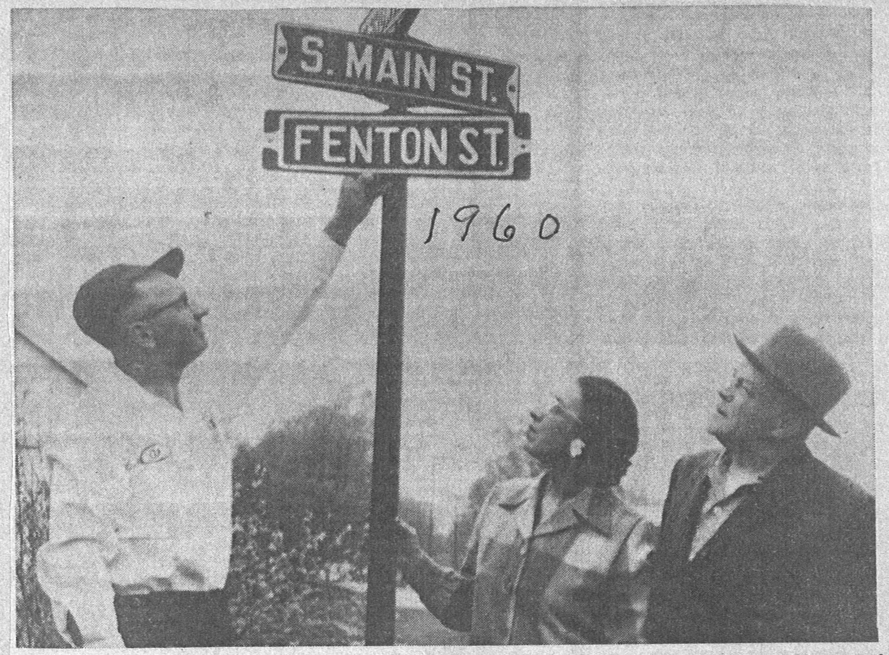
Why are Al Hoeflin (left) and Mr. & Mrs. Lane Fenton staring at these street signs in Kingsley in 1960? If you guessed that they are members of a signage admiration society, try again! Here’s your hint: What is unique about the sign that appears above “Fenton St?”
So what’s so important about these street signs? Kingsley was once two separate villages, Paradise and Kingsley Station… and each had their own Main Street! So, when the two eventually merged (sometime between 1900 and 1908), good ol’ Kingsley had two Main Streets. (The merger apparently involved much bitterness on at least one side, but the man who platted Paradise, Myron S. Brownson, did get to name the township and had a major street in Kingsley named after him.)
By 1908, the village began to distinguish between the two as North and South Main Streets. In 1960, the village finally had enough of the whole business, and renamed the street after a third-generation village family, the Fentons.
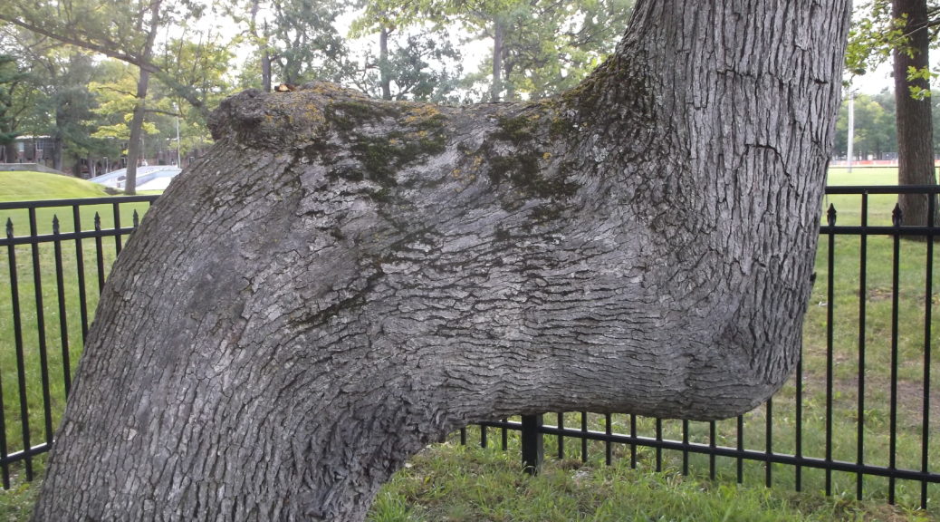
Congratulations to library patron Elizabeth, who successfully answered last month’s Mystery Photo! Indeed, the trail marker tree at the Grand Traverse County Civic Center was part of a trail that spanned from the Straits of Mackinac to Detroit.
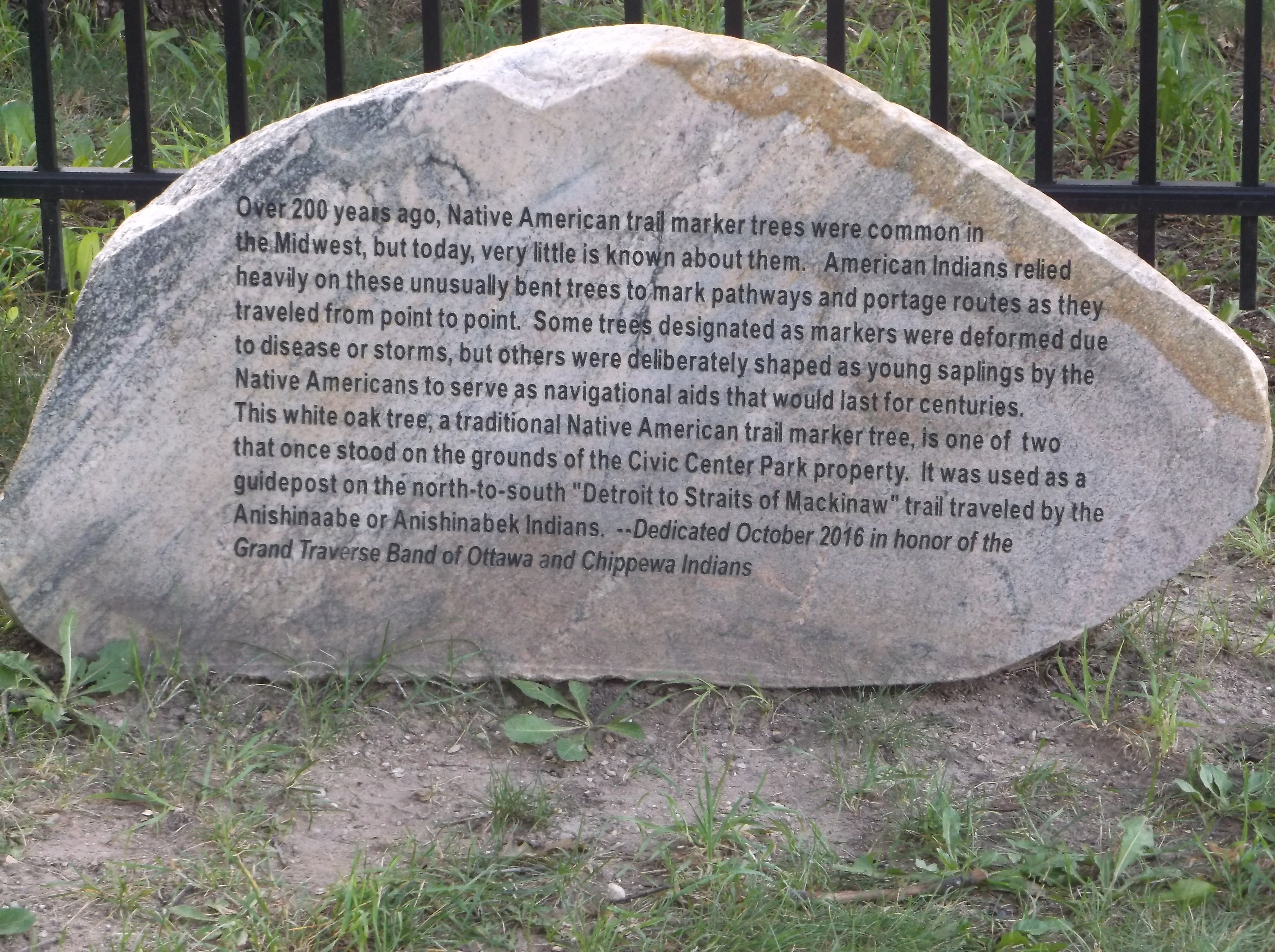
Plaque for trail marker trees at the Grand Traverse County Civic Center, image courtesy of Richard Fidler, August 2017.
Why are Al Hoeflin (left) and Mr. & Mrs. Lane Fenton staring at these street signs in Kingsley in 1960? If you guessed that they are members of a signage admiration society, try again! Here’s your hint: What is unique about the sign that appears above “Fenton St?”
A plaque near this white oak, by the Grand Traverse County Civic Center, tells the story of a number of trail marker trees found in Michigan. This tree was part of a navigational aid to assist travelers on a trail that ran from one point in Michigan to another, likely used by Anishinaabe or Anishinabek Indians. Some of the trees used on the trail were shaped deliberately as young saplings, while others were made notable by disease and storms.
So, where did the trail take you? We’re talking across the whole State, not just in our neck of the woods. Hint: If you go and see the tree, the marker plaque next to it will give you the answer! History Road Trip!
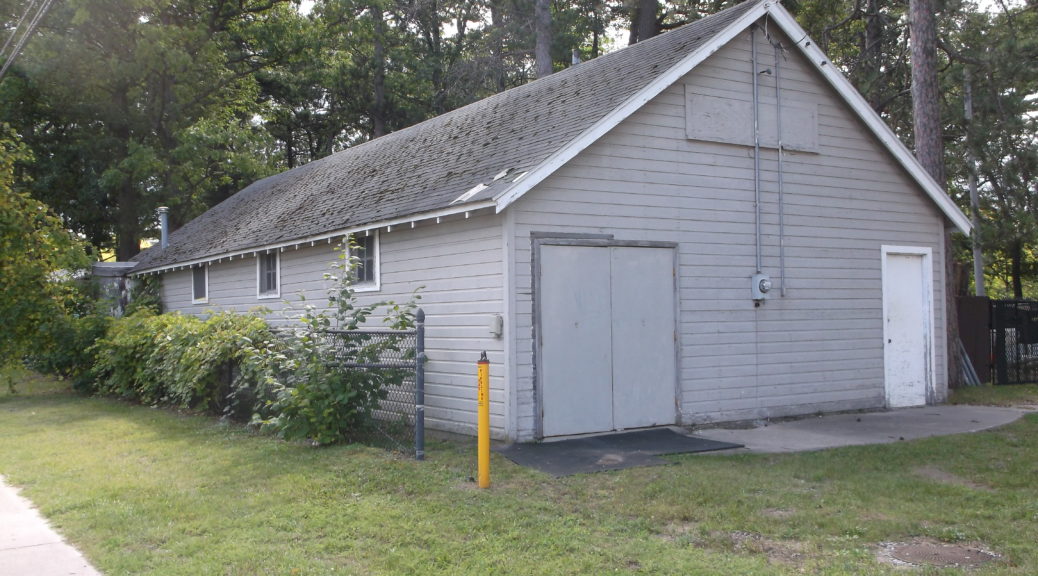
This building sits on the grounds of the Grand Traverse County Civic Center. What do you suppose this building was used for before 1974? Are there any unique features to this building that might give us a hint?
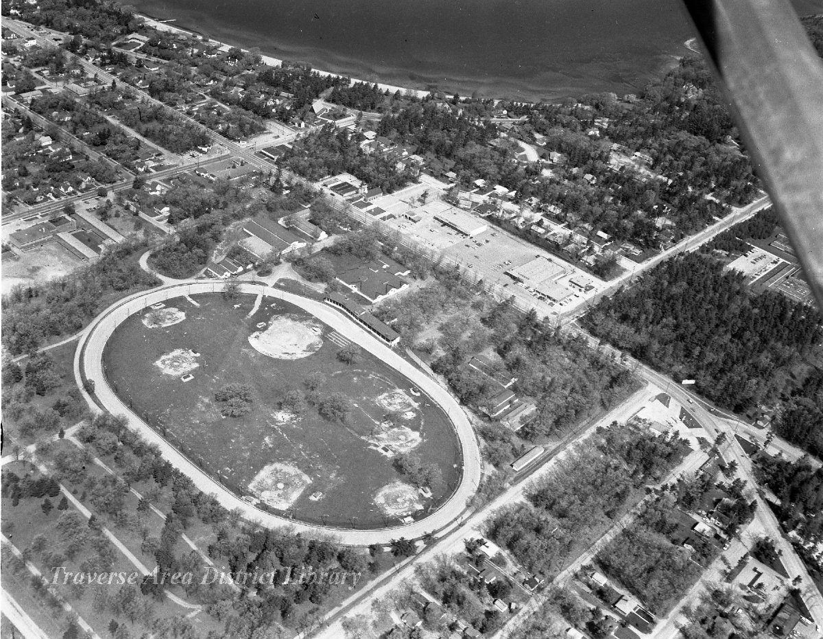
After a bit of back-and-forth with our knowledgeable audience, we know one thing for sure… and we’ll just have to speculate on the rest. This building was indeed a structure in use during the Grand Traverse County Fair at one time, the predecessor to the Northwest Michigan Fair. In the 1890s, what we now call the Civic Center was known as the “Driving Park.” Many sulky races were held here, then horse racing in general, followed by car racing and then the fairgrounds. This was a hopping spot!
Aerial image of the Civic Center, once known as the Driving Park. You can still see the racing track in this 1960s photograph, from the Al Barnes Collection at Traverse Area District Library Local History Collection.
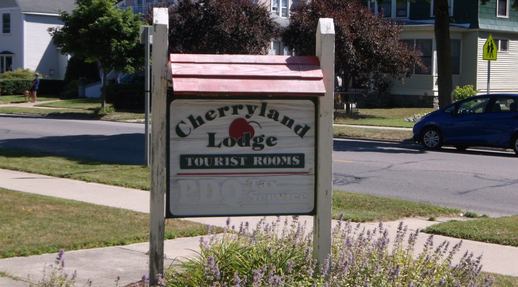
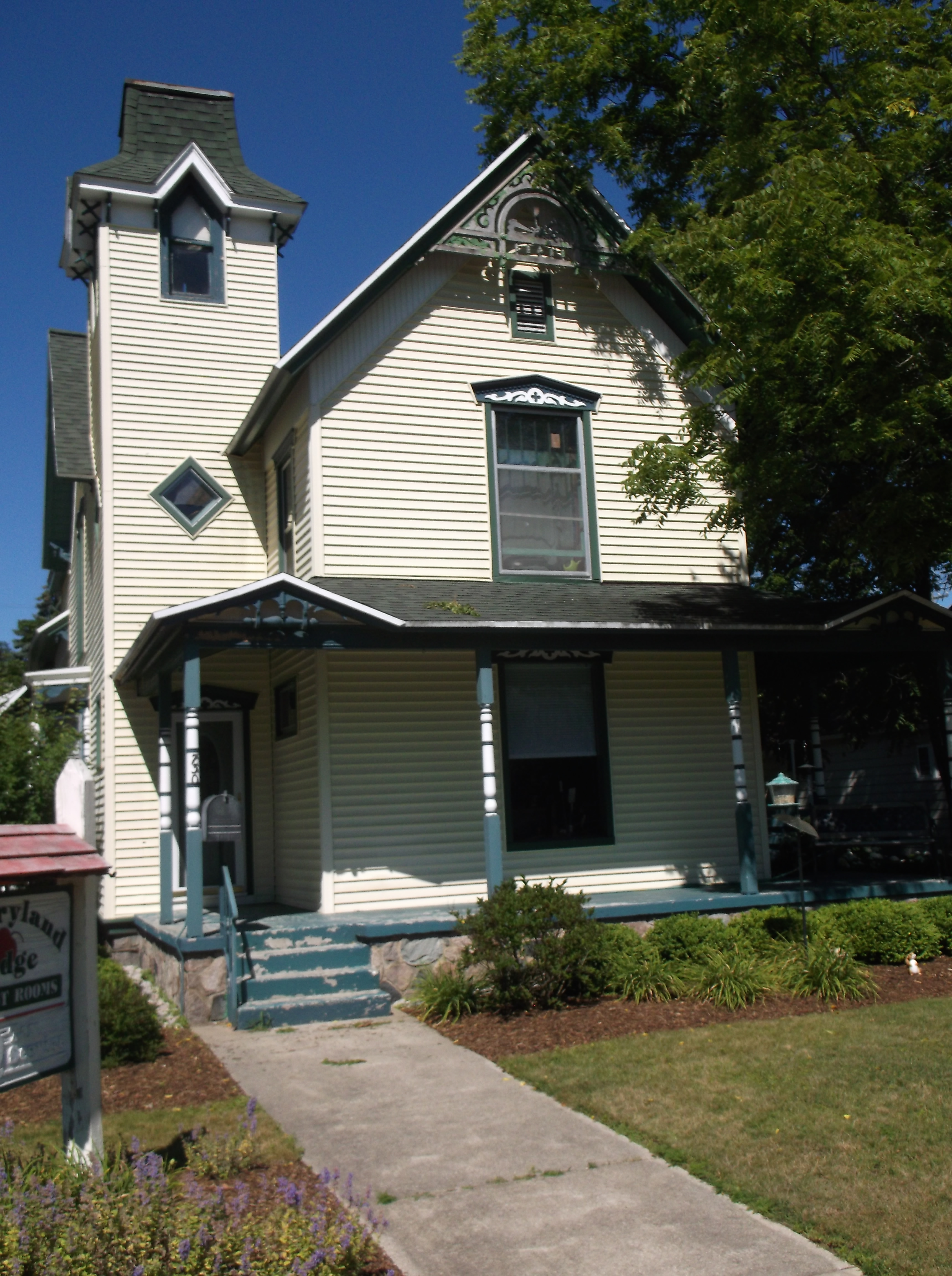
Here is an example of the original Airbnb, the Tourist Home! Do you know where this last “tourist home” is located in Traverse City?”
Bonus question: Do you know of other “tourist homes” in the area?
Congratulations (again) to Larry! You’ve won a free virtual stay at the Tourist Home of your choice, just close your eyes and imagine the splendor!
From Larry: “740 South Union Street, NW corner of Union and Eleventh Street. I don’t know if your second question relates to current Tourist Homes or prior. If the latter: ‘Southworth’s Tourist Home’ was at 116 S. Boardman Avenue, in at least the 50s and 60s.”
This building sits on the grounds of the Grand Traverse County Civic Center. What do you suppose this building was used for before 1974? Are there any unique features to this building that might give us a hint?
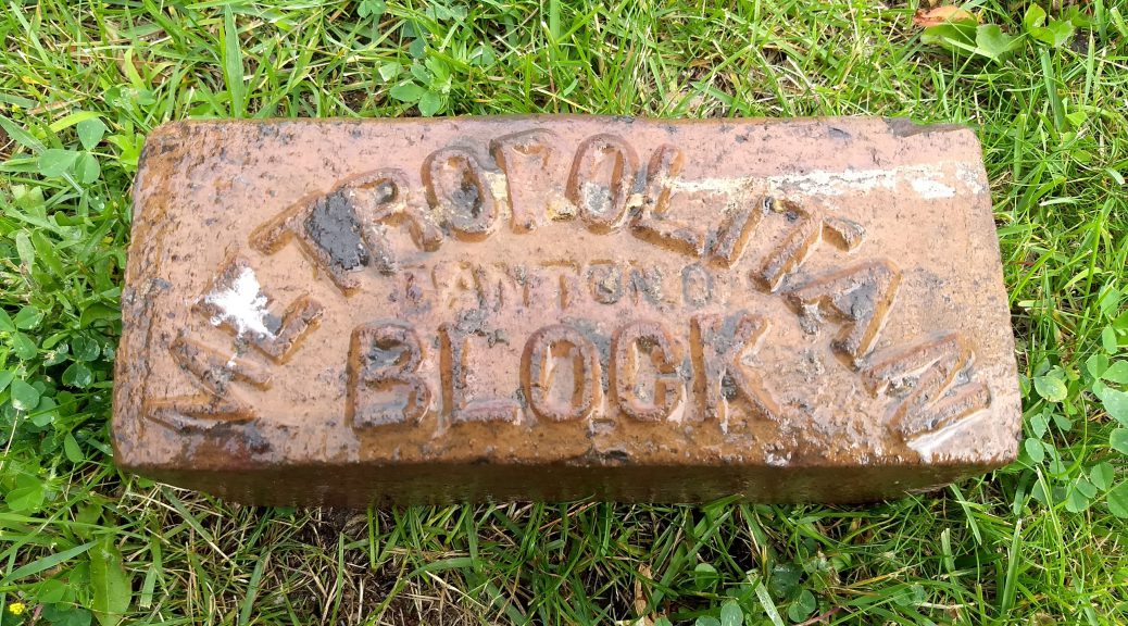
Just look at this beautiful brick street paver, a product of Metropolitan Block from well over 100 years ago! Like the Nelsonville Pavers, which we featured in a mystery photo way back in August 2015, this paver was, until recently, part of the roadway of Traverse City.
Here’s your question for July 2017: What two streets in TC are paved with brick?
Thanks to readers Cathy and Larry, we’ve got our answer! “Brick pavers are still visible on Sixth Street (Division to Union) and Eighth Street (Division to Union).”
Those streets may not be paved with gold, but they are paved with a whole lot of character!