Tag Archives: Grand Traverse Bay

Sudden Flooding Along the Bay: Are We Due for Another Seiche?

Map of Grand Traverse Bay, courtesy of WikiMiniAtlas.

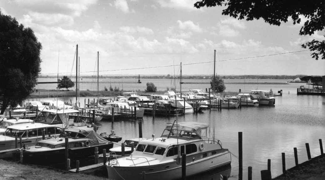
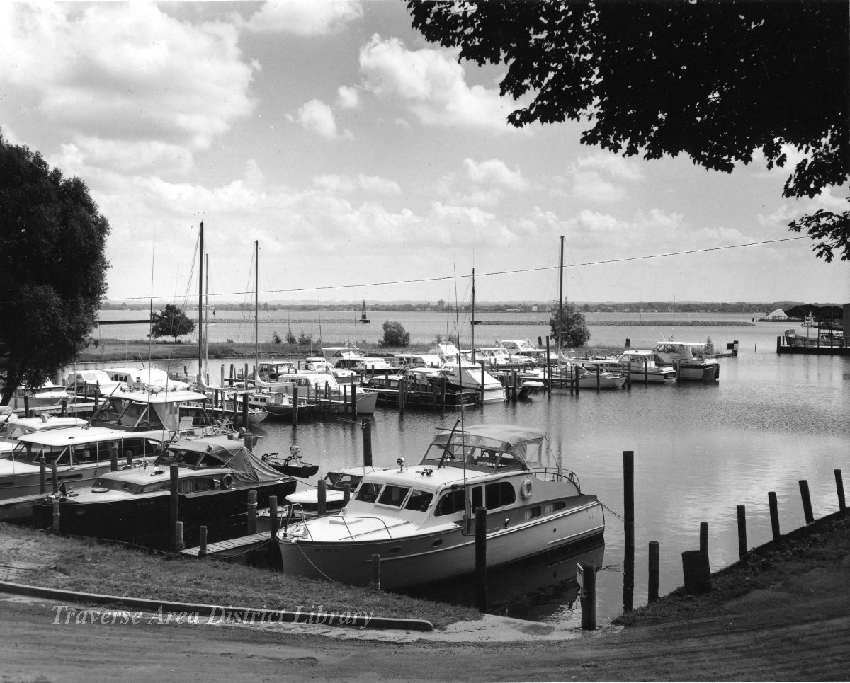
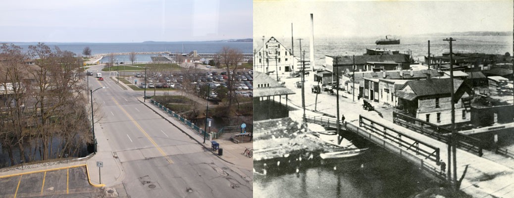
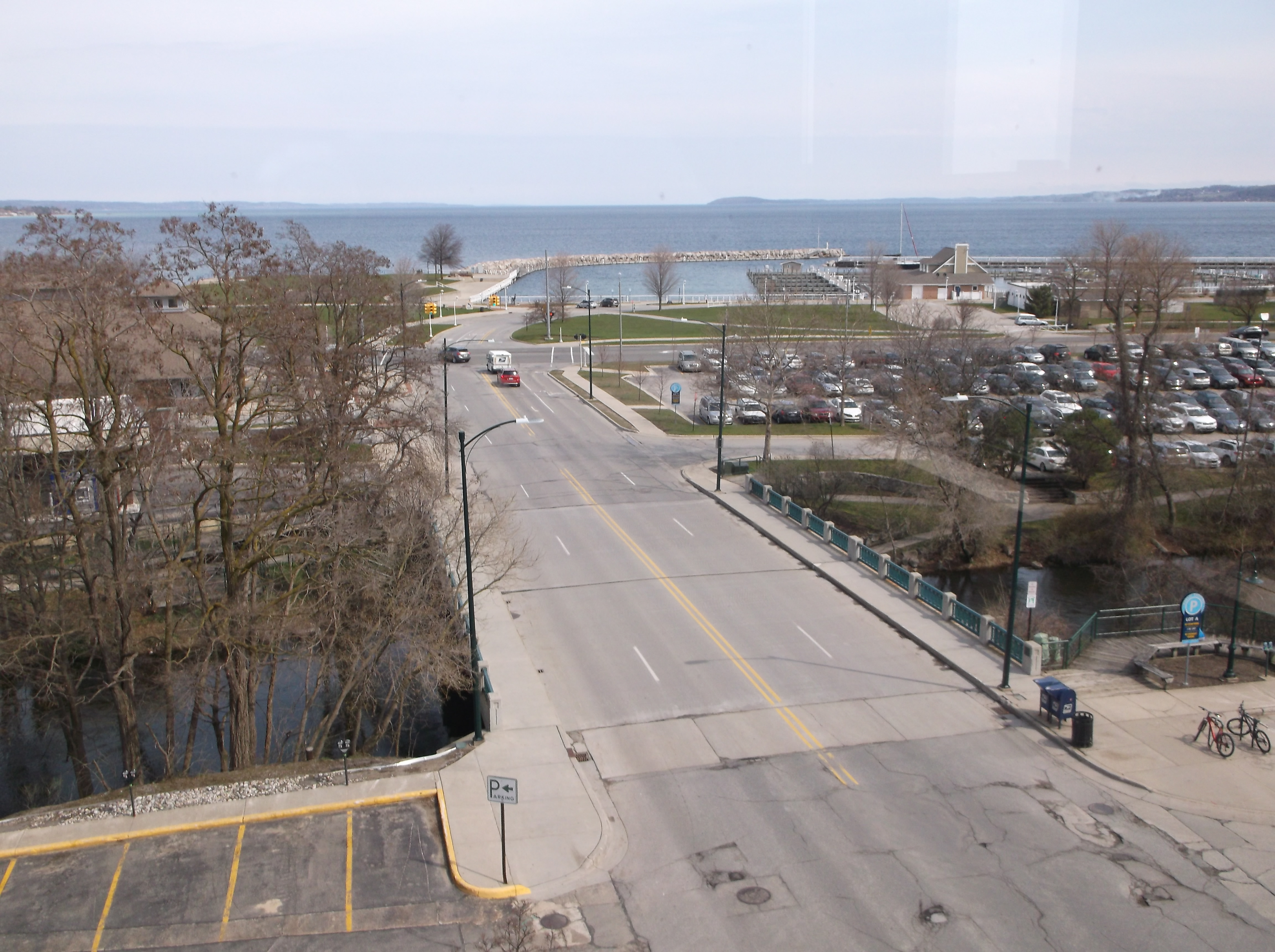
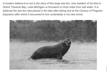
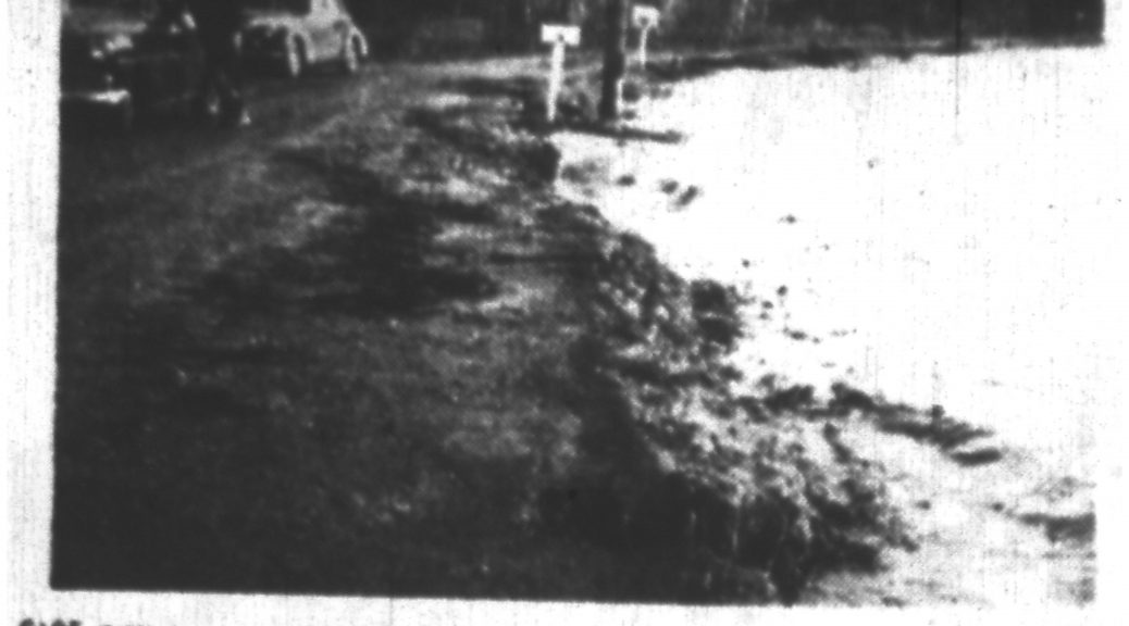
How many times has it happened?   Along East Bay, usually at night or early morning, the water surges up, rising four feet or more from its normal level, only to subside within minutes.  In the past, roads have been flooded, docks floated away, and debris swept into the water.  Houses and cottages have been flooded and cars damaged by the flooding such that they had to be towed away for repair.  West Bay gets them, too, but East Bay, especially at the south end, from Five Mile road west to the Birchwood area of Traverse City have been especially hard-hit.

The 1950’s experienced a number of these events, not just locally, but throughout all the Great Lakes.  At first, no one knew what to make of them: newspapers called them “Tidal Waves,” often using quotation marks since everyone knew they had nothing to do with the tides.  The only similarity is that the water rose somewhat gradually, and not with an abrupt crash of giant waves on the shore.  In 1952, the Traverse City Record Eagle declared no one knew what caused them, but that observation was soon to change: a surge of water with immense waves swept up on the Chicago shore on June 26, 1954, causing the deaths of ten persons.  That tragedy sparked interest among scientists studying the phenomenon.  They would soon uncover the causes.

First in a series of photographs documenting a seiche in East Bay, 5 May 1952, from the Traverse City “Record-Eagle” (used with permission).

Gordon E. Dunn, Meteorologist-in-charge of the Chicago office, realized that, on past occasions, the surges always occurred after the arrival of a pressure increase associated with a rapidly moving storm front coming from the north.  On July 6, 1954, just ten days after the devastating surge described above, conditions looked nearly identical to those of that day.  Based upon his understanding of the event, Dunn issued the first seiche warning. Somewhat to his surprise given his scant knowledge, a moderate seiche did strike Chicago, one that caused little damage, much to the relief of all.

Since those early times, we have learned much more about seiches.  They are associated with fast-moving storm lines, especially those moving faster than 50km/hr.  There must be a significant pressure rise associated with those lines, with a long fetch of water covering the entire width of a body of water—Lake Michigan or Grand Traverse Bay–making for more the most dramatic events.  One factor Dunn did not understand was the most fundamental thing of all: storm surges bounce off shores and send reflected waves outward to interact with those coming in.  It is like a basin of water with a water disturbance that reflects off the sides, sometimes building into surges that are magnified by the coming together of different waves.  Surges and the receding of water can go on for days as waves interact, just as water in a basin takes time to settle if it is disturbed.  All of this happens during seiches.

Second in a series of photographs documenting a seiche in East Bay, 5 May 1952, from the Traverse City “Record-Eagle” (used with permission).

East Bay presents another aspect of seiches.  It has vast shoals—shallow areas—that extend from the south and west shores.  When rising water strikes them, waves grow taller, driving farther inland.  One of the descriptions of a seiche claims that the water rushed 30 to 40 feet inland from its usual position, but only in areas at the base of the Bay.  This “shoaling” effect is known to increase the severity of seiches.

East Bay also presents an obstructed range of open water (a “fetch”) that enables waves free travel down its length.  By contrast, West Bay has a narrowing at Lee’s Point on the west side and Bower’s Harbor on the east, after which it widens at the south end.  Contours of the land also affect the severity of seiches, and East Bay seems especially suited to maximize high water surges.

Third in a series of photographs documenting a seiche in East Bay, 5 May 1952, from the Traverse City “Record-Eagle” (used with permission).

This is not to say West Bay has not experienced them.  On April 1, 1946, a resident of Bay Street in Traverse City reported the water level rose two feet before subsiding.  An older story is told that in March, 1891, the city had been withdrawing water from West Bay for household use by means of an intake pipe that extended two hundred feet from the shore under twenty feet of water.  When the pumps started racing one morning, it was realized that no water was being moved at all.  Upon breaking the ice that covered the intake, it was discovered that the water had receded to the point that the mouth of the pipe wasn’t in the water at all.  Soon after, water levels rose, and residents were able to get water for their morning coffee.  The peculiarity of this event—occurring when the Bay was frozen—sets one to wondering if some factor besides a seiche wasn’t operating.

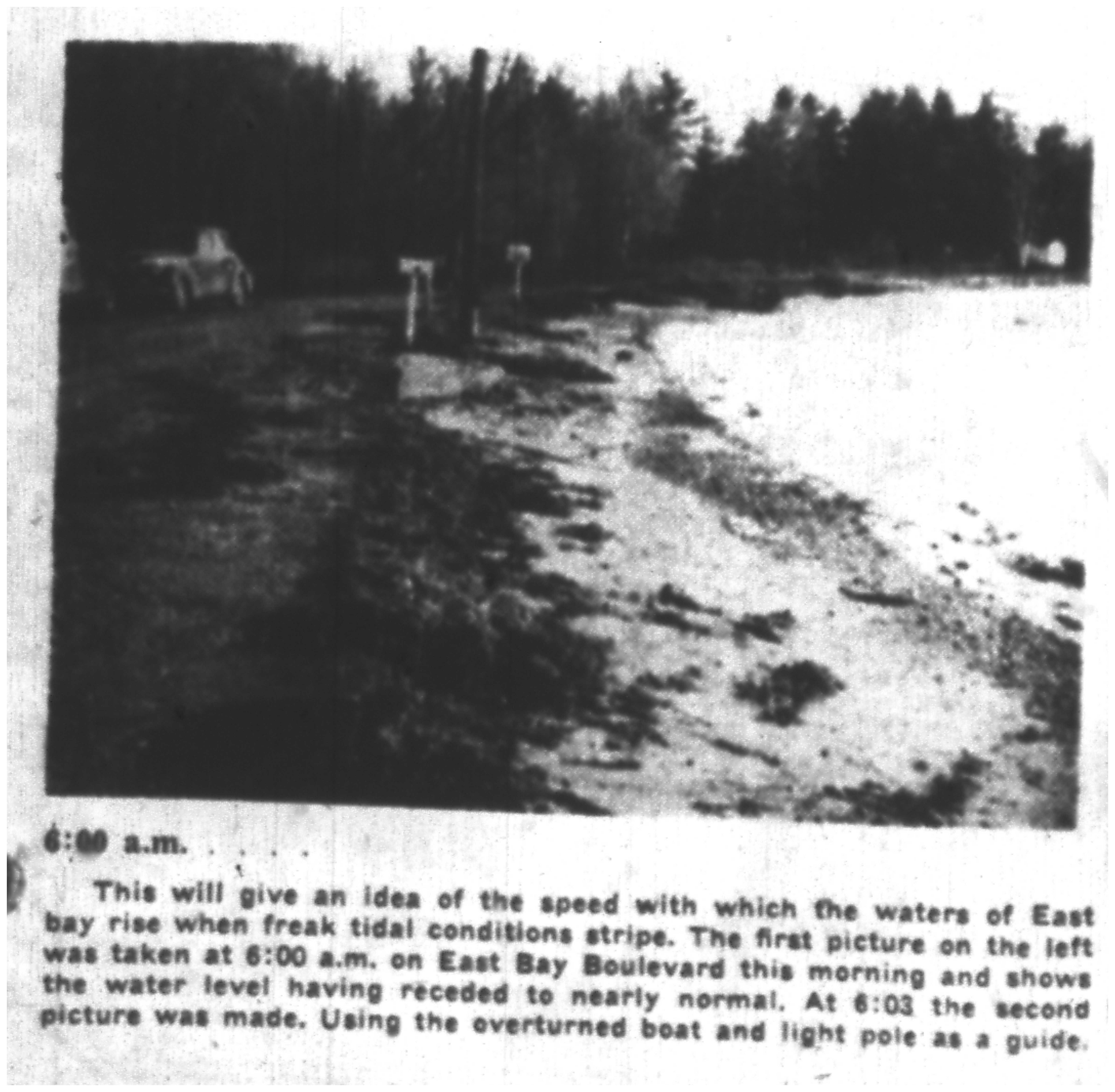
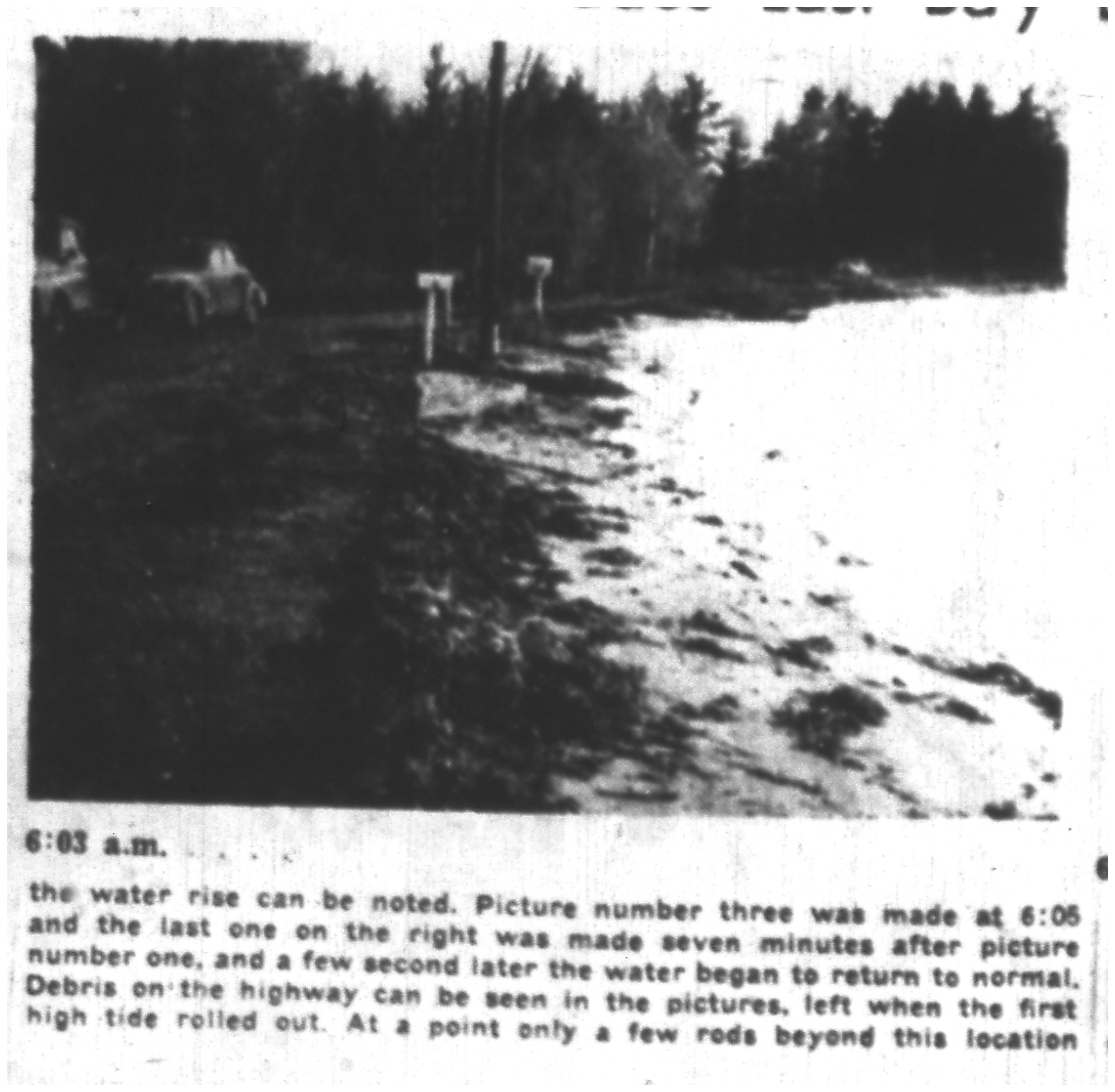
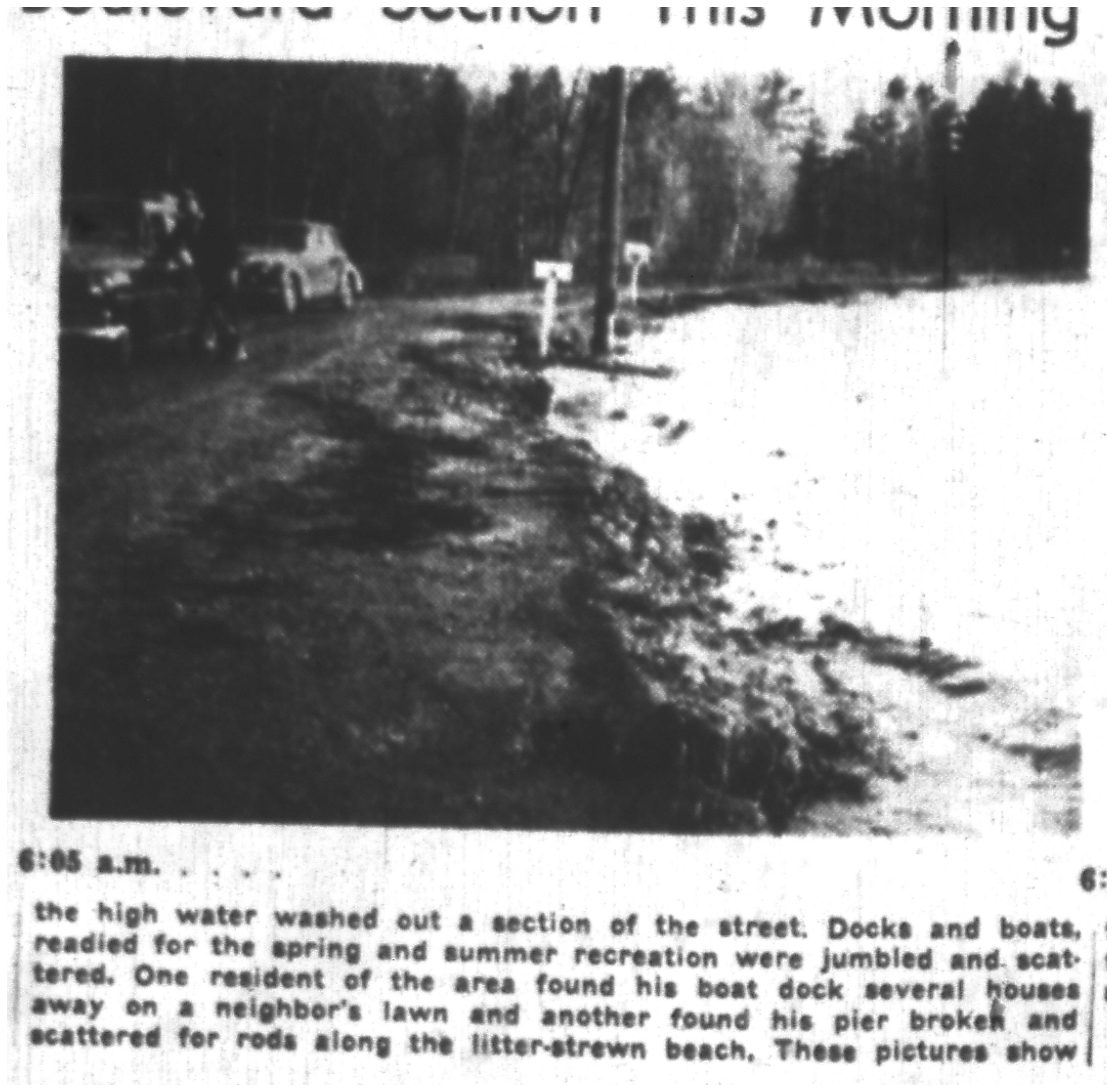
East Bay experienced three significant seiches in the two years 1952-53.  The May 5, 1952 seiche is interesting because we have access to hour-by-hour data about wind speed and direction.  Hour-by-hour after midnight the wind direction changed: 1:00 AM: out of the East at 7 mph; 2:00 AM: out of the west at 7 mph; 3:00 AM: out of the south at 10 mph: 4:00 AM: out of the west at 8 mph; 5:00 AM: out of the north at 12 mph.  The wind direction stayed out of the north after that time for the rest of the day.   Note the time of day: after midnight and early morning.  For reasons not completely understood, the biggest surges of water tend to happen in early morning up to noon.  Also note that the wind direction jumps from one direction to another, finally ending with a strong wind out of the north.  The effect is to pile up water on one side of the Bay, only to have it rush in from the north.  Given the contours of that body of water, that is exactly what you would expect in order for the biggest surge of water to occur at the southern end.

Fourth in a series of photographs documenting a seiche in East Bay, 5 May 1952, from the Traverse City “Record-Eagle” (used with permission).

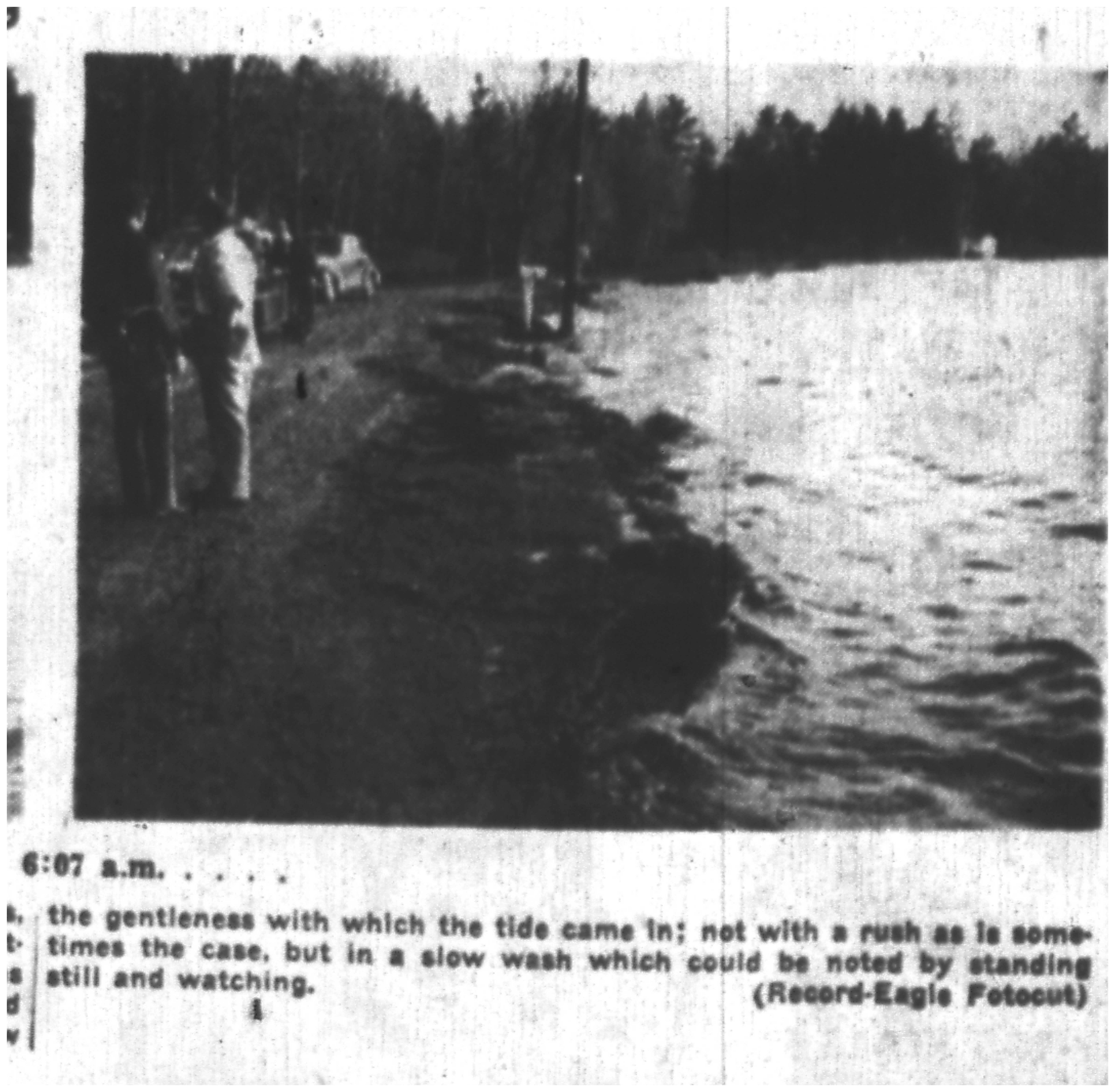
Residents on the south shore of East Bay notified the sheriff of the flooding shortly after 4:00 AM, a time fairly consistent with the wind change out of the north.  After the first surge, water rose again and again, but never reached the high water mark of the first rush.  That behavior goes along with our present understanding of seiches as disturbances in a closed basin with waves that reinforce each other at times.

When will the next seiche be?  Who can say?  We should beware when a fast-moving storm line moves in from the north associated with rapidly rising air pressure.  The National Weather Service now issues warnings when conditions are favorable for water surges and high waves, and persons living in vulnerable places should take precautions to protect their lives and property.   It has been some time since the last big one and it is easy to become complacent in the absence of memory.  After all, Nature acts whether we are ready or not for what she gives us.

The Five Wharfs of the Bay: a 1938 Study of Traverse City’s Land Use

A quality scholarly study is a valuable tool for any researcher, which is why so many reports, dissertations, and the like, have been preserved by Traverse Area District Library, Traverse Area Historical Society, and Northwestern Michigan College.

This piece of scholarship comes to us from Allen Belden, a student at the University of Oklahoma in 1938. His work, title “Land Utilization in Traverse City, Michigan,” provides a fairly detailed snapshot of land use at the time. This excerpt focuses specifically on transportation opportunities, especially the various points along the bay shore used by various companies. Maybe one of our readers is interested in updating this study?:

“The Transportation Patterns

Probably the most basic land use features of present-day Traverse City are its transportational forms. These lend themselves to a ready classification into three sub-types, namely, wharves, railways, and Streets. The patterns of these will be described and discussed separately.

Wharves: In Traverse City the facilities for waterway transportation consist of five wharves at which boats larger than very small craft, such as rowboats, may dock. Four of these are on the bay side of the peninsula formed by West Bay and Boardman River where they are centrally located along the city’s waterfront. The fifth wharf also is on West Bay, but it stands alone about one block east of the mouth of the Boardman River. From west to east these wharves are the Hannah, Lay and Company wharf, the J.C. Morgan Company wharf, two municipal wharves, and the Cherry Growers Canning Company wharf.

West Bay harbor. Perhaps a reader with a better eye for boats can help us date this photograph? Send responses to gtjeditor@tadl.org

Only a meager use is made of any of these wharves at present. Hannah, Lay and Company, distributors of coal and building supplies, use their wharf to receive and store coal. The J.C. Morgan Company, cherry and apple canners, receives shipments of coal by water. The westermost municipal wharf has on it a little-used public warehouse. The municipal wharves together enclose a small harbor which is used during the summer by small pleasure craft. Signs there advertise “Boats For Rent” and “Deep Sea Fishing”. The Cherry Growers Canning Company wharf is used not only to receive coal but occasionally also to ship canned cherries.

The present utilization of Traverse City’s shoreline for waterway transportation facilities is meager for several reasons. Grand Traverse Bay is about 30 miles long, and the city, which is at the inland ends of the bay, is not close to frequently used Great Lakes shipping lanes. The city’s commercial and manufacturing establishments are small, and in most cases they ship and receive goods in the less than boat-load quantities. Railways and trucks can transport small quantities of goods more efficiently than can lake boats. The number of places that can be reached by lake boat without extra bulk-breaking is small in comparison with the number of places that can be so reached by highway or railway. The southern end of West Bay, although better than the southern end of East Bay, is not a good harbor. It is more than two miles wide and exposed to the full force of northerly winds. The depth of water at the end of Hannah, Lay and Company wharf, which is three hundred feet long and extends into West Bay at right angles to the shoreline, is only thirteen and one-half feet. It is so shallow that none but the smallest of Great Lakes cargo vessels (2800 tons) may safely dock. Even these must partially unload before completely docking. In addition, Grate Lakes transportation is interrupted during about six months of each year because of cold inters. These conditions limit the use made of the present wharves and discourage construction of additional ones.

Other water bodies are even less used than West Bay. Boardman River and Boardman Lake are not navigable by boats larger than rowboats. An abandoned dam with a fall of six feet, between Cass and Union Streets, is an effective barrier even to these. The shoreline of East Bay is considerably shallower than that of West Bay and otherwise has the same disadvantages to shipping.

718000000493
“Traverse City’s first important industry,” according to Belden. Here is a fantastic image of the Hannah and Lay sawmill on the bay with the Boardman River in the foreground. Logs are banked and in the river. This was a steam powered mill with wood scraps providing the fuel for the boiler. The tall rocket shaped item is the sawdust burner. However, the date is incorrect. The mill was built in 1852. But, one can get a sense of the advantages this location provided for industry, as described by Belden. Image courtesy of Traverse Area District Library, 718.000000.493.

In spite of the scant use of Traverse City’s waterfronts for waterway transportation facilities, the shoreline where the present wharves are located has advantages over others. The most significant factor affecting the location of all but the Cherry Growers Canning Company wharf is that the shoreline so used has from the start been centrally located with respect to trade and industry within the city. Traverse City’s first important industry was the Hannah, Lay and Company sawmill which was built on the peninsula between West Bay and Boardman River near the northern end of what is now Union Street in 1852. This company cut logs in the Boardman River basin in winter and floated them downstream to the mill in spring. The logs were fed into the mill from the river bank, and then manufactured lumber was loaded into the stern hatches of timber boats which docked a few yards away on West Bay. This was an admirable arrangement, since it reduced the handling of logs and lumber on land to a minimum. No other site in or near Traverse City had comparable advantages for such an industry. later, when railways entered the city, in 1872, 1890, and 1891, their chief objective was this mill, and the site of the early lumber wharves became a contact point for railway and waterway transportation as well as a focal point for railways. Because of this and the fact that Boardman River has been bridged by two north-south streets to improve the accessibility of the peninsula from the south and east, commercial and manufacturing establishments were attracted to the vicinity of the old mill. Even today this area is centrally located with respect to land transportation routes, and , for that reason, such companies as use Great Lakes shipping find the location favorable for wharves.

Cherry Growers Canning Company, aerial view from 1947, shows wharf and railroad spur. TADL Historical Society Collection, 3303.
Cherry Growers Canning Company, aerial view from 1947, shows wharf and railroad spur. Image courtesy of Traverse Area District Library, 3303.

The Cherry Growers Canning Company wharf is now and, except for the fact that it is not located near the heart of the city’s transportation pattern, enjoys all of the advantages of the older wharves. A special spur was needed to give it railway accessibility, however.”

From Sea to Cemetery: History is Happening in Leelanau County, Picnic in Grand Traverse

This month’s “News from the Societies” features our wonderful neighbor to the north, Leelanau County! Whether you’re looking for a fun exhibit for all ages, or you’re looking to do some hands-on history conservation, June in the “LC” is where it’s at! Special thanks to Stef Staley, Director of Grand Traverse Lighthouse, and Kim Kelderhouse of Port Oneida Community Alliance, for keeping us informed through their newsletters and Facebook pages. You, dear reader, can also stay informed directly at their respective online presences, linked below for your pleasure.

Also, join the newly re-named Traverse Area Historical Society at their first summer picnic! See below for details.

Grand Traverse Lighthouse

aircraftcarrier
Image courtesy of Grand Traverse Lighthouse.

The Lake Michigan Aircraft Carrier Exhibit has been wildly popular for the Grand Traverse Lighthouse, and if you haven’t seen it yet, you are seriously overdue! But, lucky you, the Lighthouse plans to continue the exhibit for the 2016 season (“with key additions,” teases their website). The exhibit features the history of the USS Sable (IX-81) and USS Wolverine (IX-64). Both were converted to freshwater training aircraft carriers, used on the Great Lakes between 1943 and 1945. 20,000 pilots and landing signal officers were qualified on those vessels. There are awesome stories, sweet replicas, and whole myriad of photographs and histories to look at. Don’t wait, get on up there in June!

Port Oneida Community Alliance

For hands-on fun, look to the Gravestone Preservation Workshop, hosted by the Port Oneida Community Alliance, in partnership with Cleveland Township, Leelanau County. A number of local cemeteries could use a little help in preserving their headstones, so consider getting trained at this event, and Your Editors will be glad to point you where your expertise is needed!

Cemetery Flyer

Traverse Area Historical Society

Blackman School Picnic, 1903.
Blackman School Picnic, 1903. Image courtesy of the Floyd Webster Historical Photograph Collection, Kingsley Branch Library, Kingsley (Mich.)

Join the Traverse Area Historical Society at our first social picnic of the year, at the  Civic Center Pavilion on Sunday, June 26, 2016, from 12-4p.  The Society is hosting this favorite event of years past, to bring their members together and reminisce about the simpler times. Your presence will make the picnic a success! Please bring your stories and a dish to pass! Place settings and beverages provided.

Union Street at the Bay: Two Views Separated by Time

Overview of the north Union Street bridge over the Boardman River taken from the tower of the Traverse City State bank. Steamer ”Puritan” on the bay, ca. 1910-20. Image courtesy of Traverse Area District Library, Local History Collection.

Taken from third floor of the Fifth Third Bank building (formerly, the Traverse City State Bank), two photographs taken more than a hundred years apart tell us about the dramatic changes Traverse City has experienced with regard to its water front.  The older picture shows a waterfront dominated by industry and the railroads.  The original Morgan canning plant, looking like an A-frame, occupies space at the very end of Union Street.  The railroad station stands to the left, tracks running along the Bay in either direction.  Ramshackle frame stores line the east side of Union, north of the northern-most bridge over the Boardman River. 

View from Fifth Third Bank at 102 W Front Street, looking north. Image courtesy of the author.
View from Fifth Third Bank at 102 W Front Street in April 2016, looking north. Image courtesy of the author.

The recent picture startles us with its emptiness: no railroad station, no manufacturing plants, no railroad tracks.  Open space and parking lots take their places, along with an expressway (Grandview Parkway), and a marina, with slips unoccupied on this early spring day. 

Suitably, the Visitors Center replaces the train station, a change symbolic of how the Bay has come to be seen.  No longer was it regarded as a place to load and unload the stuff of industry.  Instead, it became a place to appreciate natural beauty in all four seasons.  But the capitulation of space to provide for the needs of automobiles poses a contradiction: Can the noise and fumes of cars coexist with the fragile beauty of the Bay?  City residents hold starkly different opinions.

Grand Traverse Bay, the Loch Ness of Northern Michigan?

by Julie Schopieray

People in general are fascinated by the unknown: Bigfoot, Loch Ness, and UFOs.  What is it about the unexplained that keeps us interested?

 Historically, our region is no exception. Around the turn of the twentieth century, sightings of strange creatures in the waters of Northern Michigan were quite common- some real, most imagined. The best known at the time was the famous sea serpent of Petoskey, which showed itself in Little Traverse Bay for several summers in the 1890s and became a novelty that resorters looked forward to each summer. The mystery was solved in 1895 when it was discovered to be nothing more than a  “very crooked tree trunk that has been beating about in Little Traverse Bay for years. Its peculiar shape and the fact that it had become black with slime…gave it a very serpent-like appearance.”  The Petoskey sea serpent was celebrated for many years even after its real identity was discovered. Their baseball team was even called the Petoskey Sea Serpents— complete with a plaster serpent mascot that traveled with the team.

Other creature sightings occurred at various resort areas such as Omena and Harbor Springs. Most people made light of the sightings and it was all for fun.

 Distinguished Monster Here for his Annual Outing Near Omena. The resort business of the north is now assured as the regular summer attraction has arrived and has begun daily performances near Omena. The Sea Serpent, which has been so minutely described by summer visitors for several years, made his first appearance a few days ago and was seen by two carpenters working at Omena Inn. He seems to be in the best of health and looks as if he had enjoyed life the past few months. Just what his scheduled program for the summer will be the Eagle has been unable to learn but he will no doubt be friendly at all the ports and pay Traverse City a visit too.” [Daily Eagle June 1898].

 In 1903,  a “sea serpent” in the Boardman River near the Cass St. bridge drew attention from curious locals. “County Treasurer George W. Steward claims to be the discoverer of the monster, and may be seen frequently pointing out the “horrid green monster” to his friends. “It” is there all right, and his friends can see it for themselves, but it doesn’t move, and seems to be located in the same place all the time. Of course, it is sunning itself, but then, too, it may only be weeds and water grass collected together, which gets its snake-like motion from the current of the river…Anyhow, it is there.  ~Traverse City Evening Record 17 July 1901

 In the summer of 1907 several people saw in West Bay, what they claimed was either a sea serpent, walrus or a sea lion. On June 25, the newspaper reported that Captain Dave Duane spotted something on the beach, was four feet or more long  and “barked like it was a sea lion” . The Captain was in a rowboat when “dead ahead there sounded a terrific splash and a noise, half grunt, half bark, followed it… a moment later he was drenched by another splash…as the tail of the sea serpent, sea lion, octopus or whatever it is, broke the surface.  He had just time enough to catch a glimpse of a body perhaps four feet long and seemingly covered with a dark brown hair. The head of the animal was flat and the nose pointed while two sharp white tusks protruded from the mouth. Others saw it as well, and the newspaper reporter stated that “the telephone in the Record office buzzed frequently…the news that a real live sea serpent… on the west side travelled rapidly.”

A  day later Frank Birdsall claimed that he saw a very large animal that had to be either a seal, sea lion or walrus. Mr Birdsall was sitting on the beach near their home just after sunset when a fish leaping from the water attracted his attention. The fish jumped again in a few seconds but this time was followed by a seemingly gigantic form. This so excited him that he took no notice of what happened to the fish. Mr. Birdsall says that he can offer no estimate as to its length but as the animal left the water very near in-shore, he is almost certain that it is covered with scales or else a hard skin instead of hair. There are still many skeptical people in the city but Captain Duane and Mr. Birdsall can readily convince them of the material existence of some aquatic animal. -Traverse City  Evening Record,  25 &26 June, 1907

postcardsealionWord started to spread that perhaps this creature was “Big Ben” a trained, performing sea lion that had escaped in November, 1903 from the Lincoln Park Zoo in Chicago.  The Big Ben story made news all across the midwest and sightings continued for more than seven years after he escaped.  The incident fueled a series of articles, mostly in Chicago papers –which were widely read by Traverse City citizens– that played up the escape as a humorous event, humanizing the animal and making light of the “motives” of his escape.  One poked fun about the animal refusing to return to the zoo until he got union representation and a “nine hour day”, and many others that related sightings to the over-consumption of alcohol.

The legend of the absentee sea lion of Lincoln Park  lived on in the press for many years. Several reports of his death were announced beginning in 1904 when his body was supposedly found on a beach fifteen miles south of St. Joseph, Mich.,  and obituaries continuing as late as 1910 when it was proclaimed that the sea lion had been captured and killed by fishermen in Galveston Bay. The real truth is most likely the earliest account and the 1907 Traverse City encounters with something that looked very much like a sea lion helped sustain the appeal of the missing animal.  Sensational stories sold newspapers and continued “sightings” led to the story of Big Ben being drawn out for quite some time.

For Traverse City, this story ends with the two 1907 sightings. Nothing more about the creature is reported, but the mystique of his fate remained and the question of whether an ocean animal could survive for an extended time in the waters of Northern Michigan was debated by many.

In  June 1935, another  large aquatic mammal  was spotted in the bay and confirmed to be a seal. Photographs were taken and the story of the animal made newspapers around the region, even featured in the October issue of Hunting & Fishing magazine.  A humorous  account of the 1935 sighting, written by Detroit News  writer Herbert C. Garrison, was published in The News and in The Michigan Alumnus.   

It seems that for some weeks now the good folk of Grand Traverse region have been coming in from their fishing expeditions saucer-eyed and panting, with reports of having seen some strange marine monster disporting itself in the limpid depths of the bay. These reports have resulted in a series of theories as to the identity of the monster, all of them completely unauthenticated. Among the principal theories were these:

sealionThat it was a sea-serpenta sea lion…a walrus…a whale…an alcoholic mirage…Primo Carnera [Carnera was a professional boxer of very large size]… Purely in the interest of science, Mr. Sackett the other day determined to seek out the truth of these conflicting rumors, which have kept the neighborhood in a turmoil and have ruined the summer romance business on account of nobody daring to go out for moonlight sails…Sackett assembled himself a sea-going safari consisting of one outboard motor boat, one camera, one pack of films, one harpoon (for defense purposes only)….Sackett before leaving had imbibed only in two bottles of sarsaparilla and a hot dog (this to clear up any misunderstandings falling under the heading of Theory No. 5 above), the Ray C. Sackett Grand Traverse Bay Monster Expedition shoved off with a yo-heave-ho. We now turn to the the written record of the expedition in Mr. Sackett’s own hand, found floating in a sarsaparilla bottle which the intrepid commander dropped overboard to make sure the results of the expedition’s research would be preserved for posterity, even if the expedition itself failed to make shore… “We were proceeding with a spanking breeze on our quarter and approaching a large flat rock, about 500 yards offshore, when McGonigle, who was acting as look-out, sang out: ‘Monster Ho-o-o-o!’…I looked, and yessir there he was, sunning himself on the rock. McGonigle said it was a walrus. I said it was a seal. ‘It can’t be a seal,’ McGonigle pointed out. ‘He ain’t got no hat on. I’ve seen lots of seals in circuses. They always wear hats.’  Well, that was a stumper, until I finally got a great idea. ‘Throw the harpoon at him,’ I ordered. McGonigle threw. The monster caught the harpoon in its mouth, tossed it into the air, and balanced it on its nose when it came down….Then to cinch the matter, the seal looked toward me and distinctly said: ‘Werp!’  According to McGonigle, who hasn’t missed a circus since he could carry a pail of water, this is the old Forepaugh & Sells Bros seal dialect, now almost extinct, and means: ‘Brother, can you spare a herring?’’” Thus was the Grand Traverse Bay Monster identified. As to how he got here, I think I can clear up that point, too., I have been told there was a troupe of trained seals at the Chicago fair last year, and that one of the seals got into a rundown condition because of too much night life and was advised by his physician to take the baths. So he slipped off into Lake Michigan one night, and liked it so well he never came back.

There were no  further documented sightings of this particular animal and its fate is unknown.

An article about the history of  Traverse City sea serpent sightings over the years was written in the popular “The Observer” column in 1948.  Author Jay P. Smith  first mentioned the famous  Petoskey serpent, as well as the 1907 Traverse City incident when “that horrendous creature who, fifty years ago, emerged dripping from the bay, waddled up the beach and stole a whole critter out of the Brosch slaughter house in the southeast corner of the bay and lugged it back into the water. That was, without doubt, one of the best sea serpents Northern Michigan ever produced.”  Smith tells of fakes that were planted by pranksters for fun. “One of the smaller ones was the one Art and Bert Winnie built and arranged on a pulley just off the old Hannah & Lay lumber dock with the ropes running to the dock. A person concealed between the lumber piles could pull the ropes so the monster would raise its horrible head above the water, glare around and then submerge. Many old, short people today owe their shortness to having been scared our of several years’ growth by that serpent.”  The article concludes with this: “It became necessary for Traverse City to go out of the sea serpent business years ago. The bay got so full of them and people saw so many of them, that summer guests starting going to places where there were no monsters. They darn near ruined this community as a vacation center. So, if you hear any reports in the bay or see one, keep it to yourself. We don’t want to scare our visitors away.” [TCRE 17 July, 1948]

We are long overdue for another sea serpent sighting in the bay, but with today’s technology,  the mystique of the unknown would  likely be ruined.  I think I’d prefer the mystery of whether it was real or imagined as it was a hundred years ago.

Julie Schopieray is a regular contributor to Grand Traverse Journal.

A Strange Phenomenon: The Bay Boils and Surges

Like Sherlock Holmes, historians are on the prowl for interesting cases.   At times they cry out with enthusiasm, “The game’s afoot!” when they discover something that engages their attention so completely that it overrides their sense of public presence.  So it was when I came upon the following article from the Morning Record, dated June 15, 1899:

Strange Phenomenon

Power Island, March 24, 2015. The island has carried several monikers, listed here in roughly chronological order: Hog, Harbor (or Harbour), Marion, Ford, and now Power.

The annual explosion in the bay, opposite the G.R. & I depot occurred Monday. The water boiled furiously for several minutes and finally burst into the air with considerable force raising a large body of water about four feet above the surface.  These submarine disturbances have been a mystery for many years and as yet no explanation has been made to account for the disturbances.  The gushing of the water was observed by several persons yesterday.

Lucille Zoulek’s index to local newspapers indicated another article upon the same subject thirteen days later.  It gave even more details:

Boiling Again

There was another submarine explosion on the bay yesterday east of the G.R. & I depot.  The water was thrown into the air about 20 feet and the commotion was vigorous and continued several minutes.  Some persons in a boat chanced to be over the spot at the time and they had a lively time for a few minutes. This is the third eruption of the kind this season.

The G.R. & I depot was located near the water where the Boardman River empties into the Bay.  In the first account, the water boiled and burst four feet high, but in the second, it shot up some twenty feet high.  Indeed, boat passengers nearby would have a lively time of it. This was not a trivial rise of the water which occurs as a result of different air pressures on the Lake basin, but was something far more dramatic.

Questions arise like the bubbles of the furious bay: Was the account true?  Was it accurate?  Had such eruptions been observed in the past—or afterwards?  Did they occur at the same time of year?  And, finally, what causes them?  Most troubling to this historian is the bare fact that he is neither a geologist nor a student of the phenomena of the Great Lakes.   Still, there is the love of seeking out answers, a curiosity that grabs you by the neck and pushes you forward.  “The game is afoot!”

The first article indicated the phenomenon had been observed “for many years.”  The first thing to do would be to locate other articles that could give new locations, new times of year the eruptions occurred, and new descriptions that might shed light on its nature.  A fellow historian searched not the deepest recesses of the state archives, but the deepest recesses of the internet.  She turned up the following account recorded in the Jackson Citizen-Patriot, August, 1883:

In Grand Traverse bay recently, at some distance out in deep water, between Traverse City and Marion Island, the water began to boil and surge, and presently rose in vast jets to the height of from 10 to 20 feet.  Being observed from the shore no details could be given on account of the distance, but the same thing had taken place years before and some two years ago, according to an account given by the Herald at that time, parties in a boat were so nearly on the spot that they were obliged to hasten out of its way.  They describe the water as apparently boiling from the very bottom of the bay, which in that place was nearly or quite one hundred feet deep, bringing up with it vast quantities of mud and other substances and emitting an intensely unpleasant sulphurous smell.  The area of the eruption, if it may be so called, was about twenty feet in diameter and the time about half an hour.  At intervals the water would subside into calmness and then the commotion would begin again.  It is said by old settlers that the same thing has occurred in other years.  The disturbance is always in a line between Traverse City and the island.  It is well known by old residents that there are places in the bay where salt water springs bubble up through the water, in the neighborhood of the island.  It is possible there are submarine openings of other descriptions, either volcanic or otherwise.  It is know to scientific men that there is a tract of country on the eastern shore of Michigan, in the neighborhood of Thunder bay directly across the state from Grand Traverse bay, where slight earthquakes are frequent, and in fact the bay was named by the Indians from the rumbling noise that from time to time was heard in the interior of the earth.  It is possible that the tidal waves, as well as Traverse bay disturbances, may arise from volcanic action as a common cause, and all newspaper readers are well aware that there has never been a time within the memory of the present generation when the earth seemed to be in such a state of internal agitation as at the present, many of the known volcanoes of the world being in active eruption, now ones breaking out where none were known before, and earthquake shocks, both slight and severe, frequent in every part of the world.

This eruption was in August!  So they do not always occur in June.  The location was somewhat different: Marion Island (now known as Power island) is some distance from the city.  However, upsurges and boilings occur along a line that runs from Traverse City to the island.  Would that imply an underwater seam of rock exists there?  Could that suggest a cause?

This eruption occurred in a deep part of the Bay at a place “more than a hundred feet deep.”  Furthermore, it sent up mud to discolor that water and emitted a “sulphurous smell,” an observation that set the editor to wondering if volcanic activity might be responsible.  At a time before plate tectonics and fault lines were understood, that suggestion was reasonable: after all, weren’t volcanoes like Vesuvius erupting all over the Earth?  Krakatoa was making ominous rumblings, though it’s eruption would occur later in August.  In the light of our present knowledge about volcanoes and earthquakes we reject the likelihood of volcanic activity so close to home.  There must be another explanation for event.

This book is available for inspection at TADL, Woodmere Branch in our Nelson Room collection, or online at http://hdl.handle.net/2027/hvd.32044082044298.

Once again, my historian friend comes to the rescue: she sends me a link to Alexander Winchell’s, A Report on the Geological and Industrial Resources of the Counties of Antrim, Grand Traverse, Benzie and Leelanaw in the Lower Peninsula of Michigan, printed in 1866.  On page 59 a clue jumps from the page that helps me to understand the cause of the “strange phenomenon” upon the bay.

The well authenticated existence of an ancient salt spring on the neck of land connecting Harbor (Hog) island (now, Marion or Power island) with the peninsula, I should regard as a confirmation of this opinion [that the salt/gypsum layer found in SE Michigan should be found elsewhere in the lower Peninsula] since, if a fissure existed in the overlapping rocks, the brine would tend to rise by hydrostatic pressure, as an artesian boring.  Deacon Dame of Northport, one of the oldest residents of the region, has furnished me with detailed information which seems to fully authenticate the current tradition relative to the former existence of this spring.

Winchell is saying that a layer of salt water lies trapped between two layers of rock in a manner that reminds him of rock formations in southeastern Michigan.  The liquid is under pressure and, if rock layers are exposed, it will come out to make a saltwater spring.  I wonder: if a wider fissure in the overlying rocks occurred, wouldn’t the brine jet out to form a fountain twenty feet high?  Is the cause of boiling and surging due to the sudden release of pressure as an underwater seam of rock opens?

If only observers back then had tested the water for salt!  Asking them to taste it would have been more than anyone should ask.  I predict it would be salty, perhaps so salty nearby fish would have been killed.   At any rate, the salt springs found locally could be linked to the eruptions in the bay.

The mystery of surging bay water has been ignored for most of the twentieth century because it was not observed over that period of time: I have been unable to find further descriptions of it after 1899.   Why has the bay been so quiet over the past hundred years?  I do not know, but I would like to find out.  Are there geologists out there who would like to participate in this investigation?  Goodness knows—there are tons of questions to be answered.

Richard Fidler is co-editor of Grand Traverse Journal.

Tracking Grand Traverse Bay Freeze Dates

When Grand Traverse Herald began publication in 1858, the editors began tracking the freezing dates of Grand Traverse Bay. Perhaps not the most thrilling of past-times, but Bay Freeze dates have long been used as a measure of weather and forecasting.

Imagine living in a dirt settlement, tracks where roads would someday be built, and you rely on your farming abilities and that of your neighbors to get you through the winter.  Supplies come in by train, but dangerous conditions, flooding, wrecks, anything that interrupts that supply line could spell disaster. To top that off, you’ve just moved to the region, perhaps from Bohemia, and have no idea what an “average” winter might be like. Stories from frontiersmen might be helpful, but how can you know?

Just as we do now, people tracked weather patterns and made other observations, like when the Bay froze over or when the ice finally melted, to establish these crucial time frames for planting and harvesting, for running timber on the rivers, and other life-sustaining activities. We know this data was important to all: freeze dates, ice storms, and other weather phenomena are recorded not just in newspapers of the time, but in the journals of men and women. Being aware of how the weather acted on average was of the upmost importance for every member of the community.

When was the last time you watched the Bay freeze over? Please click on the article below to open larger, readable images, and take some time out of your day to consider the Bay!

forgotten-bayfreezept1


forgotten-bayfreezept2

Poetry of Mary K. Buck, from the turn of the 19th Century

GRAND TRAVERSE BAY

by Mary K. Buck (1849-1901), poet of renown from Traverse City

Was ever bay so lovely as our own Grand Traverse Bay,
With the sunlight on its ripples in bright and changeful play;
With snowy clouds above it, and pine-clad hills around;
With crystal depths, and shadowy coves where finny tribes abound.

Let others sing of Naples and the blue Vesuvian Bay,
None other can be lovelier than greets my eyes today.
Its changefulness enchants us, we love each varying mood—
If lashed to foamy billows, or by soft zephyrs wooed.

Each time it meets our vision more beautiful it seems;
It murmurs in our mem’ry, it flashes through our dreams.
The mood wherein we see it seems ever best of all,
Be it in morning’s brightness, or when the shadows fall;

When lulled to glassy smoothness, by south winds soft and low,
Or when above its white-capped waves the cold north breezes blow;
When rippling in the moonlight, or dyed with sunset’s glow,
Or in the morn when white-winged boats glide gladly to and fro.

There’s magic in its beauty—it holds us with a spell.
Could we but understand it, a strange, weird tale ‘twould tell:
Of red men of the forest, of dusky lovers’ vows.
Of warriors bold, and council fires where now the farmer plows.

But placidly it smileth ‘neath fleecy summer skies,
While o’er it sparkling waters no more the arrow flies.
Where once the red man hunted, now peaceful hamlets lie,–
But, like an echo of the past, still rings the loon’s wild cry.

Bright jewel of the northland, within thy green hills set,
Though other lands may claim me, thy charms I’ll ne’er forget.
Though ‘mid the storied splendors of distant shores I stray,
My longing thoughts like birds will fly back to Grand Traverse Bay.

ON THE BAY

Over the bay, over the bay,
Glide little boat for the billows are gay;
Bright in the sunlight the wavelets are dancing,
Down in the depths shining fishes are glancing,
Happy and free, happy and free,
Song birds are singing in glee.

Over the bay, Over the bay,
Lightly we row for our hearts are gay;
Blue are the skies that are bending above us,
Near are the friends that so tenderly love us,
Happy and gay, happy and gay,
Over the sparkling bay.

From Michigan in Literature, Andrews, Clarence, 1992:

An unusual entry is Mary K. Buck’s Songs of the Northland (1902), published posthumously.  Mrs. Buck (1849-1901) was born Marjanka Knizek in Bohemia and came to Traverse City, Michigan, at the end of the Civil War.  She attended college, became a schoolteacher and a contributor to several nationally circulated magazines.  She also collaborated with Mrs. M. E. C. Bates (see the October “Forgotten Stories” feature for information on Mrs. Bates) on a volume of northern Michigan stories, Along Traverse Shores.

Image courtesy of Traverse Area District Library, Local History Collection, Tom Olds Historical Postcard Collection. And if you guessed it was an Orson W. Peck postcard, you were right! http://localhistory.tadl.org/items/show/2146