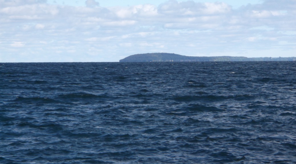
When you look out at Power Island, South Manitou, or Mackinac Island, you see a tiered wedding cake apparition rising from the water. Often we take that appearance at face value, never asking the important question, “How did it come to be that way?” Indeed, there is an explanation and it is not hard to understand.

Most residents of the Traverse area know that the Lakes were carved out by glaciers—and not so long ago in geologic time. The last major advance was 14,000 years ago, with secondary advances occurring as late as 12,000 years ago. This continental glacier was a mile thick in places, certainly big enough to carry boulders to unlikely places, make north-south gouges in underlying bedrock, and form moraines both at the endpoints of its advances and at points where the glaciers simply melted, letting down its cargo of rocks, gravel, and sand. The steep, winding path of M-72 going up from West Bay climbs the end moraine of the last glacial advance.
What does the glacier have to do with the wedding cake appearance of islands in the upper Great Lakes? The terraces far above the present lake levels are beaches created during our glacial past when the water took different pathways to drain the melted ice water.
As the ice retreated, that water left the Upper Great Lakes by way of the Chicago River to the west and Lake St. Clair and the Detroit River to the east. This was a high water level, the surface of future Lakes Michigan and Lake Huron standing at 605 feet above sea level. Since the present level of those lakes is 535 feet, an ancient beach can observed high above the water on Mackinac Island—the uppermost tier. The combined waters of Lake Huron and Lake Michigan formed a single expanse called Lake Algonquin.

Later, retreating ice opened a drainage pattern through Georgian Bay and out through Ontario by way of the Ottawa River. This event marked a low water stage for the Upper Lakes, a state that was not preserved very long.
As the weight of the glacier left the land, it sprang back up much like a trampoline relieved of a hurtling athlete. The effect was to cut off the drainage directly through Canada and bring back the familiar pattern through the Chicago River and the Detroit River. Another high water level stage resulted, this time resulting in a combined lake comprising Lakes Michigan and Huron called Lake Nipissing. Lake Nipissing beaches are lower than Lake Algonquin’s, but they can be seen readily on Power Island and the Manitous.
The Great Lakes are constantly changing: the land is still springing back as a consequence of the disappearance of the glacier and changes in precipitation and evaporation (as well as human use) cause year-to-year, decade-to-decade changes. Climate change might cause rapid changes, low water stages resulting from increased evaporation or high water stages coming from increased precipitation. As yet, a clear pattern has not emerged.
The story of the Great Lakes is charmingly told in a Canadian Film Board movie, The Rise and Fall of the Great Lakes, which we reference here:
https://www.youtube.com/watch?v=afs_A_Lz2w4
Richard Fidler is co-editor of Grand Traverse Journal.