Tag Archives: lakes

Sudden Flooding Along the Bay: Are We Due for Another Seiche?

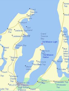
Map of Grand Traverse Bay, courtesy of WikiMiniAtlas.

How many times has it happened?   Along East Bay, usually at night or early morning, the water surges up, rising four feet or more from its normal level, only to subside within minutes.  In the past, roads have been flooded, docks floated away, and debris swept into the water.  Houses and cottages have been flooded and cars damaged by the flooding such that they had to be towed away for repair.  West Bay gets them, too, but East Bay, especially at the south end, from Five Mile road west to the Birchwood area of Traverse City have been especially hard-hit.

The 1950’s experienced a number of these events, not just locally, but throughout all the Great Lakes.  At first, no one knew what to make of them: newspapers called them “Tidal Waves,” often using quotation marks since everyone knew they had nothing to do with the tides.  The only similarity is that the water rose somewhat gradually, and not with an abrupt crash of giant waves on the shore.  In 1952, the Traverse City Record Eagle declared no one knew what caused them, but that observation was soon to change: a surge of water with immense waves swept up on the Chicago shore on June 26, 1954, causing the deaths of ten persons.  That tragedy sparked interest among scientists studying the phenomenon.  They would soon uncover the causes.
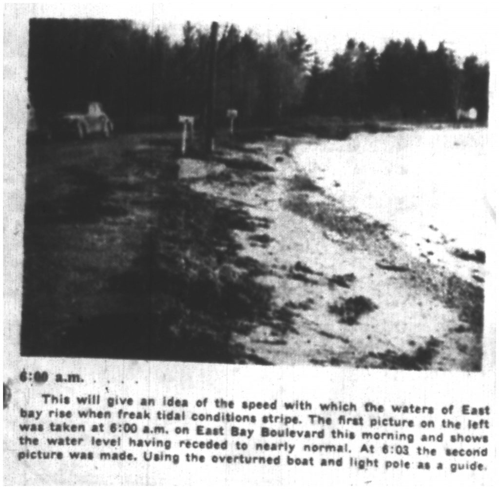
First in a series of photographs documenting a seiche in East Bay, 5 May 1952, from the Traverse City “Record-Eagle” (used with permission).

Gordon E. Dunn, Meteorologist-in-charge of the Chicago office, realized that, on past occasions, the surges always occurred after the arrival of a pressure increase associated with a rapidly moving storm front coming from the north.  On July 6, 1954, just ten days after the devastating surge described above, conditions looked nearly identical to those of that day.  Based upon his understanding of the event, Dunn issued the first seiche warning. Somewhat to his surprise given his scant knowledge, a moderate seiche did strike Chicago, one that caused little damage, much to the relief of all.

Since those early times, we have learned much more about seiches.  They are associated with fast-moving storm lines, especially those moving faster than 50km/hr.  There must be a significant pressure rise associated with those lines, with a long fetch of water covering the entire width of a body of water—Lake Michigan or Grand Traverse Bay–making for more the most dramatic events.  One factor Dunn did not understand was the most fundamental thing of all: storm surges bounce off shores and send reflected waves outward to interact with those coming in.  It is like a basin of water with a water disturbance that reflects off the sides, sometimes building into surges that are magnified by the coming together of different waves.  Surges and the receding of water can go on for days as waves interact, just as water in a basin takes time to settle if it is disturbed.  All of this happens during seiches.
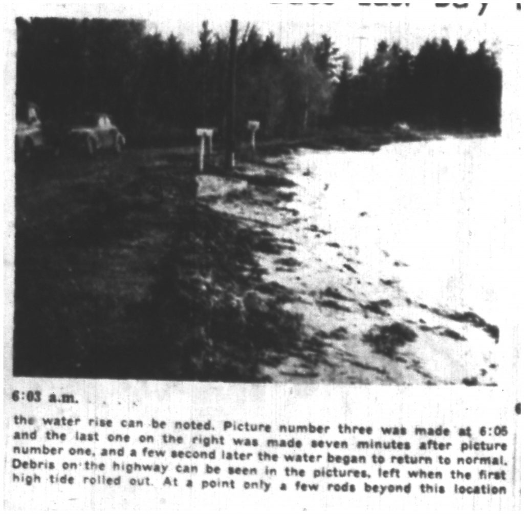
Second in a series of photographs documenting a seiche in East Bay, 5 May 1952, from the Traverse City “Record-Eagle” (used with permission).

East Bay presents another aspect of seiches.  It has vast shoals—shallow areas—that extend from the south and west shores.  When rising water strikes them, waves grow taller, driving farther inland.  One of the descriptions of a seiche claims that the water rushed 30 to 40 feet inland from its usual position, but only in areas at the base of the Bay.  This “shoaling” effect is known to increase the severity of seiches.

East Bay also presents an obstructed range of open water (a “fetch”) that enables waves free travel down its length.  By contrast, West Bay has a narrowing at Lee’s Point on the west side and Bower’s Harbor on the east, after which it widens at the south end.  Contours of the land also affect the severity of seiches, and East Bay seems especially suited to maximize high water surges.

Third in a series of photographs documenting a seiche in East Bay, 5 May 1952, from the Traverse City “Record-Eagle” (used with permission).

This is not to say West Bay has not experienced them.  On April 1, 1946, a resident of Bay Street in Traverse City reported the water level rose two feet before subsiding.  An older story is told that in March, 1891, the city had been withdrawing water from West Bay for household use by means of an intake pipe that extended two hundred feet from the shore under twenty feet of water.  When the pumps started racing one morning, it was realized that no water was being moved at all.  Upon breaking the ice that covered the intake, it was discovered that the water had receded to the point that the mouth of the pipe wasn’t in the water at all.  Soon after, water levels rose, and residents were able to get water for their morning coffee.  The peculiarity of this event—occurring when the Bay was frozen—sets one to wondering if some factor besides a seiche wasn’t operating.

East Bay experienced three significant seiches in the two years 1952-53.  The May 5, 1952 seiche is interesting because we have access to hour-by-hour data about wind speed and direction.  Hour-by-hour after midnight the wind direction changed: 1:00 AM: out of the East at 7 mph; 2:00 AM: out of the west at 7 mph; 3:00 AM: out of the south at 10 mph: 4:00 AM: out of the west at 8 mph; 5:00 AM: out of the north at 12 mph.  The wind direction stayed out of the north after that time for the rest of the day.   Note the time of day: after midnight and early morning.  For reasons not completely understood, the biggest surges of water tend to happen in early morning up to noon.  Also note that the wind direction jumps from one direction to another, finally ending with a strong wind out of the north.  The effect is to pile up water on one side of the Bay, only to have it rush in from the north.  Given the contours of that body of water, that is exactly what you would expect in order for the biggest surge of water to occur at the southern end.

Fourth in a series of photographs documenting a seiche in East Bay, 5 May 1952, from the Traverse City “Record-Eagle” (used with permission).

Residents on the south shore of East Bay notified the sheriff of the flooding shortly after 4:00 AM, a time fairly consistent with the wind change out of the north.  After the first surge, water rose again and again, but never reached the high water mark of the first rush.  That behavior goes along with our present understanding of seiches as disturbances in a closed basin with waves that reinforce each other at times.

When will the next seiche be?  Who can say?  We should beware when a fast-moving storm line moves in from the north associated with rapidly rising air pressure.  The National Weather Service now issues warnings when conditions are favorable for water surges and high waves, and persons living in vulnerable places should take precautions to protect their lives and property.   It has been some time since the last big one and it is easy to become complacent in the absence of memory.  After all, Nature acts whether we are ready or not for what she gives us.

Godzilla vs. Spongilla: A Contrast in Life Styles

A sponge is the antithesis of a super hero.  It stays in place, sifting out plankton (microscopic algae and animals) from the water that passes through its body.  Its body is not of great interest, lacking appendages altogether, not even possessing tentacles that might enwrap evildoers and others that would do it harm.  Its personality is not engaging, either, since it does not have a brain. 

To get its food, it has many small openings that take in its tiny prey, and a few larger ones that expel the water it has cleansed.  The pumping system that carries on the circulation is primitive: cells with tiny whip-like appendages (flagella) line passageways, setting up the current.  There are no robust hearts in sponges.

A simple animal reproduces simply.  In some species of sponge, balls of cells (gemmules) form in mid- to late summer that can break off from the parent animal and grow into a new sponge somewhere else.  This asexual form of reproduction is perhaps the most common means of making new sponges.   However, sperms and eggs can be made inside its body, those fertilizing each other in a display that has nothing to do with affection.  You wonder, without courtship, without males showing off what they’ve got, what is the point of reproduction like that?

Sponges do have a skeleton of sorts, however.  In the ocean, some of them have a soft one made up of spongin, a substance that becomes flexible and absorbent upon being rehydrated.  Those sponges have been used for hundreds of years in the Mediterranean Sea and elsewhere for scrubbing everything from floors to human bodies.  Mostly replaced by plastic substitutes, they are occasionally used today.

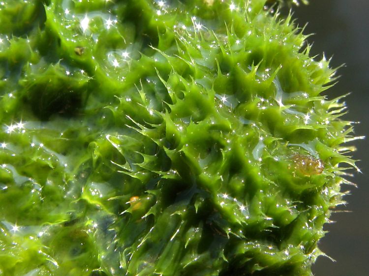
Many years ago I took a course in invertebrates at the University of Michigan’s Biological Station at Pellston, Michigan, and was surprised to learn that we have a freshwater sponge that inhabits our lakes: Spongilla lacustris (a few other species can be found here, too).  As I observed it, its body most often was in the form of a greenish blob attached to sticks or pondweed–the green color, I found out, came from algae inhabiting the animal.  It was not at all gooey or gelatinous, but felt rough to the touch and a bit like glassy bits stuck together when dried.  Unlike its ocean brethren with its spongin, it had a skeleton made of crystal-like tiny elements made of silica, the same stuff that comprises most of our sand in Northern Michigan.

At least one animal appreciates Spongilla–but not for its appearance or life habits.  Spongilla fly larvae feed on it with zest, later pupating to become small flies we are certain to ignore among the multitude of other flies that hatch in lakes and ponds.  No life form–not even the sponge–is too humble to escape predators.

Spongilla is very particular about where it lives: it must have the cleanest, purest water around.  For that reason, it is considered to be an indicator of pristine, unpolluted lakes.  Far from being a pestilence, freshwater sponges are a gift.  We should not condemn them for what they are not—gifted superheroes of the animal world.  They are not delicious, not cute, not pretty, but they do constitute a component of our most treasured biological communities, the clear lakes that grace our landscape in Northern Michigan.  Let us rejoice in their presence here.

Readers Flounder in Ruggs Pond

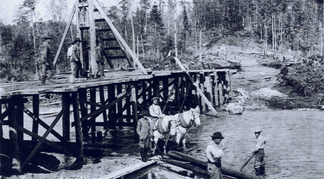
Ruggs Pond is formed by a dam originally intended to generate power for what Northern Michigan community?  (Hint: it forms at the junction of two tributaries of Rapid River)

Regrettably, not one person recognized that the dam at Ruggs Pond provided hydroelectric power to Kalkaska, Michigan. We encourage you to visit the Pond.  It is a beautiful place.

Postcard of Rugg Pond, Rapid River, 1905-1906. Image courtesy of Traverse Area District Library, 953.031910.13-2


Image courtesy of GroundSpeak, http://www.waymarking.com/waymarks/WMF022_Rugg_Pond_Dam

Freshwater Jellyfish: Cute, and They Don’t Sting

Students frequently confront teachers of biology with a variety of organisms: snakes captured under porches, wild birds rescued and nurtured at home, preying mantises temporarily housed in glass jars, occasional pet hamsters brought to school in their wire cages, and—occasionally—creatures one doesn’t see regularly.  That was the case when a boy lugged a large bucket of water into the classroom one September day.  His question was the kind I welcome the most: What are these?

highlake
Location of High Lake, East Bay Township, Grand Traverse County, Michigan. Image courtesy of Google Maps, September 2016.

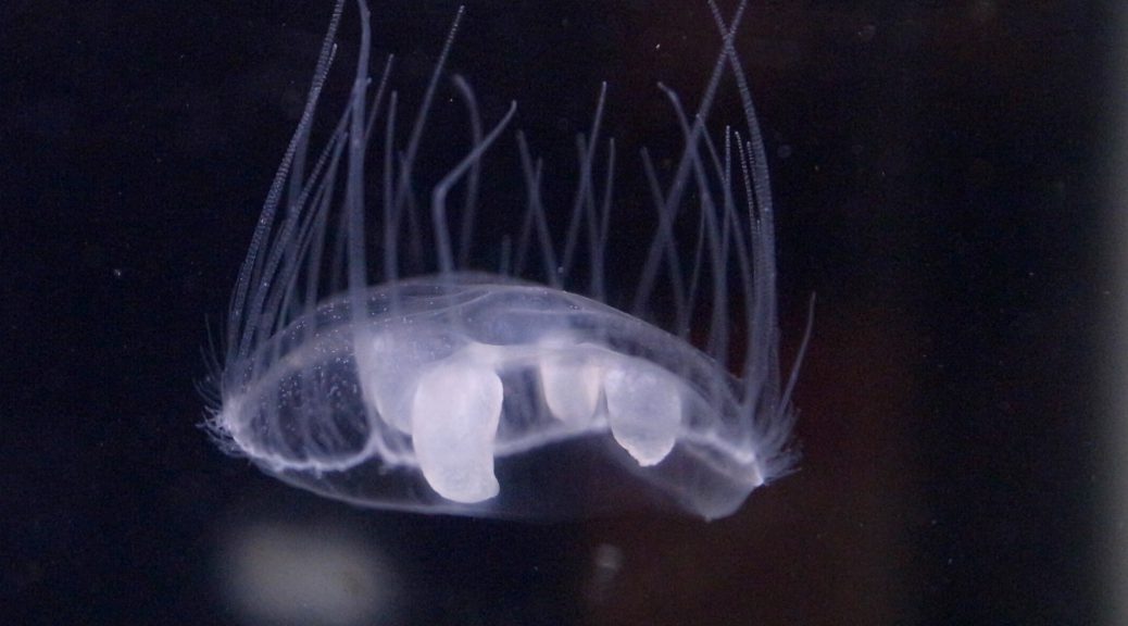
I looked inside the bucket, at first not seeing a thing as I focused on the bottom of the bucket.   Then I saw them, swimming in the water column, tens of white, almost transparent disks, each one the size of a penny, swimming—is that too strong a word?—keeping themselves from sinking to the bottom.  Astounded because I had never seen them before, I croaked out, “Do you know what you’ve found?  Freshwater jellyfish!  They’re rare…where did you get them?   The boy, proud of his accomplishment, replied, High Lake.  High Lake!  High Lake had freshwater jellyfish! I wondered if I should report this finding to the University of Michigan.

Since that time much has been learned about freshwater jellyfish.  The source I had used concerning these organisms, Pennak’s Freshwater Invertebrates of the United States (1953) was outdated even at the time my classroom adventure occurred.  The book emphasized how rare the animals were, having been found at only fifty locations throughout the country.  As I read about them today I get a different impression about their origin, frequency and distribution across the lower 48 states.

Craspedacusta sowerbyi, a freshwater jellyfish native to China that is now a world-wide invasive species. Image courtesy of OpenCage (opencage.info) [CC BY-SA 2.5 (http://creativecommons.org/licenses/by-sa/2.5)], via Wikimedia Commons
Craspedacusta sowerbii, a freshwater jellyfish native to China that is now a world-wide invasive species. Image courtesy of OpenCage (opencage.info) [CC BY-SA 2.5 (http://creativecommons.org/licenses/by-sa/2.5)], via Wikimedia Commons
They are not native to North America, having gotten here from China most likely with shipments of tropical fish and aquarium plants.  Fifteen years ago High Lake was one of the earliest lakes affected by that introduction.  They are not rare:  freshwater jellyfish are found in bodies of water in almost all of the states east of the Mississippi River as well as many more out west.  Outside of the United States they are now found in North and South America, Australia, and New Zealand, almost always in temperate locations.  Alas, my excitement at finding rare fauna has cooled considerably.

Another invasive species!  I anxiously turned to Wikipedia to read about its effects on local ecosystems: What foul deeds is it performing on our freshwater lakes?  At present it is not clear what harm they are doing.  They do not seem to disrupt the major feeding relationships among the animals we care about, the fish, birds, and mammals.  Certainly they feed upon near-microscopic members of the zooplankton–the animals that feed small fish–and occasionally upon minnows themselves, but their presence seems benign—at least so far.

The development of Jellyfish. This image is taken from the book "Das Meer" (The Sea), by Matthias Jacob Schleiden. Top are medusae, or jellyfish; bottom are polyps. In the middle polyps strobilate (divide horizontally) to form medusae. Image courtesy of Matthias Jacob Schleiden (1804-1881) - Schleiden M. J. "Die Entwicklung der Meduse". In: "Das Meer". Verlag und Druck A. Sacco Nachf., Berlin, 1869.NOAA photo library, Public Domain, https://commons.wikimedia.org/w/index.php?curid=2051
The development of Jellyfish. This image is taken from the book “Das Meer” (The Sea), by Matthias Jacob Schleiden. Top are medusae, or jellyfish; bottom are polyps. In the middle polyps strobilate (divide horizontally) to form medusae. Image courtesy of Matthias Jacob Schleiden (1804-1881) – Schleiden M. J. “Die Entwicklung der Meduse”. In: “Das Meer”. Verlag und Druck A. Sacco Nachf., Berlin, 1869.NOAA photo library, Public Domain, https://commons.wikimedia.org/w/index.php?curid=2051

The fluttering disks I saw in the bucket represented the medusa stage of the jellyfish, the sexual stage in the life cycle, the stage that produces eggs and sperms.  However, the creature usually prefers the ease of asexual reproduction—a statement supported by the observation that all of the medusae in a lake might be male or else female, never a mixture of the two genders.

Students of Greek mythology might remember the word “medusa”, a monster with a hideous female face surrounded by venomous snakes, its visage so terrible that humans would be turned to stone upon beholding it.  The jellyfish medusa, thankfully, does not possess that power.  It is named after the many tentacles that hang from its margin, a reminder of the monster’s snakes.  Indeed, like the snakes,  it does possess venom—in tiny darts called “nematocysts”—but these are not robust enough to penetrate our skin.  They cannot “sting” us like their relatives, the Portuguese Man of War.

How does the jellyfish reproduce without sex?  It spends much of its life under water in the form of a polyp, a tiny but not microscopic form without tentacles that pinches off the little caps that become the medusa.  Sometimes it does not even bother with that, simply budding off a new polyp from its side.  Boaters and swimmers may not even see medusae in the water for years at a time.  The animal produces them when he/she is ready.

That bucket of water from High Lake did open my eyes to something I did not know existed, even if it proved not to be the rarity I had imagined.  It made me aware of another living form I had never heard of.  Does stimulating my curiosity add to the value of an organism?  If so, I have come to value the freshwater jellyfish.

Richard Fidler is co-editor of the Grand Traverse Journal.

Portage Lake, a Hotbed for Land Use Controversy, 1866-2016

by Stewart A. McFerran

Before high water and before low water, the bank was stable for many years. It was shady with huge hemlocks, white pine and cedars overhanging the water. Before fire and development, impenetrable thickets lined the shores and teemed with fish and fur. Breezes cooled by patches of snow rippled Portage Lake until June. A winding creek emerged as the forest gave way to dunes. All the spring water from the Lake and uplands were contained in that fast flowing creek. The shifting sand of the dunes, currents and waves mixed with the flow of Portage Creek always.

On Sunday, May 7th, 1871, the neighbors of Portage Lake gathered in the morning. The night before they had a big party and dance on Portage Point. The farmers had completed a narrow ditch that ran from Portage Lake to Lake Michigan. They did not know what would happen when the water started to flow. An ox moved a log that held the water of Portage Lake back.  They were shocked at what they had done on that Sunday morning.

New channel of Portage Lake to Lake Michigan. Image courtesy of the author, August 2016.

The flow grew and grew. Soon the power and weight of the water became apparent. An entire forest was swept out into the big lake. Some worried that Portage Lake would drain away completely. It did not, but hundreds of fish were left on the wide new shore flopping about. Many witnessed a forest of trees floating miles out in Lake Michigan. Just what this event would mean for the farmers around Portage Lake and the mill on Portage Creek would soon become apparent and is still talked about.

The controversy over land use on Portage Lake continues today. At a recent Onekama Township town hall meeting, plans for the historic Portage Point Inn were presented by the Inn’s new owners. The Inn has stood on dunes of sand between Portage Lake and Lake Michigan since 1903.  The survival of the historic hotel is certainly a major concern, as well as the results of unchecked development.

The development of Portage Point began with a survey of the dunes between Portage Lake and Lake Michigan in 1837. At that time, the level of Portage Lake was much higher. Joseph Stronach started building the dam and mill at Portage Creek in 1845. Thick cedar groves covered the main street of Onekama before there was a main street. As the population grew, land use changed from logging to farming, causing strife among neighbors. Things came to a head in 1871.

A Mr. James Francis Hannah (cousin of Perry Hannah) purchased the Mill at Portage Park in 1857. He would pay farmers for the flooding of their lands when the gates of the dam closed to build a “head” of water to power the sawing of logs. The water in Portage Lake would rise as much as six feet and logs could be floated up to the mill.  Farmers all around Portage Lake objected to the high water levels that flooded their “improved land.”

The mill was sold to Porter Bates in 1866.

General Grant, Speed, Sea Gem and Dall were schooners that stopped at the Portage Pier. Porter and Company controlled the pier which was at the mouth of “Portage Creek.” Access to the vessels that sailed along the coast of Lake Michigan was key to trade. Porter charged a heavy toll to anyone wanting to ship lumber, tanbark (bark from trees used to tan leather, usually oak or hemlock), or farm produce to the wider market.

Amos Pierce, who owned sixty acres on the South end of Portage Lake, would not take payment for the flooding of his land. In March of 1867 Pierce told Bates: “a lot of us would come down and tear his dam down and he said if we did he would shoot us.” (Chaney, Story of Portage).

Map from "Story of Portage," showing the location of the old and new channels to Lake Michigan.
Map from “Story of Portage,” showing the location of the old and new channels to Lake Michigan.

Pierce and other rogue farmers were jailed for digging a new channel from Portage Lake to Lake Michigan. While Pierce was in jail others took over. When they were put in jail and Pierce was released, he carried on digging the channel. What they dug was narrow and was held back by one log… the log that was pulled away by one ox on Sunday, May 7, 1871. This controversy over land use was solved by collective action after the dance that Sunday.

The rogue farmers opened a channel from Portage Lake to Lake Michigan about a mile south of Porter Mill. The water of Portage Lake rushed into Lake Michigan creating a channel 300 feet wide and 18 feet deep. Fish from the inland lake mixed with their big lake cousins that they had not seen for centuries. Some were left stranded and were scooped up in buckets.

Porter Mill was left high and dry as Portage Lake fell to the level of Lake Michigan. The dam was no longer able to control the waters of Portage Lake. With no falling water the mechanism of the mill could not operate. The farmers had won by guaranteeing low water levels in Portage Lake. In addition, trade was no longer restricted to the small Portage Creek and the pier on the Lake Michigan shore. In fact, “Portage Creek” ceased to exist.

The tug Williams made the first entrance into Portage Lake. She was hailed by the waving of hats and handkerchiefs, and loud hurrahs and firing of guns. The original settlement at Portage Park was largely abandoned.  The new Post Office was moved to the Northeast section of the lake because many points along the shore of Portage Lake were open to trade. The flow of development was redirected to the East end of the Lake when the flow of Portage Creek was redirected to the South end of the Lake.

More Change Coming to Portage Point Inn, 1902-Present

Portgage Point Inn. Image courtesy of the author, August 2016.

It was standing room only July 7th, 2016, at the Onekama fire house as plans for the historic Portage Point Inn were presented by the Inn’s new owners. The Inn has stood on dunes of sand between Portage Lake and Lake Michigan since 1903.  Many Portage Point cottagers worried about the preservation of the historic hotel, others that they would all be swept away by a rush of development. Opinions were expressed to Onekama Township officials regarding developments on the sleepy Portage Point.

The Onekama Township Planning Commission considered amendments to a special use permit this summer.  The amendments would accommodate changes to the Portage Point Inn and surroundings, as the new owner would like to reopen the historic Inn, which has fallen into disrepair. The Inn was last open in 2012.

The Portage Point Assembly was originally incorporated in 1902 under State Legislation that encouraged the building of hotels and clubhouses. The Assembly was also charged with “preventing and probation of vice and immorality”.

The Casino at Portage Point Inn sits behind the Inn proper, and has fallen into disrepair. Image courtesy of the author, August 2016.

Construction on the Portage Point Inn began in 1902. The Inn and the “casino” were the centers of activity for cottagers for many years. Vacationers traveled on the Puritan which passed through the channel once a week and stopped at the dock in front of the Inn. Fond memories abound.

In addition to obvious renovations, there needs to be an upgrade to the sewer capacity. Other requested changes include plans for forty additional boat slips and a gas dock. There would be capacity to haul large boats and store them nearby.  Changes would be made to public access to Portage Lake, and a public fishing dock would be built.

From the Author: I cannot exaggerate what a big deal THE "Sunset House" is to the cottagers at Portage Point. ANYONE with a history ON THE POINT knows where the Sunset house is. Even though as you can see it is a simple cheap building it is maintained be the PP Association. They also maintain the signs with family names posted on the roads. They publish a book of members. They have a meeting. It IS a big deal!
The Sunset House marks the place where the pier once stood. Image courtesy of the author, August 2016.

The historic stream bed of Portage Creek winds through the lively ghost town of Old Portage. The Sunset house at the end of Lake Isle marks the place the pier once bustled with activity. The “boat house” is on the bank that overlooks a tiny pond that was once Portage Creek. Cottagers have a long history with each other as well as the place.

Boat House at Portage Point. Image courtesy of the author, August 2016.
The “Boat House” is on Lake Isle Street and rests on the bank of what once was Portage Creek which was the original outlet of Portage Lake to Lake Michigan. Image courtesy of the author, August 2016.

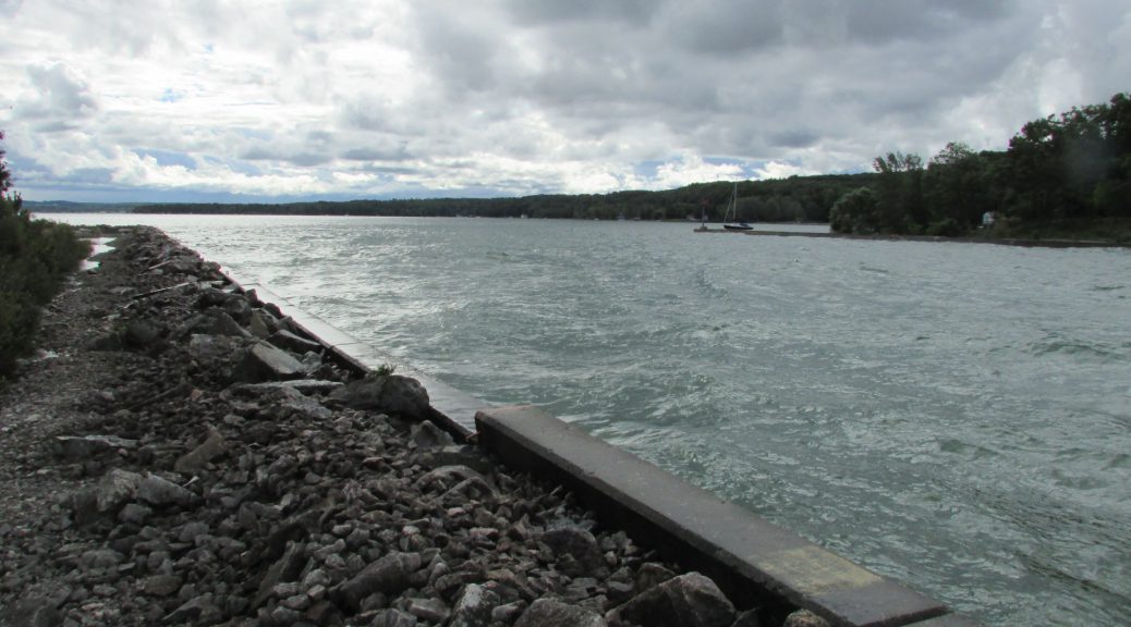
Amos Pierce and his rogue bands of militant farmers are long gone, but the channel they created from Lake Michigan to Portage Lake remains. The concrete walls stabilize the shifting sand but currents and high energy waves deposit sand during the long winter. The water of the “freshet” called Portage Creek now flows through the navigation channel and still mixes with the waves of Lake Michigan.

Current residents of Old Portage have been isolated. With hundreds of square miles of open water to the west and thousands of acres of National Forest to the east, Portage Point is on the way to nowhere. Not like it used to be. It was a destination and origin of raspberries and pickles that made the overnight trip to Chicago market on the Puritan.

Like the controversy of 1871, changes facing the community on the dune between Lake Michigan and Portage Lake came to a head… but this time, there were no threats of violence and all firearms were concealed.

Thanks to Portage Point resident Tom Gerhardt for sharing his knowledge with us, and providing details and dates.

Stewart. A. McFerran teaches a class on the Natural History of Michigan Rivers at NMC and is a frequent contributor to the Grand Traverse Journal.