Tag Archives: History Road Trip

November 11, 1896: Traverse City’s Worst Fire

November 11, 1896

Well after midnight Fire Chief Dupres, Alfred Waterbury, and Night Watchman Allen Grayson stood shivering in a brisk southwest wind that would ordinarily send them inside after a few minutes.  Tonight, however, something seemed wrong: a dull yellow light flickered to the northeast of the Cass Street fire station where they had gathered.  It danced on the thin crust of snow that covered the street in front of them, the same flicker they had all seen so many times before.  Fire!

The alarm was sounded, a pealing of bells in a specific pattern that alerted firefighters to the location of the fire.  It was in the direction of Front Street and Park, a place where frame buildings stood side-by-side, an invitation to a catastrophic spread of flames.  Hitching the fire engine to the waiting team, firemen worked frantically to let the horse collars come down onto the horses’ necks; the rest of the harness was in order in less than four minutes.

Meanwhile, the fire within the steamer was turned up full blast to ready the engine for its pumping duties to come. As the men left the station upon their new engine, Queen City, the horses’ breath raising clouds of steam in the cold, they congratulated themselves on their quick exit.  The steamer was new to the town, but they had practiced hard to get away fast, and that practice had paid off.

Front Street Hotel, from the "F.E. Walker Business Directory, 1894." This is the only know image of the Hotel.
Front Street Hotel, from the “F.E. Walker Business Directory, 1894.” This is the only know image of the Hotel.

No more than two blocks from the station, they came to a stop in front of the Front Street House, a large wooden three-story hotel that dominated the south side of the street.  Already flames and smoke billowed from the roof in places, the worst of it came from the part of the building that connected the large building on Front Street to the smaller frame building behind it by the alley.  So quickly had the flames spread, the firemen doubted they could save the building.

Already persons could be seen scrambling out the windows on the first floor, most in their nightclothes.  One brave soul hoisted himself out from a third floor window, making it somehow to the second story, and then dropping to the ground.  A little girl, contracted into a ball in fear, rolled off the edge of a roof, only to be caught by a fireman.  In all thirty people made it out of the fire: one did not.  Ed Newberry, a Swedish hotel porter, was found later, his dog beside him.

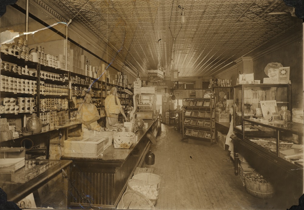
As predicted, the fire swept through the frame stores and saloons on the south side of the street, first the hotel, then a drug store within it, Broesch and Sons meat market, C.A. Cavis’s cigar store, Hiram Cook’s grocery, then a barbershop, and two saloons.  Next, a large two-storied structure, the Rich & Hallberg building caught fire, one of its walls coming to rest against the brick Tonneller building.  Four firemen were caught under the burning timbers, somehow escaping without serious burns. It was here the battle line would be set up to block the advance of the fire to the west.  In the end, the line held.

Image of the "Queen City No. 1" Fire Engine, from the "Grand Traverse Herald."
Image of the “Queen City No. 1” Fire Engine, from the “Grand Traverse Herald.”

One of the most gallant soldiers in the fight was the steamer Queen City, which performed magnificently, pouring water onto the flaming wall in a continuous stream, extinguishing the fire.  It was backed up by the city’s water system. Unbelievably, nineteenth century hydrants and water mains performed without failure.  Afterwards the newspaper would remark about the competence of the fire department and the water works in delivering water where it was most needed.

Image of the 1896 fire, actively burning frame buildings on the north side of Front Street. From the Local History Collection, Traverse Area District Library.

Even so, the blaze spread to the other side of Front Street.  In what some described as a flaming arch reaching from one side of the street to the other, buildings on the north side began to catch fire.  One by one they succumbed until they encountered Julius Steinberg’s brick opera house.  Father Julius Steinberg and son Aleck as well as employees of the dry goods store attached played streams of water everywhere to cool the building.  As cornices burst into flame, they hastened to put them out.  In the end, though gravely damaged, the dry goods store and opera house were saved.

In fact, the city downtown was saved.  Later, everyone remarked that the direction of the wind made all the difference, the fire starting at the Front Street House (or possibly the drugstore within), a location at the east end of the business district.  The southwesterly gale-force winds drove the fire primarily to the east, keeping it away from the busy area of storefronts to the west.  Credit also went to brave firemen, the fire engine that performed flawlessly, draymen who offered their services free of charge to those having to move store goods, the efforts of businessmen like Julius Steinberg, and ordinary citizens who did their part to help.  One business owner, Mrs. E.M. Daniels, was singled out for her bravery in removing her grocery store stock and relocating it nearby at the peak of danger.  Another citizen saw the glow of the fire from several miles away, and, suspecting the downtown was ablaze, drove to town just in time to save the merchandise in his sister’s store.  There were heroes everywhere to be recognized.

After the fire. Can you spot the fire-proof safes in the rubble? Their owners must have been pleased by their foresight. Images from the S.E. Wait Glass Plate Negative Collection, Traverse Area District Library.

Upon the rising of the sun the next day, the scene was horrific.  Fourteen stores had been burned to the ground.  More fortunate ones standing on the north side of the street suffered the ravages of smoke and heat, smudged with soot, with gaping holes where glass used to be in their front windows.  Black charcoal, square nails lying on the ground, broken crockery, and a few other things resistant to the fire littered the ground. The Grand Traverse Herald remarked that it was the most serious fire that ever visited the city, and, indeed, it was.

November 6, 2016

Students of history sometimes receive unexpected rewards.  For some time I had observed that the space across the street from Horizon Bookstore was being excavated to make way for a new building.  Whenever the ground is torn up in the downtown area, you can count on interesting things being uncovered.  Just two years ago, for example, West Front was repaved, that resurfacing job exposing Nelsonville, Ohio pavers, a brick that covered the road in years past.  Now, seeing the earth in neat piles alongside the trenches, I had to go over and inspect the work.

I had something specific to look for.  In 1896 I knew a great fire had leveled half a block of frame buildings on the south side of Front Street, the fire extending through the area where the digging was now taking place.  Would there be any sign of the fire?  Would there be charcoal buried down under?

The day is Sunday and all work had stopped on the excavation.  A gentle wind fluttered the yellow ribbons warning passers-by to keep away, and enforcers of a “No Trespassing” sign were nowhere in evidence.  In a quick yet fluid movement I ducked under the ribbons and stepped into the trench made by a shovel standing nearby.  Nothing revealed itself at the surface, but a foot-and-a-half down there was a streak of black punctuating the beach sand that made up the soil.  Bending down to pick some of it up, I sniffed at it and let out a small cry of joy: it was black charcoal from the fire.

It did not take long to find other things: broken window glass, two square, weathered nails, and bits of crockery, one of them big enough to read the name of the maker.  Evidence of the fire was everywhere: How I wished I could sieve the pile of dirt to find more relics.

crockery-from-1896-fire
Image courtesy of the author, November 2016.

Picking up a piece of crockery, I felt a sense of connection to those living at these shores of Grand Traverse Bay at a time before automobiles, before radio, before television.  Looking at the bottom of what could have been a bowl, I made out the maker: Meakin Ironware.  A quick search revealed that the Meakin company, founded in England in 1851, had produced it more than 120 years ago.   Somehow these ceramic shards survived the fire of 1896: people had handled this vessel, perhaps admired it, and then that awful thing happened.   What they had lost now I had found.  In a way that made me a participant in the event.  History does that that to us: it weaves our own lives into the tapestry of the past.

Editor’s note: The Queen City fire engine described in the article may be seen at Fire Station Number 1 on Front Street.

Author’s note concerning this article: The description of the fire came from an extensive account in the Grand Traverse Herald.  Reading the article carefully, a researcher can write a description like this:

Well after midnight, Fire Chief Dupres, Alfred Waterbury, and Night Watchman Allen Grayson stood shivering in a brisk southwest wind that would ordinarily send them inside after a few minutes.  Tonight, however, something seemed wrong: a dull yellow light flickered to the northeast of the Cass Street fire station where they had gathered.  It danced on the thin crust of snow that covered the street in front of them, the same flicker they had all seen so many times before.  Fire! 

Upon casual inspection it seems that the author has drifted perilously close to writing fiction: How could he know that three persons gathered in front of the fire station early in the morning?  How could he know about the wind, its direction and speed?  How could he know about the yellow light to the northeast that turned out to be the fire?  The snow?

The answer is that the Herald account had references to all of those things.  Far from creating an imaginary world, the writer only wove facts together in a manner that gave the scene life and interest.  This kind of historical writing is frequently done nowadays.  Seabiscuit, a tale of a famous racehorse, and Isaac’s Storm, the story of the Galveston hurricane of 1900, are just two examples that have become popular in recent years.  The advantage of this approach is that it makes history come alive—often in contrast, to stodgy description in the traditional style.

From time to time the Journal will present stories told as an exciting narrative.  Perhaps you would like to try your hand at it.

A. Papano’s Serves Up Hot Pizza, Quality History

For the staff at A. Papano’s Pizza of Kingsley, history is more than just a rehashing of the past; It is all about building community, according to Jeff Yacks, owner.

“The community of Kingsley has meant so much to us, and it’s so underserved. They deserve more–to be served a great product–and they deserve great service. That should be an expectation.”

So when A. Papano’s crew leader Jeff Pearson began researching the history of the building occupied by the business at the corner of Brownson and Blair, he saw an opportunity to engage with the community on a more meaningful level.

“Initially, I didn’t think this project would come to mean what it has. When Jeff asked to research the building we’re in, I thought it was for a grade, a score, a plaque, but it turned into a lot more than that. I would say it was a humbling experience. We spoke with a lot of community members, the research we did, just hours of it. It turned into this huge, amazing, overwhelming thing.”

The research project culminated in the unveiling of a display, now available for public viewing in the seating area of the restaurant at the Kingsley location. The display features the history of the building, tracing the previous owners and functions, as well as pointing out some of the unique parts of the building, left over from years of remodeling.

Downtown Kingsley is largely comprised of brick structures dating from the early 1900s, and over the years, doors were closed off, windows bricked up, and more. The staff are especially proud of uncovering the last bit of original tin ceiling in their building, which miraculously survived an early 1990s demolition project.

The ceiling of Beyer's Grocery, now on display at the Kingsley Branch Library. Image and artifact courtesy of Yacks.
The ceiling of Beyer’s Grocery, now on display at the Kingsley Branch Library. Image and artifact courtesy of Yacks.

“Through the Kingsley Branch Library staff, I found out that the ceiling of Tony Beyer’s grocery had been ripped out in the early 90s, and they supposed that all of it was gone. I then went and talked to our landlord, and he thought there might be some left. We (A.Papano’s staff) searched and searched all 2000 square feet of the building, and found a 4 by 6 foot section. There was plumbing and insulation in the way, we had to get a ladder… and Jeff got metal shavings in his eye, so I sent him to get a tetanus shot… three hours later, we ended up with a piece of the tin ceiling!” The ceiling tile is now on display at the Kingsley Branch Library.

For their tireless efforts, the research team was awarded the Floyd Milton Webster Prize for History in June 2015. When asked about what made this research project worthwhile, Yacks pointed to the June 22nd award ceremony.

Interior of Tony Beyer's grocery, now A. Papano's Pizza, downtown Kingsley, 1924. Image courtesy of Kingsley Branch Library.
Interior of Tony Beyer’s grocery, now A. Papano’s Pizza, downtown Kingsley, 1924. Image courtesy of Kingsley Branch Library.

“When we got there, I was overwhelmed. All these community members, people I looked up to as local heroes, were sitting there, and I remember thinking we were out of our league and should just walk out. But then they called us up, and I was shocked; Mr. Webster was there, all 96 years of him, and at that moment not only did I feel like this project was so beyond what I expected, but that I was accepted into this legacy, and I knew I had to continue. That was the a-ha moment, where all this time spent, all this research, was all worthwhile. When someone like Mr. Webster shakes your hand… he looked at us as the future; There was almost a sense of blessing, a passing of the torch.”

So what was the most difficult part of the project? “Early on, we were trying to find the initial land plotting, and I was going through all the libers at the governmental center, tracing all that history. We were trying to prove or disprove if Doctor Brownson (who operated Brownson Sanitarium in Kingsley at the turn of the 20th century) ever owned the land, but we never did find that link. That was a lot of Friday afternoons spent,” explained Yacks.

The governmental center wasn’t the only place the research team turned to for help. Yacks praises staff at both the Kingsley and Woodmere Branches at Traverse Area District Library for their assistance, even though he was leery to use those services at first.

“In my line of work, I am use to schedules, everything is fast-paced, minute-by-minute. Our employees have expectations on efficiency. When I started, I didn’t really know how to work with the library employees. I felt like I was sucking up all their time. What I learned is that for librarians, time isn’t measured in minutes, but in outcomes, and solutions. It was hard to ask for help, then take up an hour of time, and thinking that person should be doing something else. For me, the whole experience really embedded the library in the community.”

Despite the significant amount of time spent on the project, Yacks stresses the value of engaging in a history research project like this, and what it has done for his business.

Jeff Pearson (right) with Jeff Yacks in front of A. Papano's Pizza of Kingsley history display. Image courtesy of Yacks.
Jeff Pearson (right) with Jeff Yacks in front of A. Papano’s Pizza of Kingsley history display. Image courtesy of Yacks.

“Engaging in this project benefits both the business and my employees, which are really like family, and for the community. Our business was already aligning with the community in many ways, and it was perfect timing, for the business, staff and community to have a common tie.”

“This project fits with my philosophy, that when we can establish relationships with our customers, it creates top-mind awareness. When customers see us at community events, look at our display, it leads them to thinking of us over our competitors. Because of something like this, we’re establishing the emotional connections that build loyalty. Talking with community residents to accomplish this meant a lot of relationship building. It changed the course of our business in our community. We’re embedded in our community now, more than any amount of marketing could do.”

Amy Barritt is co-editor of Grand Traverse Journal.

All Roads lead to Fall Color, whether by steamer, carriage road or car

Despite a pleasantly warm September, Grand Traverse Journal eagerly reminds its readers that fall approaches. Why ? History Road Trip, of course!

Chicago, where most of our summer tourists hailed from during the era of the Lake Michigan passenger steamers, 1840-1920, “was distinctly not a lovable place.” The Chicago River in particular was notoriously odorous, a product of having a negligible current and a shallow, marshy disposition, exacerbated by the development of industry in the city and the traffic from steamer ships. What better way to escape the city, than to hop a luxury steamer up to Charlevoix, Michigan? (Hilton, 127)

Postcard image of Northern Michigan Transportation Company steamer "Manitou," which ferried passengers from Chicago to Mackinac. Image courtesy of Don Harrison, https://flic.kr/p/anVGQv
Postcard image of Northern Michigan Transportation Company steamer “Manitou,” which ferried passengers from Chicago to Mackinac. Image courtesy of Don Harrison, https://flic.kr/p/anVGQv

The working class frequented the short trips, from Chicago to St. Joseph, while the wealthier Chicago residents enjoyed much longer cruises. The steamer line Northern Michigan Transportation Company, shuttled the wealthier Chicago residents to ports as far as Mackinac Island. Frankfort, Glen Haven, Leland, Northport, Elk Rapids, Charlevoix, Petoskey, Harbor Springs, St. James (Beaver Island), Cross Village, St. Ignace and Cheboygan were all ports of call for the line. (Hilton, 306)

As the weather turned cool, the tourists returned on those same steamers back to Chicago. Until the advent of reliable roads and vehicles, only those who braved Northern Michigan year-round had the pleasure of fall, that beautiful and fleeting season of riotous color. Although we would hardly call the roads “reliable” by today’s standards, the carriage road from Traverse City to Elk Rapids of 1898 was one means of enjoying a ride through fall color.

This excerpt, from the Northern Michigan Handbook for Traveler’s, depicts the route with a degree of accuracy, but the charm of the writing is what distinguishes this work from modern travel guides. Perhaps it will inspire you to take the northern color tour this year?:

The trip from Traverse City to Elk Rapids may be made by carriage road and will afford a pleasant drive or bicycle ride. The road is, in general, in good condition and for many long stretches very fine. It is somewhat hilly in the central portion, the hills being long but not steep. The distance is eighteen miles and many fine views are to be enjoyed.

Aerial view of Grand Traverse Region, colored postcard, ca. 1910. Image courtesy of Traverse Area District Library local history collections, http://localhistory.tadl.org/items/show/2115.
Aerial view of Grand Traverse Region, colored postcard, ca. 1910. Image courtesy of Tom Olds, Traverse Area District Library Local History Collections, http://localhistory.tadl.org/items/show/2115.

Crossing the Old Mission peninsula, the road follows along the bay immediately above the railroad, which it crosses at Acme (4 miles). From this point it runs nearly due north, with occasional glimpses of the lake, through a fine farming country passing (about 13 miles) a little lake on the right known as Lake Pto-ba-go (Note: now Petobago Pond, part of the Grand Traverse Regional Land Conservancy). Soon we climb a hill whose crest reveals a fine expanse of lake and shore line. The character of the country from this point begins to show a marked change. Long and beautiful hedges of spruce and fir, wide “openings” adorned with the low, flaring and circular juniper – a shrub or bush of the evergreen family – and exquisite copses of small pines take the place of fields and farms. The road is from this point (for five miles), to Elk Rapids, exceptionally fine and the whole scene is one of wild, romantic beauty and delightful interest to the visitor. (Note: the next 4 paragraphs describe taking the route north by boat through various lakes and rivers; we have edited out that text to maintain the land conveyance).

…From Elk Rapids bicyclers may continue the journey to Charlevoix, following due north between Torch Lake and Grand Traverse Bay to the village of Torch Lake (about 13 miles); hence north to the extremity of Torch Lake to Eastport (3 miles); hence due north eight miles, passing the little town of Atwood, five miles from Eastport. From this point the road travels in angular direction northeast, nine miles to Charlevoix. While the journey may be readily made, the road can not be called first class and the bicyclist must be prepared to do some hard riding.

Why so far north for a History Road Trip, when you can run up one of the Peninsulas? Prepare yourself for the long-haul past Harbor Springs to the “Tunnel of Trees Scenic Heritage Route,” or M-119. Just north of Little Traverse Bay, this lovely route follows the Lake Michigan shoreline, and the trees are as advertised. Consider it a fall treat from your editors at Grand Traverse Journal!

References:

Hilton, George.  Lake Michigan Passenger Steamers.  Stanford, California: Stanford University Press, 2002.

Inglis, J.G. Northern Michigan Handbook for Traveler’s, 1898. Petoskey, Michigan: George Sprang, 1898.

Fall color image in header courtesy of Erin Malone, https://flic.kr/p/dhEPqj.

Amy Barritt is co-editor of Grand Traverse Journal.

Famous Fly for Fishing calls Mayfield Home

Out in the little village of Mayfield, Grand Traverse County, is Mayfield Pond and the Halladay Family Memorial Park. An annual June celebration in Kingsley, just south of Mayfield, honors a particular event that took place at the Pond in the 1920s.

Do you know what happened at Mayfield Pond? Your hint: Leonard (Len) Halladay, and his good friend Judge Charles Adams, were both involved… Len was the local guide, and Adams a visiting enthusiast of a particular sport. He practiced his sport most frequently on the Boardman River and Arbutus Lake.

Thanks to reader Beth of Kingsley, we have our answer! One of the world’s most famous fly fishing ties was developed and tested right in our collective backyard on the Boardman River, the Adams Dry Fly. Len Halladay put little Mayfield on the map when he created the fly at the request of his friend Judge Adams, and the popularity of the fly has skyrocketed ever since. Some anglers say if they were only allowed one fly for the rest of their life, it would be the Adams.

Visit the Kingsley Branch Library for their display on the Adams Fly, and take a peek at an original tied by Halladay himself! History Road Trip!

Celebrate a “Halladay” during National Fishing Month!

Out in the little village of Mayfield, Grand Traverse County, is Mayfield Pond and the Halladay Family Memorial Park. An annual June celebration in Kingsley, just south of Mayfield, honors a particular event that took place at the Pond in the 1920s.

Do you know what happened at Mayfield Pond? Your hint: Leonard (Len) Halladay, and his good friend Judge Charles Adams, were both involved… Len was the local guide, and Adams a visiting enthusiast of a particular sport. He practiced his sport most frequently on the Boardman River and Arbutus Lake.


Down the Road of Life We’ll Fly: Retracing an Auto Tour From 1920

As a fumbling collector of automobile-related relics, I had long wondered why I couldn’t get road maps before the 1930’s.  It took some time for me to understand that the folded maps offered free by the oil companies—Gulf, Shell, and Mobil—didn’t come out until the thirties.  Before that time, I wondered, how did motorists navigate the highways in the first three decades of automobile travel?

titlepageMy discovery of the Automobile Blue Book answered the question.  Not to be confused with the Blue Book that gives the cash value of automobiles, the Automobile Blue Book was a navigational aid to motorists at the dawn of the automobile age.   Through primitive maps and step-by-step written directions, it outlined routes from one destination to another, Traverse City to Benzonia, for example, or Traverse City to Old Mission.

Blue Books contained much more than directions about how to get from one place to another: They offered information about roads (dirt, gravel, crushed stone), steep grades, and blind curves, and recommended the best and safest routes to drivers and navigators.  Along some roads they cautioned travelers about boulders and washed-out places.  With the unreliable machines of the time, information about garages and hotels was included within the directions: A breakdown requiring repairs and an overnight stay could occur anywhere.

trip-genderSuccessful auto trips required two partners—the driver and the navigator–since the driver cannot take time to keep looking at the book and the mileage while avoiding oncoming traffic, cattle blocking the highway, or ditches that loomed on either side of the road.  An advertisement for a celluloid protector for the Blue Book showed a man in the driver’s seat with his spouse alongside, patiently (we would presume) giving instructions to her husband.  Of course, women drivers were not unknown in the twenties either, and roles could be reversed.

At first, most cars lacked odometers altogether; they had to be purchased as an accessory.  A starting point from each city center was designated—in Traverse City the junction of Union Street and Front served for all routes.  Mileage was zeroed out at that point, all subsequent turns and landmarks measured in tenths of a mile. Like a modern GPS system, the navigator informed the driver of the route ahead, turns and distances, presumably in a calm voice that did not betoken a lack of confidence in the driver.

The Blue Book educated travelers about the areas to be explored.  Of Old Mission Peninsula it generously wrote:

Grand Traverse peninsula [sic] extends 18 miles into Grand Traverse bay and varies from one to three miles in width and in height from bay level to several hundred feet.  With its rugged shore line, many promontories, sandy beaches and sheltered bays, it is the most beautiful region in southern Michigan.

One can imagine travelers from remote places reading the Blue Book to educate themselves about the places they passed through.  It was far more than a navigational aid: it was a book full of answers, much as our internet toys are now.

Upon receiving my Blue Book via an internet sale, I resolved to set out on a journey to catch the flavor of auto travel in the 1920s.  Of course, it wouldn’t be the same: my Honda with its climate control system, stereo radio, comfortable seats, and relatively noiseless and dust-free operation would not capture the same sense of adventure (which, no doubt, was associated with the likelihood of misadventure) that motorists felt so long ago.  I would not have to stop to fix flats as auto travelers frequently did in that era, in part because horseshoe nails no longer littered the roads.  Highways and byways would be paved and smooth without the hazards of poor design, hasty construction, and the absence of highway warning signs (which hadn’t been standardized yet).  In case of an accident I count on four air bags deploying at once while a Model T lacked seat belts and the advantage of a cabin protected by a cocoon of metal that can withstand crashes at 40 miles per hour.  Perhaps all of that safety gear was not necessary given that the speed limit in Michigan and practically anywhere else in the country was slower than a horse’s gallop, 25 miles per hour.

One of my Backspacer friends (the Backspacers are a tiny group of persons interested in local history), Marly Hanson, agreed to act as navigator during our journey.  Possessing the preciseness of mind and the devotion to detail of a former reference librarian at the Traverse Area District Library, she was well suited for the job.  While we were never in danger of getting lost, we would often have to make sense out of outdated instructions.  After some consideration, we decided to go to Leland by way of Suttons Bay and Lake Leelanau, a short jaunt that could be done in a couple of hours or so.  And so, with Blue Book in hand one early September day, we set out on our adventure.

We zeroed out the odometer at the corner of Front and Union in front of the 5/3 bank, already feeling a sense of connectedness to our history since a bank had stood there in 1920, the Traverse City State Bank, founded by Perry Hannah, one of the founders of our town.  However, we quickly realized that the Grandview Parkway did not exist at that time, an extended Bay Street carrying the traffic towards Leelanau county.  Still, odometer readings were in fairly good agreement with the book as we crossed imaginary railroad tracks—now the TART trail—as we passed 72 which led up the long hill to the west of town.

At 2.6 miles we were told to turn left, onto what is now Cherry Bend road, and this we did.  A church was at the corner as indeed it was the West Bay Covenant Church.  We expected to turn away from the bay here since the road from Traverse City did not proceed directly to Suttons Bay as it does now.  It went inland and rode the ridge high up from the water.

At approximately 9.7 miles we passed through a 4-corners with school and church—now Bingham–those buildings having been converted to the township hall and to a residence respectively.  It was a straight sail to the end of the road and a large brick church, St. Michaels, in Suttons Bay.  The trip had been easy so far, the roads no longer gravel but paved and straight for the most part.  Old maples lined the highway, still standing after having been planted by local farmers ninety or more years ago.  They were showing signs of age, premature aging, perhaps, due to the salt applied in winter.

Pages 931 and 932 of the Blue Book, detailing trip author took.

The entrance to Suttons Bay was different from now, the old road joining up with the modern one before the fire station which still stands, though now converted to a restaurant.  Resisting an urge to spend time in the village, we proceeded out of town, up a “long, winding grade”—surely a staggering job for the engine of a Model T laboring to bring the car through gravel on a hot summer’s day.  Reaching the top, we settled down for the long descending trek towards Lake Leelanau, that name being “Provemont” in 1920.

Before we crossed the channel, we read a cryptic note: “4-corners; turn diagonally left.  Cross channel connecting Lake Leelanau 4.3”  The 4-corners still remains, but there is no possibility of a diagonal left turn: the bridge extends straight-ahead.  Leaving town, we see that Main Street crosses our highway: Could it be that the bridge had been moved to the north, separating “Main Street” from the passage across the narrows?  We would learn more on our return.

Leland at last!  We turned right, away from the waterfront to the center of the village, presumably a plot of land where the courthouse stood.  Fairly recently that institution has been moved outside the village to a location along the road we had just traveled.  Forlorn as if awaiting its possible demise, an old brick building with barred windows stood in a mowed field–the county jail–a vestige of the rule of law in this place.  The center of town has moved from here to the busy commercial strip along M-22 and in Fishtown.

Marly and I stopped to get lunch and serendipitously met a friend, David Grath, who had information that would help us understand the mysterious directions given us in Lake Leelanau.   Attracted to this area as a youth, David has explored the northern parts of Leelanau county since 1957, using his geographical knowledge to build an international reputation as a landscape painter.  Keenly interested in local history as well, he tells us the bridge has been moved some time ago to the north.  “If you go down by Lake Leelanau St. Mary’s cemetery to the dock extending into the narrows and look down, you can see the concrete slabs that made up the foundation of the old bridge.  Main Street, used to be the main drag through town, only after they built the new bridge, it became a side street.”

We got in the car and returned to Lake Leelanau, eager to see if evidence of the old bridge can still be found.  We passed the school and wound down a moderately steep hill to a dock that extended into the narrows.  Walking out on it and looking down into the water, we saw slabs of concrete, surely relics of the 1920 crossing.  The road on the other side would have had to bend diagonally to meet the bridge as the directions declared.  Upon reaching the west bank, Main Street would have carried traffic through the tiny town: only a store and post office were mentioned as landmarks to look for.  The post office is now gone, having been moved across the highway to St. Joseph Street, though a small frame building looking old enough to serve as “the store” remains.  Provemont—Lake Leelanau—was not a major stop for travelers in 1920 or in 2014.

So it was that we completed our day of travel following directions given in our Blue Book.   Without need of wiping the dust from our faces or the perspiration from our brows, we returned to Traverse City the direct way, along the Bay.  Our journey was without the romance of early automobile travel, but still provided the smallest glimpse into how motoring used to be.  We decided we would plan another Blue Book guided trek to a new destination in coming weeks.  Who knows what relics of history will be illuminated in that adventure?

Note: Readers may visit the Woodmere branch of the library to inspect this Blue Book in the Nelson Room.  Pages may be photocopied for those wishing to plan an expedition using Blue Book instructions.  Happy motoring!

Richard Fidler is co-editor of Grand Traverse Journal. The image within the header is of Provemont, the “ghost town” of Lake Leelanau, and the steamer SS Leelanau, ca. 1908; Image courtesy of Don Harrison, Up North Memories, https://flic.kr/p/s6YaBg

Honoring those Lost at Sea

Wave breaking on the shore of Lake Michigan by Lincoln Park while a man watches from High Bridge Chicago Daily News, Inc., photographer. Published 1913 Nov. 10. Photo courtesy of Library of Congress, American Memory project.
Wave breaking on the shore of Lake Michigan by Lincoln Park while a man watches from High Bridge Chicago Daily News, Inc., photographer. Published 1913 Nov. 10. Photo courtesy of Library of Congress, American Memory Project.

Honoring all hands lost at sea has been a ubiquitous ritual of life in the Great Lakes State. Despite the beauty of the Lakes, we are always fearful of the next Great Lakes Storm of 1913, or a November gale. Earning a living from the Lakes has never been an easy task, and we honor that struggle, sometimes in very creative ways.

Were you aware of the monument to those lost at sea that lies at the bottom of Little Traverse Bay? A 1,850-pound, Italian marble Crucifix rests there, about 800 yards off Sunset Park in Petoskey. Officer Denny Jessick of the Emmet County Sheriff’s office has long invited the public to view this memorial through the ice. These viewings began in 1986, around the same time that the Crucifix was moved from it’s original site, about 1200 feet off the Petoskey breakwall, where it was placed in 1962 by the U.S. Icebreaker Sundew.

This is a unique event honoring our communion with the Great Lakes, and a respectful (albeit fun) way to introduce people young and old to the history of that communion. A fun historical tidbit to throw out there while you’re on the ice: of the 12 ships lost at sea during the Great Lakes Storm of 1913, 4 are still missing. The most recently found was the Henry B. Smith, likely discovered in June 2013.

thenandnow-crucifix
Petoskey’s underwater crucifix, image courtesy of Emmet County government.

That’s right readers, time for a History Road Trip! The viewing of the Crucifix is always free and takes place if the ice is thick enough; Look for a tent at the viewing area. Viewing dates are publicized on the County home page, www.emmetcounty.org, in the Petoskey News-Review, and on local Chamber of Commerce web sites.

Amy Barritt is co-editor of Grand Traverse Journal.