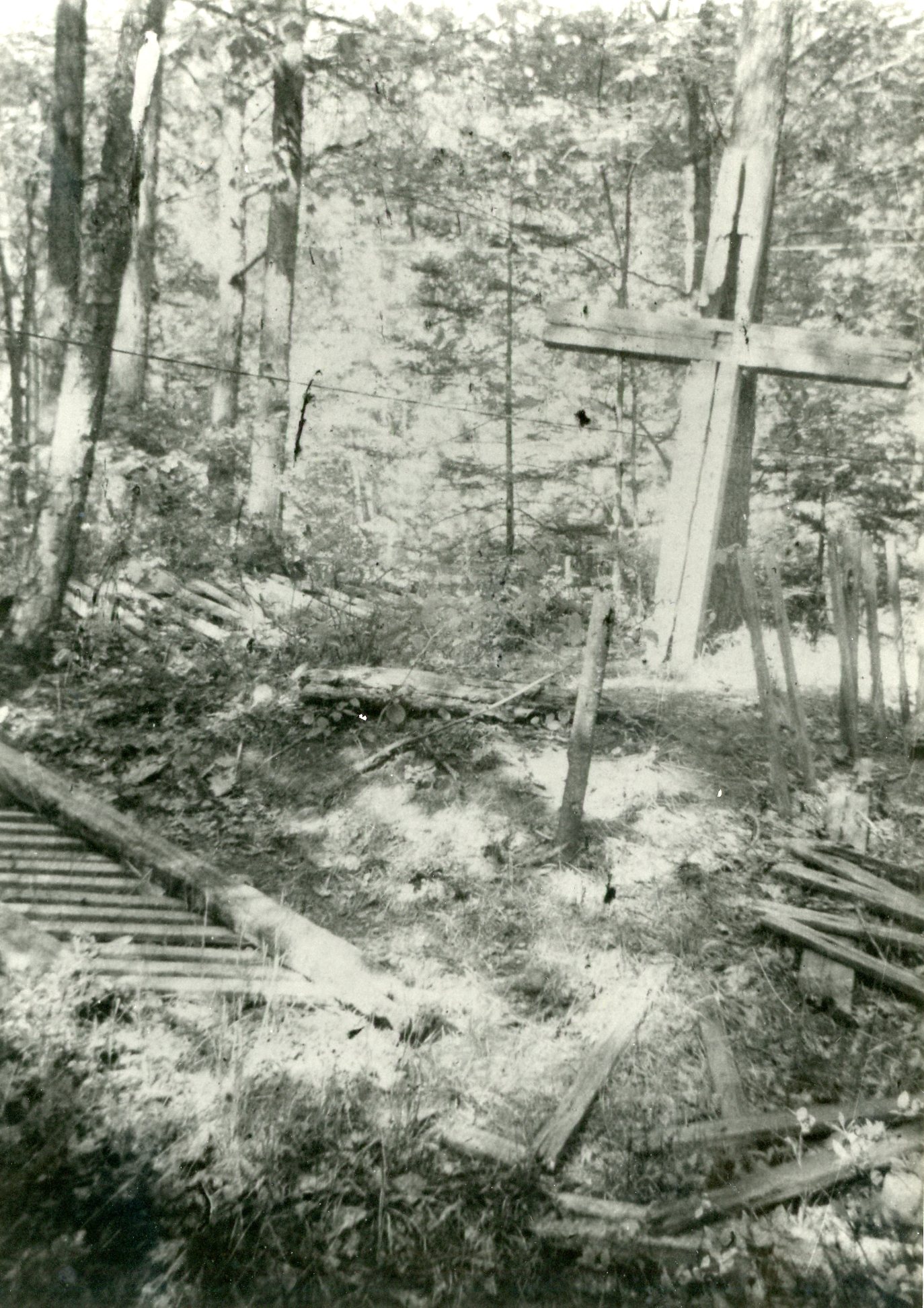
This story was passed on to Lloyd “Allie” Westcott by his grandmother, Mrs. Charles (or John) Fisher. The recorder was Roy H. Steffens, a local historian operating largely in the 1960s and 1970s, known especially for his interest in Civil War and Spanish American War soldiers and grave sites. A manuscript copy of this story was found among Steffens’ papers in the Local History Collection at Traverse Area District Library. Steffens and Westcott restored the cross and fence described later in this story, in 1968.
“Summer in Northern Michigan,” by teh Grand Rapids & Indiana Railroad Company, image courtesy of the Library of Congress.
The lake was fairly calm that day and a couple men from the settlement of Glen Arbor were down by the lake when they noticed this small rowboat with a white sheet for a makeshift sail not far out from the shore. Word got back to the settlement of this boat with two people aboard. In a short time most of the people from the settlement gathered at the beach to welcome some strangers or newcomers to their settlement.
It was discovered that there was two people aboard the small boat, a man and a woman. There seemed to be some reluctance on the part of the couple aboard the boat to communicate with the people on shore or land their boat, not knowing where they were or if the people were friendly. It was known by the couple in the boat that there was animosity among the people on mainland and those that were from King Strang’s cult.
However in due time thru conversation the barrier of fear soon was overcome and the boat landed. The couple made themselves known as Mr. and Mrs. Fields and they had come from Beaver Island. They had explained they escaped from the island in the darkness of night as they wanted to get away from the tyranny that King Strand held over his people. They asked that they may stay a short while to rest up from their tedious trip as they wanted to get passage on steamer (propeller) that plied the Lakes to Chicago or some other port.
The men helped to unload their meager belongings from the boat and all proceeded to the settlement. The Fields knew of the consequences they might suffer from the hands of King Strang’s ruthless men should they be found. It was decided to push the empty boat out in the lake to drift so if found it might be presumed that those in it had drowned or met with some other misfortune.
After unloading the boat all the people along with Mr. and Mrs. Fields proceeded up to the settlement. The local people realizing their plight vowed they would not reveal their names, their whereabouts or that they had been there. A John Dorsey that had a sailboat he used to bring in supplies from Frankfort agreed that when the Fields were ready he would take them to South Manitou Island where they might get passage on a steamer that would stop there. South Manitou was a port of call for the steamers to load up with cord wood which was used for fuel.
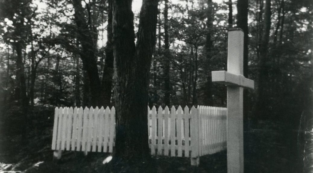
Fields’ original cross and fence, in 1968. Image courtesy of Roy Steffens.
It was imminent that Mrs. Fields was about to give birth to a child and her time would be shortcoming. The women of the settlement prevailed up on them that they should stay with them until after the child was born. In a short time her time came and she gave birth to twins. Sadly enough though she should die from childbirth as well as the two babies.
Mr. Fields secured some lumber and constructed a coffin in which was placed his wife with a child in each arm. A grave was dug on the small hill in which the coffin was placed. The people of the settlement all gathered for this sad event and she was given a Christian burial.
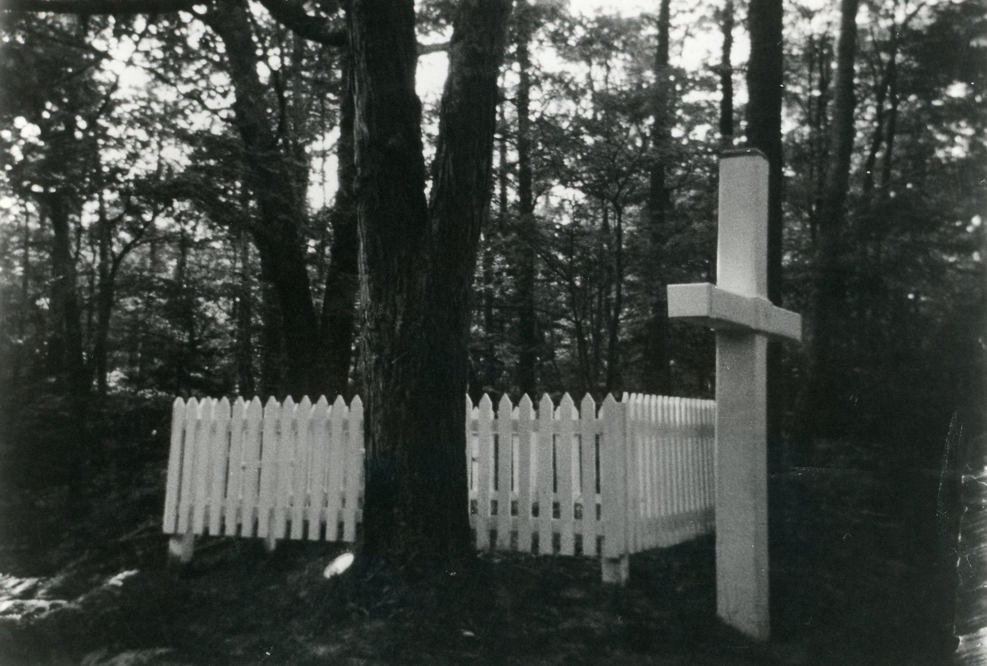
Restored cross and fence, by Westcott and Steffens, 1968. Image courtesy of Roy Steffens.
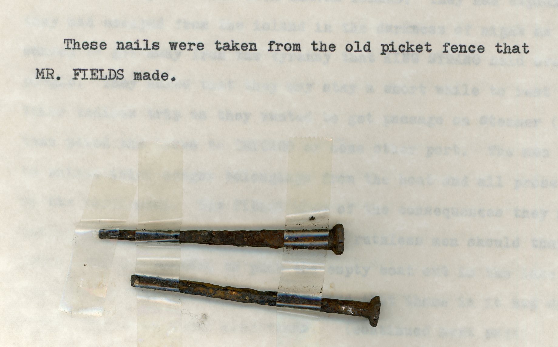
Mr. Fields constructed a large wooden cross out of cedar which he placed on the hill. The large cross thru time had weathered badly and became broken. He also made a picket fence to surround the grave which weathered away due to time. A not of interest is that the picket fence was put together with iron cut nails. Also he placed at the head of the grave a smaller beautifully carved cross.
After completing his work Mr. Fields sought passage on a steamer to leave and never returned as far as anyone knows.
Iron-cut nails removed from the original fence around the Fields’ grave. Text and nails courtesy of Roy Steffens.
The grave marker and picket fence described in this tale are found in Fisher Cemetery, Glen Arbor, Michigan. As James Strang ruled on Beaver Island from late 1850 until his murder in 1856, for this story to have any veracity, it must have taken place during these years, dating the graves of Mrs. Fields and her children to about the same time. This very dramatic story is widely known and repeated, but little corroborating evidence has ever come to light. Richard Fidler, editor of Grand Traverse Journal, published this piece way back in November 2015, concerning the Strang murder.
This month’s “News from the Societies” features our wonderful neighbor to the north, Leelanau County! Whether you’re looking for a fun exhibit for all ages, or you’re looking to do some hands-on history conservation, June in the “LC” is where it’s at! Special thanks to Stef Staley, Director of Grand Traverse Lighthouse, and Kim Kelderhouse of Port Oneida Community Alliance, for keeping us informed through their newsletters and Facebook pages. You, dear reader, can also stay informed directly at their respective online presences, linked below for your pleasure.
Also, join the newly re-named Traverse Area Historical Society at their first summer picnic! See below for details.
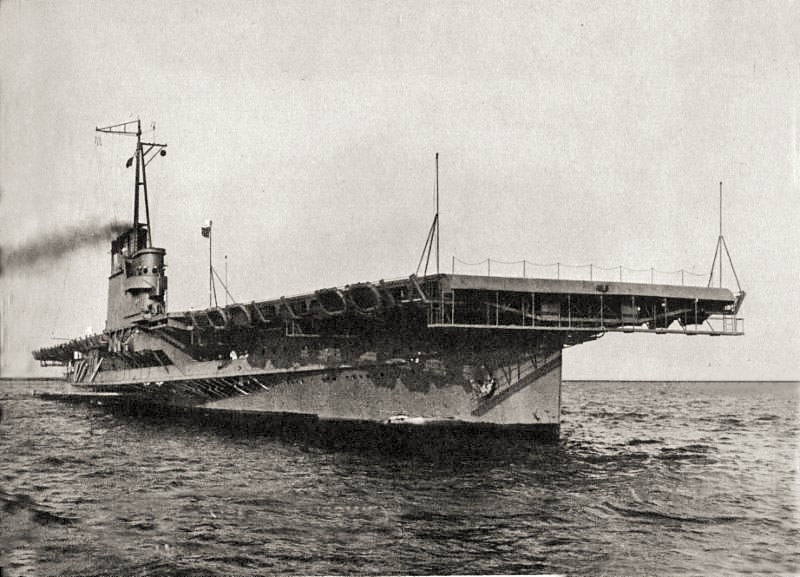
The Lake Michigan Aircraft Carrier Exhibit has been wildly popular for the Grand Traverse Lighthouse, and if you haven’t seen it yet, you are seriously overdue! But, lucky you, the Lighthouse plans to continue the exhibit for the 2016 season (“with key additions,” teases their website). The exhibit features the history of the USS Sable (IX-81) and USS Wolverine (IX-64). Both were converted to freshwater training aircraft carriers, used on the Great Lakes between 1943 and 1945. 20,000 pilots and landing signal officers were qualified on those vessels. There are awesome stories, sweet replicas, and whole myriad of photographs and histories to look at. Don’t wait, get on up there in June!
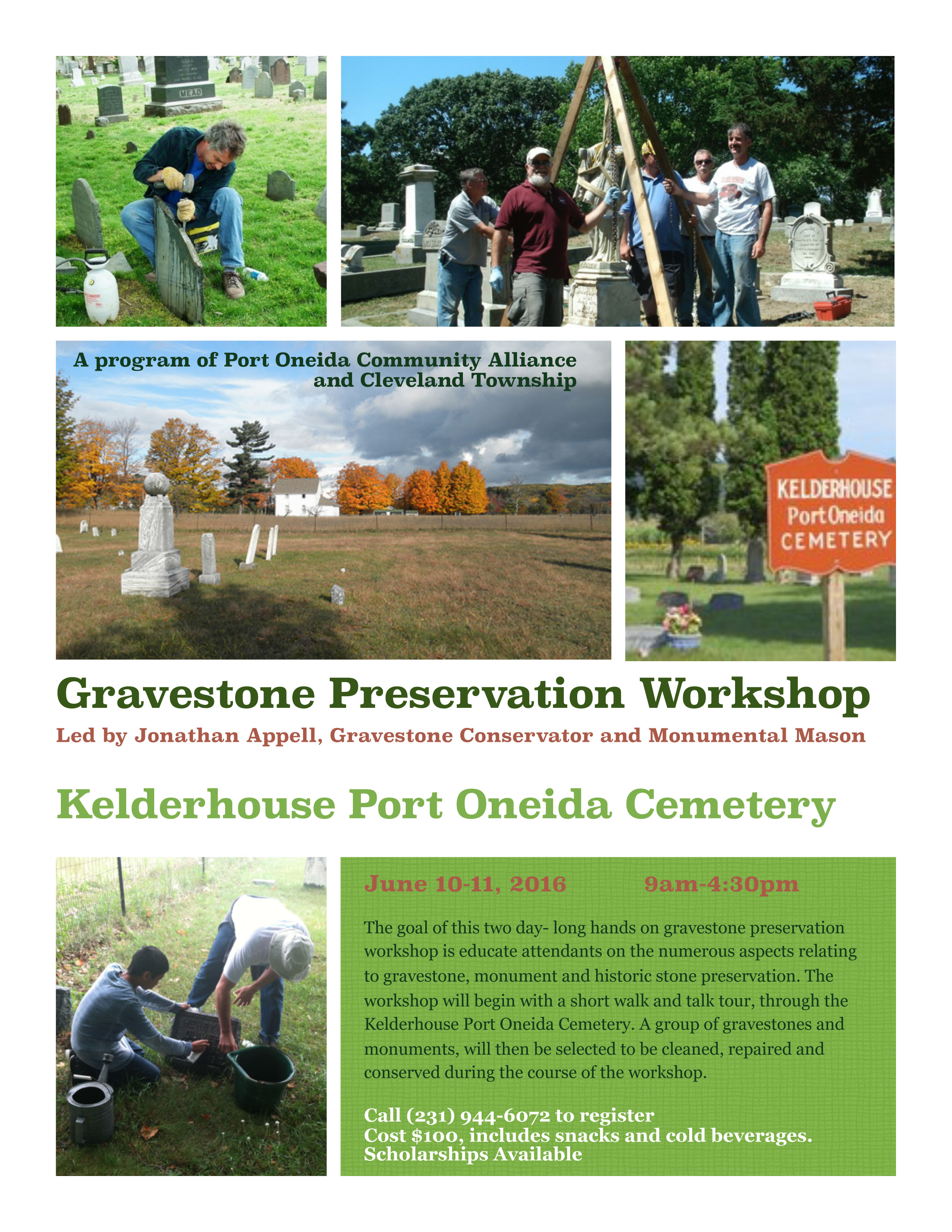
For hands-on fun, look to the Gravestone Preservation Workshop, hosted by the Port Oneida Community Alliance, in partnership with Cleveland Township, Leelanau County. A number of local cemeteries could use a little help in preserving their headstones, so consider getting trained at this event, and Your Editors will be glad to point you where your expertise is needed!
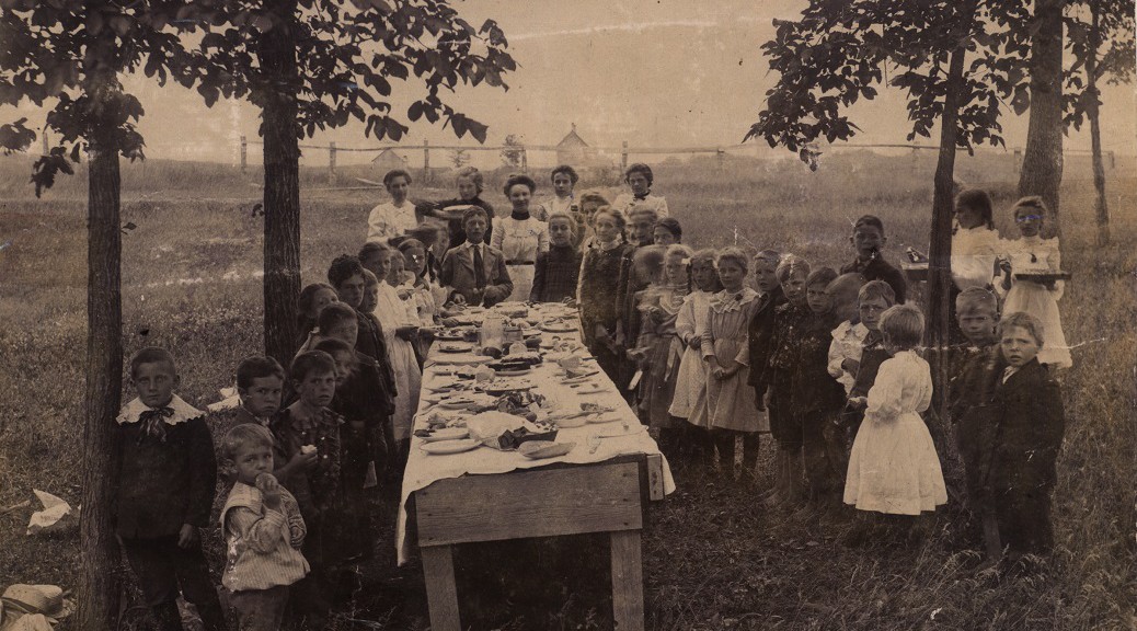
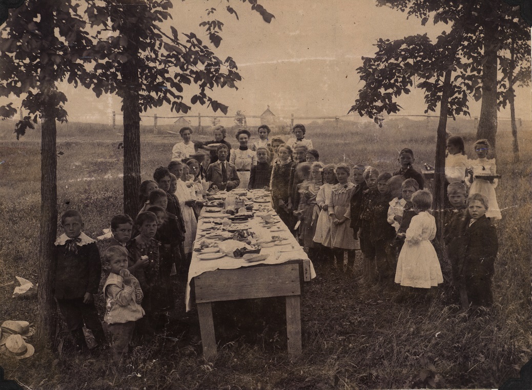
Blackman School Picnic, 1903. Image courtesy of the Floyd Webster Historical Photograph Collection, Kingsley Branch Library, Kingsley (Mich.)
Join the Traverse Area Historical Society at our first social picnic of the year, at the Civic Center Pavilion on Sunday, June 26, 2016, from 12-4p. The Society is hosting this favorite event of years past, to bring their members together and reminisce about the simpler times. Your presence will make the picnic a success! Please bring your stories and a dish to pass! Place settings and beverages provided.
By Stewart A. McFerran, Benzie resident and instructor of The Natural History of Great Lakes Fish for Northwestern Michigan College’s Northern Naturalist Program.
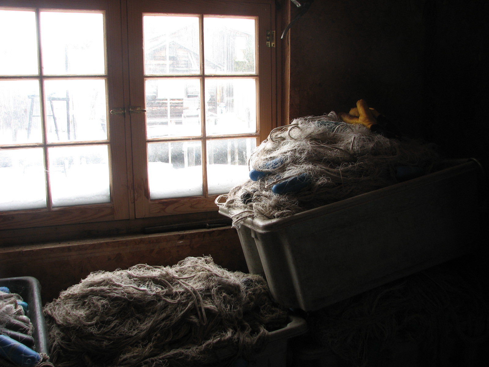
Nets, nets, and more nets. Image courtesy of the author.
I took a job as a deck hand for Lang Fisheries of Leland Harbor. Ross Lang operated the Joy and the Frances Clark, both commercial fishing boats. As one might expect, a commercial operation means catching fish for profit. Unlike charter fishing operations, we worked until the ice clogged the harbor and the steel hull could no longer break a path through ice packed into Leland Harbor.
The Frances Clark was a classic high-decked Great Lakes fishing tug. Everything inside was dedicated to the lifting of nets. Nets could be set in the deepest part of the lake. When the net came in through the side near the bow, fish were taken out and put in boxes. The net was carefully stacked in a different kind of box ready for “set back” out the back of the boat.
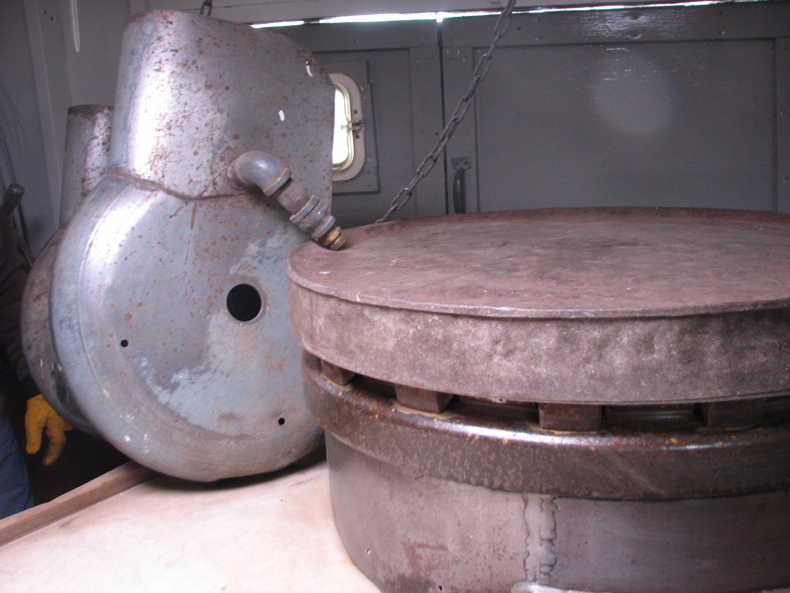
“Lifter,” equipment used in fishing tugs to pull up nets full of catch. Image courtesy of the author.
The crew, Ross and I worked at a table near the “lifter”. Ross steered and I stacked the net in a box. On days when there were lots of chubs in the net, it was slow going, sometimes taking from first light until the afternoon to lift. The chubs, or Coregonus hoyi, are part of a genus including whitefish, cisco and lake herring. There were days we caught over a thousand pounds. I was a novice fisher but had the advantage of never getting sick.
We fished from Northwest of North Manitou Island to Platte Bay, some of the same waters that Magdalene (Lanie) Burfeind fished in 1869. She kept her boat at Port Oneida and sold her catch to the crews of the steamers that stopped at Port Oneida. In this description of seventeen-year old’s Lanie’s fishing methods, written in 1869 and published in The Evening Wisconsin newspaper in October of that year, she had:
been the master of a handsome craft and a set of ‘gill nets’. She puts them out early in April and continues them till late in the Fall. She is out every day at daylight and again in the evening in all but the roughest weather. She takes a younger sister with her to help set and draw the nets. She often brings in a couple of hundred fine lake trout white fish… Her white mast and blue pennon is known by people far along the coast. Boats salute her in passing.*
At the time Lanie Burfeind fished, there were ten known species of Coregonus living in different parts of the lakes. Miss Burfiend may have caught and sold coregonids that were never described and included in the genus.
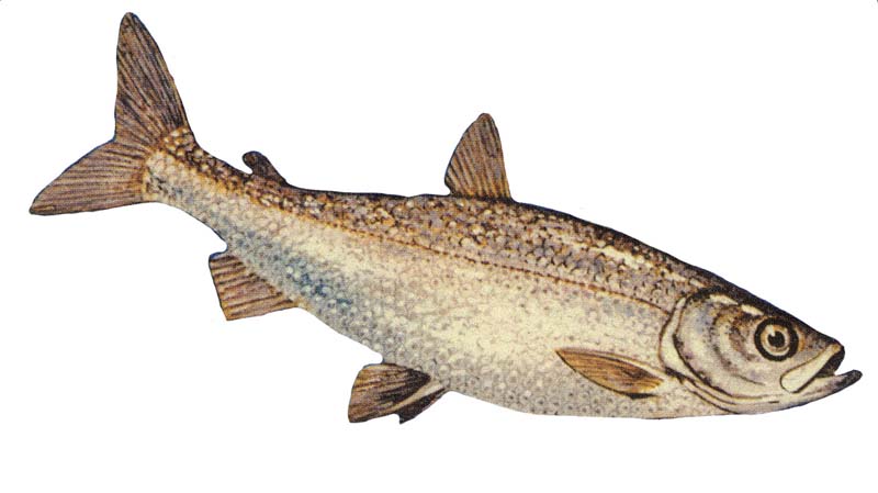
Bloater, Coregonus hoyi. “Coregonushoyi”. Licensed under CC BY-SA 3.0 via Wikimedia Commons – http://commons.wikimedia.org/wiki/File:Coregonushoyi.jpg#/media/File:Coregonushoyi.jpg
Coregonus hoyi and culpeaformis were the fish Ross and crew caught in the Manitou Passage more than 100 years later. As the net came in so did other fish and objects from deep dark places 300 feet down. A cod relation, the “big, bad” Burbot, also known as “lawyer” came in over the side with the hoyi catch. Spiky Stonerollers, stream boat clinkers and the occasional trout came in with the chubs but often nothing else but Coregonus hoyi. They had the deep dark lake to themselves. On bad days Ross sped up the lifter and the net came in empty. In 1984, a net could stand on the lake bottom and catch nothing. Not so today; Bushels of quagga mussels foul nets as they filter the same zooplankton preferred by coregonids.
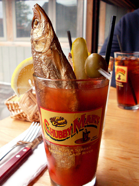
Chubby Mary at The Cove in Leland. Yum! Image courtesy of Scott Schopieray, https://flic.kr/p/6H96j2
After months of releasing “chubs” from the net I began to be aware of the variation in color and shape. There were very slight differences in hue in the silver of the sides. Sometimes I wonder if I was witness to the last of a species of Coregonus that was sold as a “Chubby Mary” at the Bluebird in Leland. It is my understanding that the popular drink is no longer made with C. hoyi but with C. artidie. Not having a degree in mixology I can’t be sure.
(Editor’s note: Upon further inquiry, the “Chubby Mary” is still available for consumption at the Cove restaurant in Leland. Described as “part appetizer, part drink,” Chubby Mary is made with the house blood mary mix, a pickle, two olives, and lemon garnish to accompany the fish, a smoked chub served with pita chips. The servers were unsure what species of Coregonus is now used.)
The US Fisheries Commission reported in 1890 that whitefish and lake herring, (both within the group Coregonus), accounted for 58% of the commercial catch in Lake Michigan. At the time there were eleven commercial fishing boats operating in Benzie County and eleven in Leelanau. None in Grand Traverse. The Booth Company was developing a wide network to exploit fisheries and fishers in both American and Canadian waters.
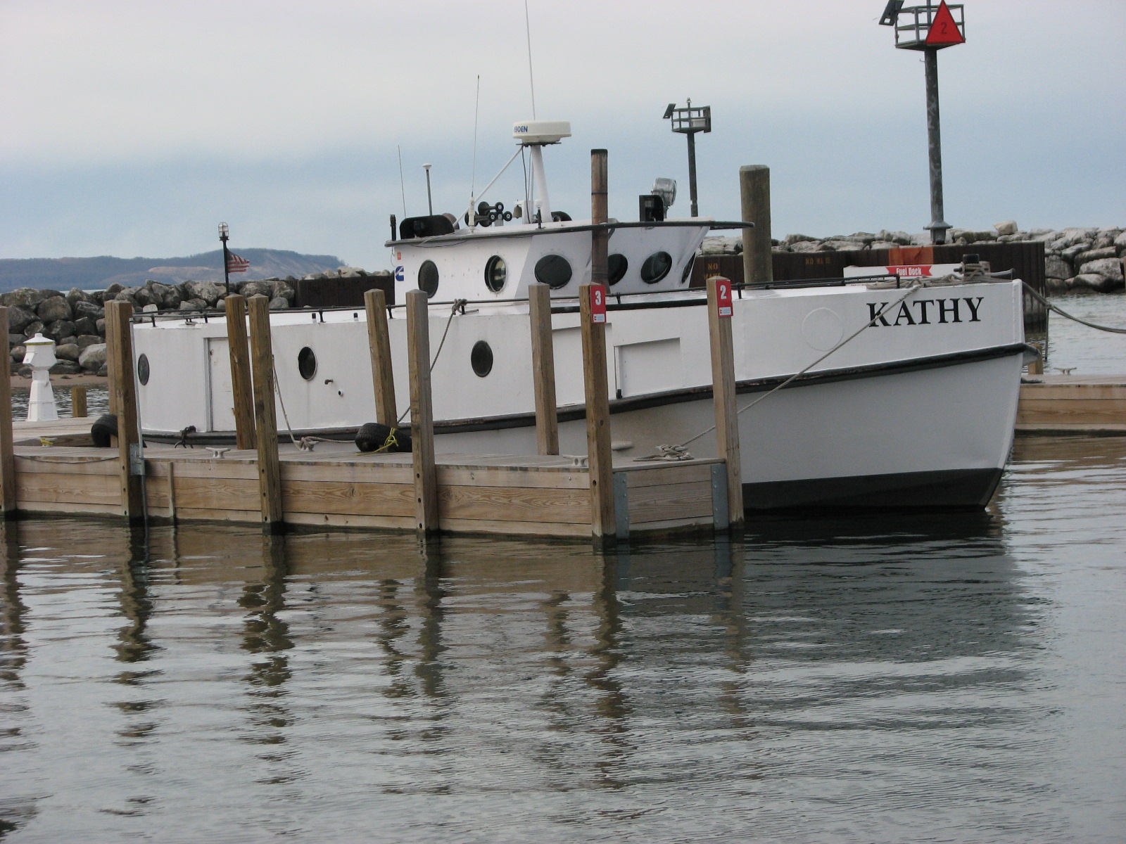
Standard modern fishing tug, “Kathy,” docked at Leland Harbor, May 2015. Image courtesy of the author.
Coregonus nigripinnis was found in great abundance in the deep waters of Lake Michigan in 1890. Blackfin whitefish were “sought mostly in steam vessels and are taken in gill nets set 60 to 110 fathoms deep.” The longjaw whitefish (C. zenithicua) lived at similar depths but did not have black markings on the fins.
The Manitou Islands have little in common with the Galapagos Islands other than the fact that a unique group of species evolved over time in isolation. Diving in the Galapagos I saw many fish and I talked with fishers unloading shark fins. I saw finches flitting about under the table of the café at Puerto Ayora. As a coffee drinker I could not miss them under foot as they evolved a taste for biscotti. It was fascinating to see that same assemblage of species that Darwin had so famously observed.
As the ice receded from the Great Lakes the coregonids were at the margin 10,000 years ago. Like Darwin’s finches they were separated into different populations as the lakes rose and fell. Each group changed as the ice continued to melt. The populations responded to local conditions and donned different colors and shapes. Deepwater blackfins became the dominant planktivore in the fathoms of Lake Michigan. The pelagic longjaw coregonids are hard to spot in the deep remote places of the big lakes, but, like the finches, changed in response to the environment.
While inhabiting remote niches and not making big splashes, the Great Lakes coregonids are a group of fish with many names that reflect the wide distribution and importance of the group. Other species of Coregonus are: kiyi, bartletti, johannae, reighardi and hubbsi. Hoyi are thought to still be present in Lake Michigan and sometimes called “bloater chub”. The blackfin and shortjaw can still be found in Lake Superior. Coregonids evolved the ability to move in the water column by regulating buoyancy as they fed on zooplankton.
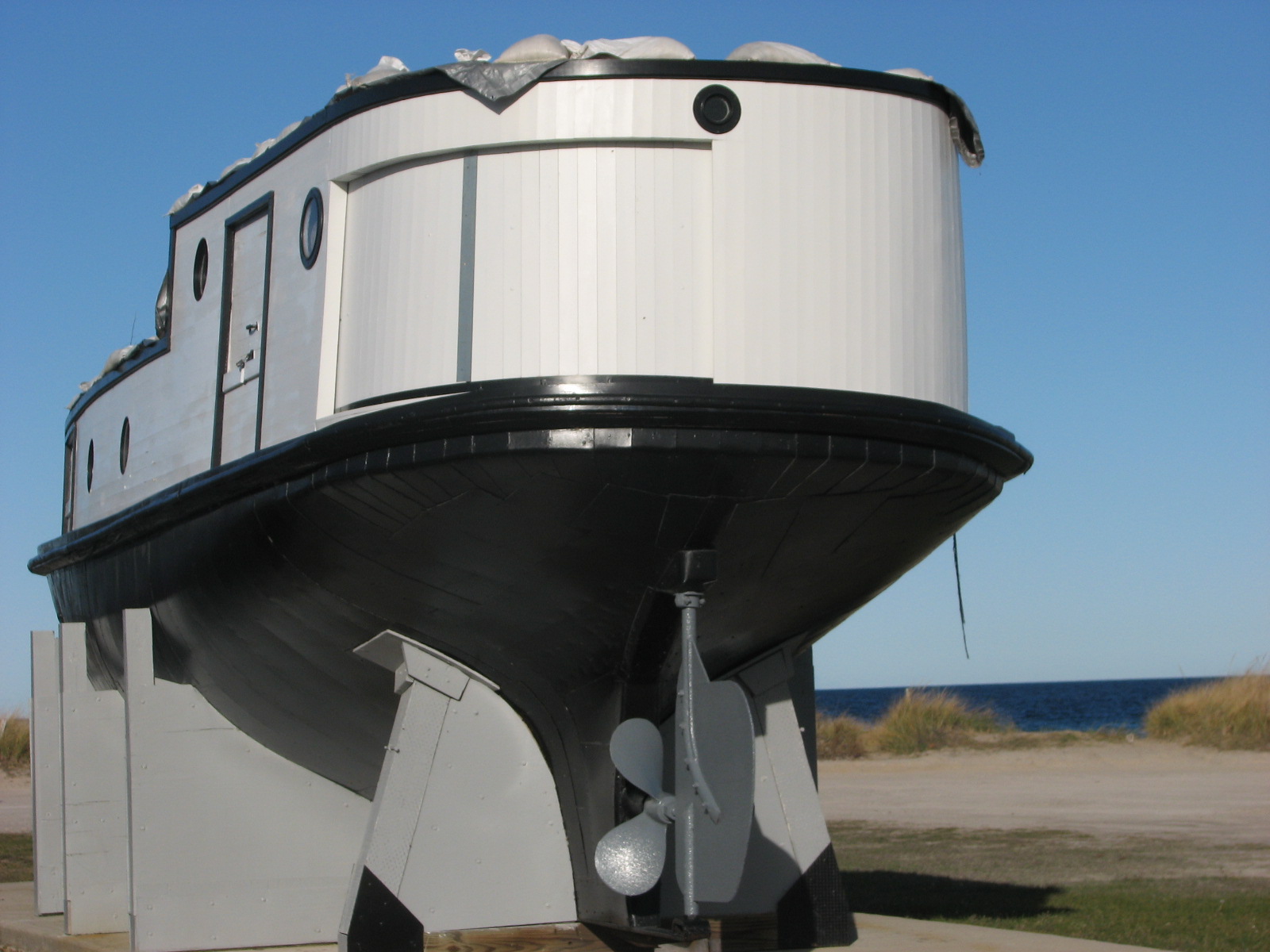
Fishing tug on display at Glen Haven by the National Park Service. Image courtesy of the author.
Over time the Great Lakes fishing tug was perfected to a point where fish numbers were threatened. The “Lifter” was developed to pull nets from the deep regions of the lakes. The covered decks on the tugs allowed the fishing operations to continue into bad weather. One such vessel is on display at the Sleeping Bear National Lakeshore in Glen Haven near where Lanie fished.
When the steamer Normon lay wooding up at Port Oneida in 1869, it was recorded that Miss Burfeind had delivered fish: “The clerk at the office tipped his hat to her as if he was in the presence of a Duchess. ‘That’s the smartest girl in Michigan,’ said the engineer as she passed out the gangway. The girl gave no heed to admiring glances and compliments that followed her, but straightaway sought her little fish cabin where she was mending nets, by the shore.”*
The decline of coregonids took place over many years. The introduction of chemicals and invasive species changed the ecology of the Great Lakes. Tiny eggs of C. kiyi and C. hoyi left to drift in the water column were gobbled up by unwanted intruders. The free floating C. zenithicus eggs were acted on by numerous kinds of chemicals. Ecological change has come to that water column in ways that biologists are still trying to understand, but it is clear that the diversity of the Coregonus group has been reduced since 1869.
It is unfortunate that the group has been so reduced. More than any other assemblage of organisms they evolved in the Great Lakes and represent the lake environment as true natives, just as finches represent the Galapagos Islands.
Stewart Allison McFerran has a degree in Environmental Studies and worked with Frankfort students on a robotics project. He led an Antioch College environmental field program to the Great Lakes and worked as a naturalist at Innisfree. He worked as a deck hand for Lang Fisheries and currently is an instructor at NMC Extended Education program. He lives on a Benzie stream. He did graduate studies in science education and was a Research Associate at the Lawrence Berkeley Laboratory. He grew up on a Lake in Michigan where he caught and released many turtles from his rowboat “Mighty Mouse”. McFerran is a regular contributor to Grand Traverse Journal.
*Article on “Lanie”, Semi-Weekly Wisconsin (Milwaukee, Wisconsin), Sat, Oct 16, 1869, Page 3
In my spare time I read field guides—books that help me identify flowering plants, ferns, salamanders, fossils, and insects. It has always been so—going back to my grade school years—and I make no apologies for it. Such a hobby, while unpromising as a source of wealth or useful knowledge, has no downsides as far as I can see. And frequently it leads me onto pathways of delight, whenever a fringed gentian in a marsh comes to my attention, a fossil crinoid discovered upon the beach, or an ant lion pit dug along a sandy trail. Field guides make such delights possible.
So it was that I picked up Barnes and Wagner’s Michigan Trees to spend a profitable quarter hour before bed. The page opened to the American Chestnut and there on page 208 the following passage appeared:
A plantation of chestnut trees, established in 1910 in Benzie Co., gave rise to a stand of several thousand offspring (Thompson, 1969).
Checking the source (Thompson, 1969) at the back of the book, I discovered that an obscure Michigan journal, the Michigan Academician, published the original paper describing the plantation. Could I get a copy of it and find out if this mysterious grove of chestnuts still existed, disease-free?
European Chestnut leaves, image courtesy of the author.
Here it is necessary to provide background for my curiosity. The American chestnut, Castanea dentata, was a grand component of the eastern American hardwood forest throughout the nineteenth century. In Michigan it naturally penetrated as far north as St. Clair county and was locally abundant in Monroe and Wayne counties in Southeastern Michigan. Beginning about 1900 the tree suffered the attack of a vicious fungus, Cryphonectria parasitica, likely imported from Asia, which destroyed American chestnuts everywhere. By 1940 the tree had largely disappeared from American forests, though suckers from dead trees continued to sprout for years afterwards, only to die upon reaching maturity.
The American chestnut should be distinguished from the horsechestnut, Aesculus hippocastanea, a tree commonly planted around homes. That tree, a permanent resident arrived from Europe after white settlement here, displays candelabras of white blossoms in June, finally producing inedible nuts that resemble chestnuts in appearance. Contrary to expectation, it is not enjoyed by horses, neither the leaves nor the nuts, though folklore insists it cures COPD in those animals.
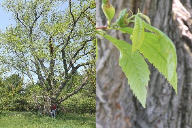
American chestnuts were planted in the Grand Traverse area from early times. I had seen individual trees planted near farms on Old Mission peninsula and had heard stories of trees planted elsewhere nearby. But had a whole grove of them survived, a grove planted in 1910? If they still lived, the trees would be more than a hundred years old. They would be magnificent.
The Grand Traverse Conservancy provided the key that would unlock the mystery of the hidden chestnut grove. In response to my query, Conservancy staffer Angie Lucas, plant expert extraordinaire, e-mailed me the Michigan Academician article. And there it was: the information I needed to find the chestnuts:
The grove, owned by James Rogers, is located at Chimney Corners (SE ¼ Sect. 35, T27N, R16W) at the top of the Point Betsie Moraine, a massive 300-foot glacial ridge which flanks the north shore of Crystal Lake.
I live in Traverse City and am scarcely familiar with Crystal Lake, but I had a human resource that would guide me to the proper coordinates: Dan Palmer, resident of Leelanau county, knowledgeable in forestry, brought up in Frankfort, and familiar with the back trails of Benzie county. We would explore the north of Crystal Lake and find these trees hidden in Chimney Corners.
To those who know Benzie County, Chimney Corners is hardly obscure. It is a venerable resort with roots going back to the early twentieth century. The lodge stands now as it did in 1908, its stone fireplace dominating the space as you enter, grooved beadboard woodwork, electric lights from an earlier time, collections of beach reading from the fifties, and the grit of sand on hardwood floors. The proprietors kindly allowed us to walk the ridge to see the chestnuts: Just follow “chestnut trail,” they said.
The three-hundred foot moraine was surmounted with breathlessness as our party proceeded up the trail. It was a steep climb through a maple, beech, and basswood forest of moderate age, but there was no sign of the sharply toothed leaves of Castanea dentata. Were we in the right place?
Then, up ahead, a clue, though not a felicitous one. An enormous white skeleton of a tree stripped of its bark with many of its larger branches fallen roundabout stood out in the shade of taller trees. It was long dead, likely a chestnut, given its size and location. My hopes dropped: They were gone, all of them.
European Chestnut bur, image courtesy of the author.
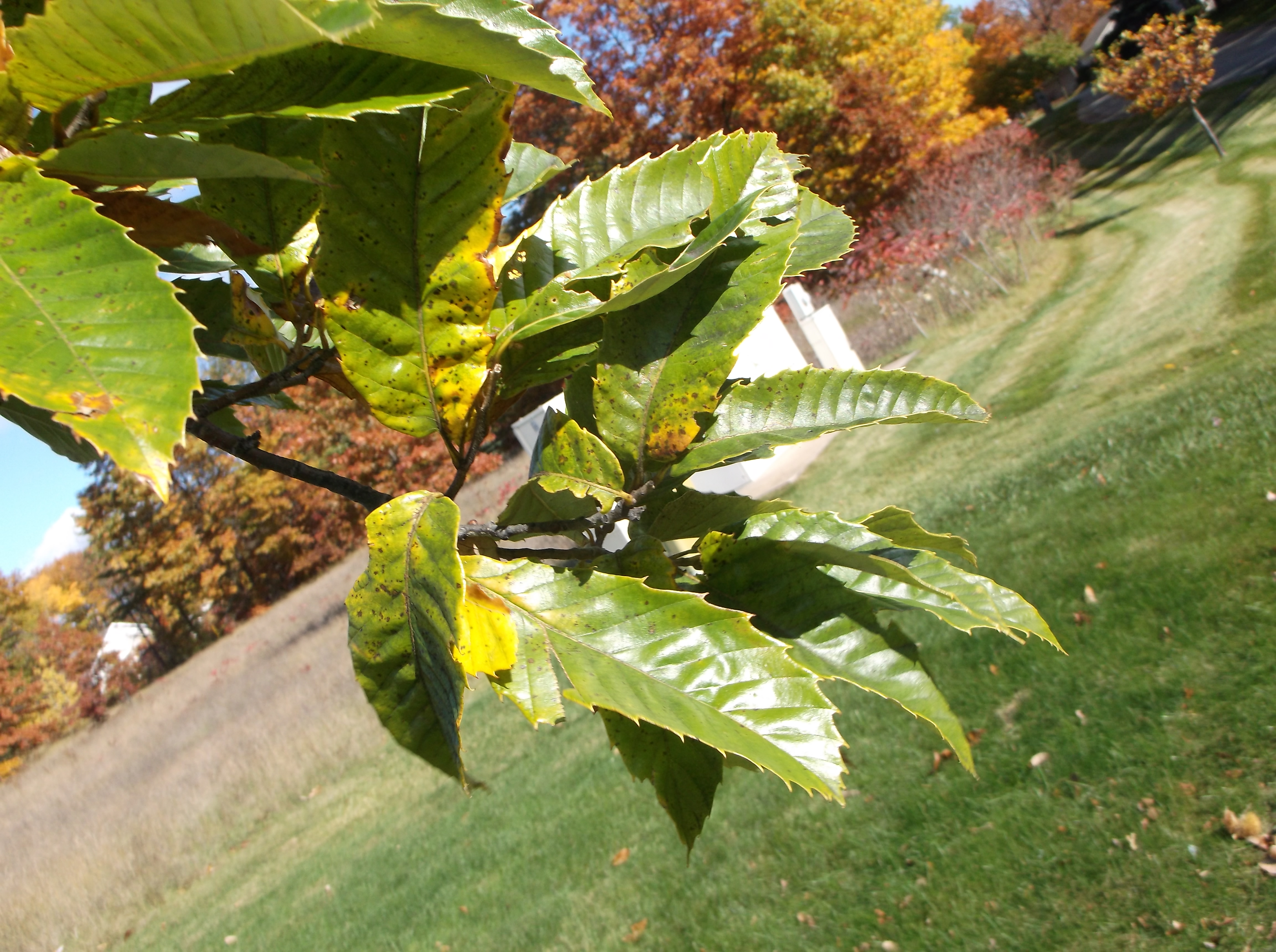
Still, we kept walking and along the trail were more dead trees, but some of them had suckers at the base that brandished the green leaves of living chestnuts. The forest floor, though, was not littered with the burs that encased the shiny chestnuts. Reproduction was not happening here: the shoots would live for a decade and die before flowering. The chestnut grove was doomed.
As we walked out of the forest, there were more dead trees, but as we came into a sunnier place, the chestnut suckers—offshoots–were more robust, as much as five inches in diameter, some of them reaching twenty-five feet or more into the sky. Green spikes of flowers appeared at the end of twigs, vague promises that chestnuts might be found in autumn at this place. We found a few burs from last year, the chestnuts missing from inside, either because the trees had not enough energy to make the nuts or because squirrels had devoured them.
Cankers caused by Cryphonectria parasitica appeared on the small stems of the chestnut suckers: the trees were unhealthy and would not live much longer. It would be a race between their mortality and their ability to produce nuts that would grow into the next generation. Remembering the fate of the white giants within the forest, I would bet on the fungus to destroy the trees before they could reproduce. There is good reason that Castanea dentata disappeared from the eastern United States.
The story could end here, but there is another thread to follow. The Grand Traverse Conservancy has just acquired a beautiful parcel of land from the estate of Naomi Borwell. Located just inside Manistee county off Manistee County Line Road, it offers a diversity of habitats: hardwood forests, deep valleys, frontage on the Betsie River, swamps, and a developed farm planted with a variety of interesting trees: spruces, birches, hawthorns—even a row of shagbark hickories—unusual in this part of Michigan. Best of all, there is a grove of American chestnuts with diameters of twelve inches, standing 45 feet high—though the ugly cankers on the large branches indicate the disease has penetrated here, too. You get the feeling the chestnut plantation is waiting its doom–which lurks in its very near future.
In nature it is unfair to take sides, though we do it all the time. Cryphonectria parasitica depends upon American chestnuts for its survival, but the fungus does not charm us with its form or grace. I have read of numerous attempts to hybridize the American chestnut with Asian forms that have a degree of resistance to the disease: you can learn about those efforts at the American Chestnut Foundation, http://www.acf.org/FAQ.php It seems likely that blight-resistant chestnuts with American chestnut features will become available within a decade or two, though the degree of resistance has not been determined as of now.
Perhaps it will be years before we can obtain American chestnuts to plant beside our homes without fear of the fungus destroying the trees, but when that time comes, I will be among the first to get them, God willing. With its glorious history in our forests, its stately grace, its delicious fruit, the American chestnut is too splendid for us to abandon.
Postscript
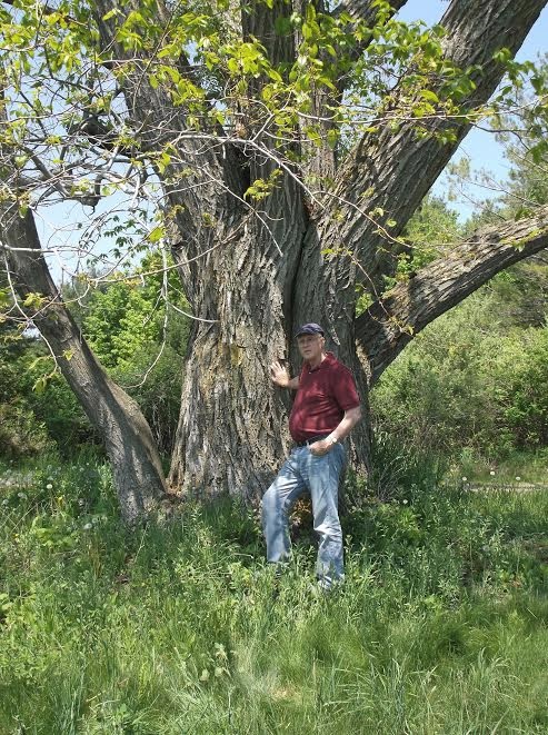
Sometimes stories refuse to end, no matter how hard you try to bring them to a conclusion. A friend at the public library informed me that he was quite sure a Michigan champion American Chestnut could be found at the end of Old Mission Peninsula. After a few days he emailed me the specifics: according to the Michigan Botanist, Volume 37, 1995, an enormous tree could be found off Old Mission Road, quite close to the country store, a bit past a curve, off a drive heading towards a cherry orchard. Could it still exist 20 years later?
Author at base of blight-free, Michigan champion American Chestnut on Old Mission, 28 May 2015.
How could anyone do anything but drive out there and find out? Surprisingly, the directions were easy to follow and, with the help of a neighbor, Jim Hilt, my friend Marlas Hanson and I soon observed a tree towering in front of us, an American Chestnut far larger than any we had seen heretofore. Its trunk was split into three stems, twisted each one of them, and the canopy spread above over a wide area. It showed a few dead limbs, but it was alive—and not in bad shape for an old tree. There was no evidence of chestnut blight.
However, there was something peculiar about the tree: one would expect American Chestnut saplings round about, planted by squirrels that forgot where they sequestered the nuts, perhaps. But there were none to be found—not one. A few old burs from the previous year were scattered around the base of the tree, the nuts gone. It looked as if the tree had bothered to produce the spiny burs, but either they were empty from the start or else contained nuts that were infertile—or maybe every single one had been consumed by wildlife. In any case this American Chestnut had no offspring.
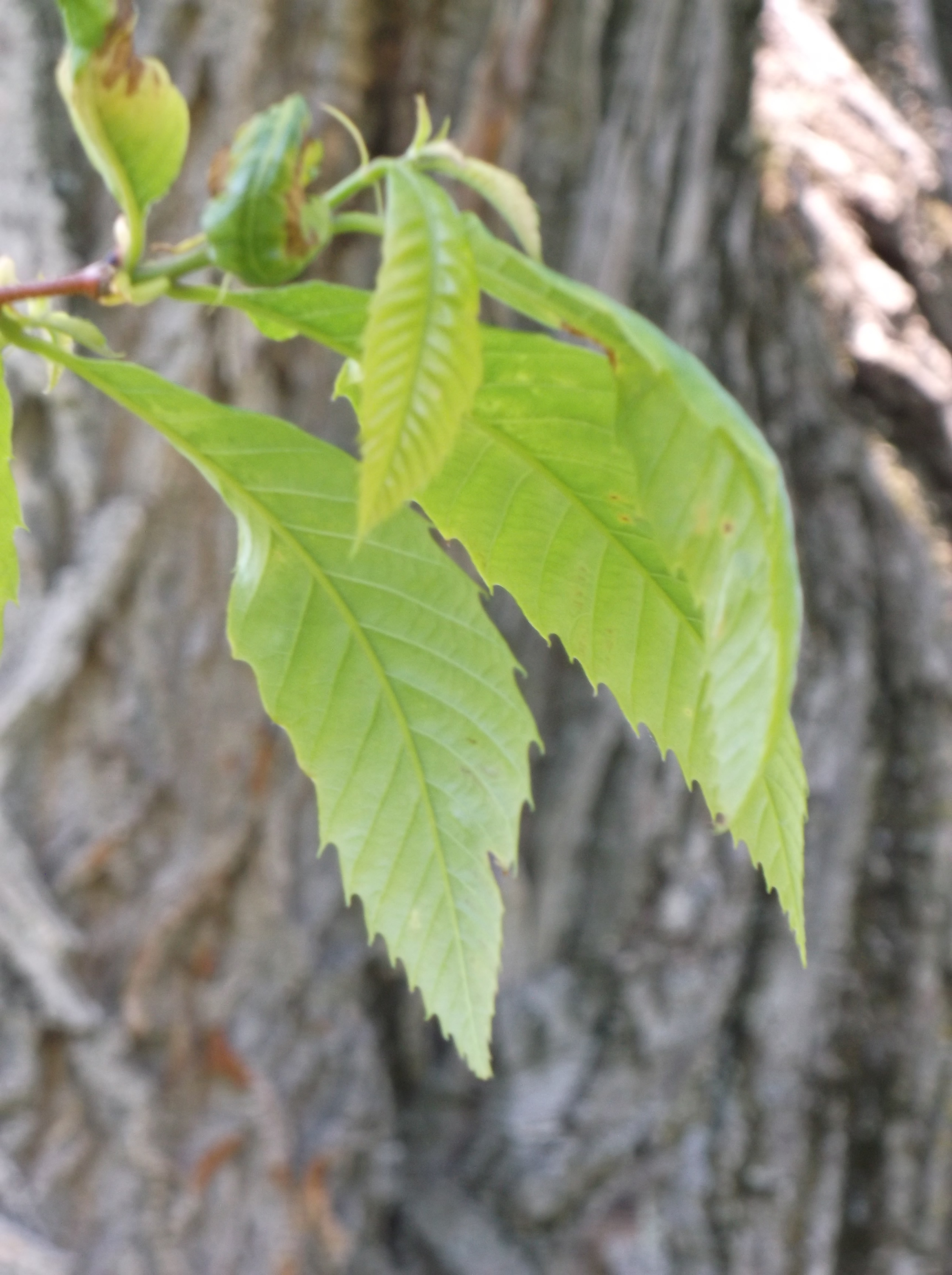
Immature leaves of the Michigan champion American Chestnut on Old Mission, 28 May 2015.
A puzzle: Does the very character that makes the tree infertile cause it to be resistant to blight? In other words, this tree—and another located three farms away—are the only ones I have seen that have not succumbed to the disease. Do they avoid blight because they are incapable of reproducing? Or is the answer simpler–that the champion Michigan tree needs other chestnuts nearby in order to obtain pollen for fertilization and that its infertility has nothing to do with its resistance? I do not know the answer, but I would like to find out–but to investigate that thread would take another year or two or five, and this story must end sometime. And so, let us end it here for now.
Richard Fidler is co-editor of Grand Traverse Journal.
Local historical societies understand your attention is in demand. Every available cultural event abounds in the Grand Traverse Region. Thankfully, many of these societies will “push” their media announcements to you, in exchange for a simple “Like”!
Facebook remains our region’s go-to for nonprofit organization social media pages. If you didn’t join over a decade ago (February 4, 2004 to be precise), it’s never too late to join up and become informed about what your favorite groups are up to.
My new favorite is Leelanau Peninsula History Network, founded in October 2014. Not only do they push their members’ activities (which includes most of the local societies in the county), they reach out to other regional societies, like the History Center of Traverse City, and repost their announcements as well. A very active group indeed!
Benzie Area Historical Society and Museum has some fantastic programs coming up in January and February, on “Rome’s Sacred Spaces” by Dr. Louis Yock and “Lizzie Borden Revisited” by Al Bryant, if you are looking for some non-local history. Search for their Facebook page and give them a “like” to stay in touch.
Finally, History Center of Traverse City‘s new monthly programs are gaining in popularity at every meeting. Chautauqua remains locally-focused, while the Megatherium Club ranges through time and space for their history topics. Like many local groups, History Center typically announces new events on Facebook before their website, so “like” once and you’re in the know.
We mark the passing of community elder Dorothy (Dottie) M. Lanham, who died on December 30, 2014, five days after her 90th birthday.
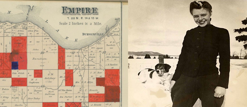
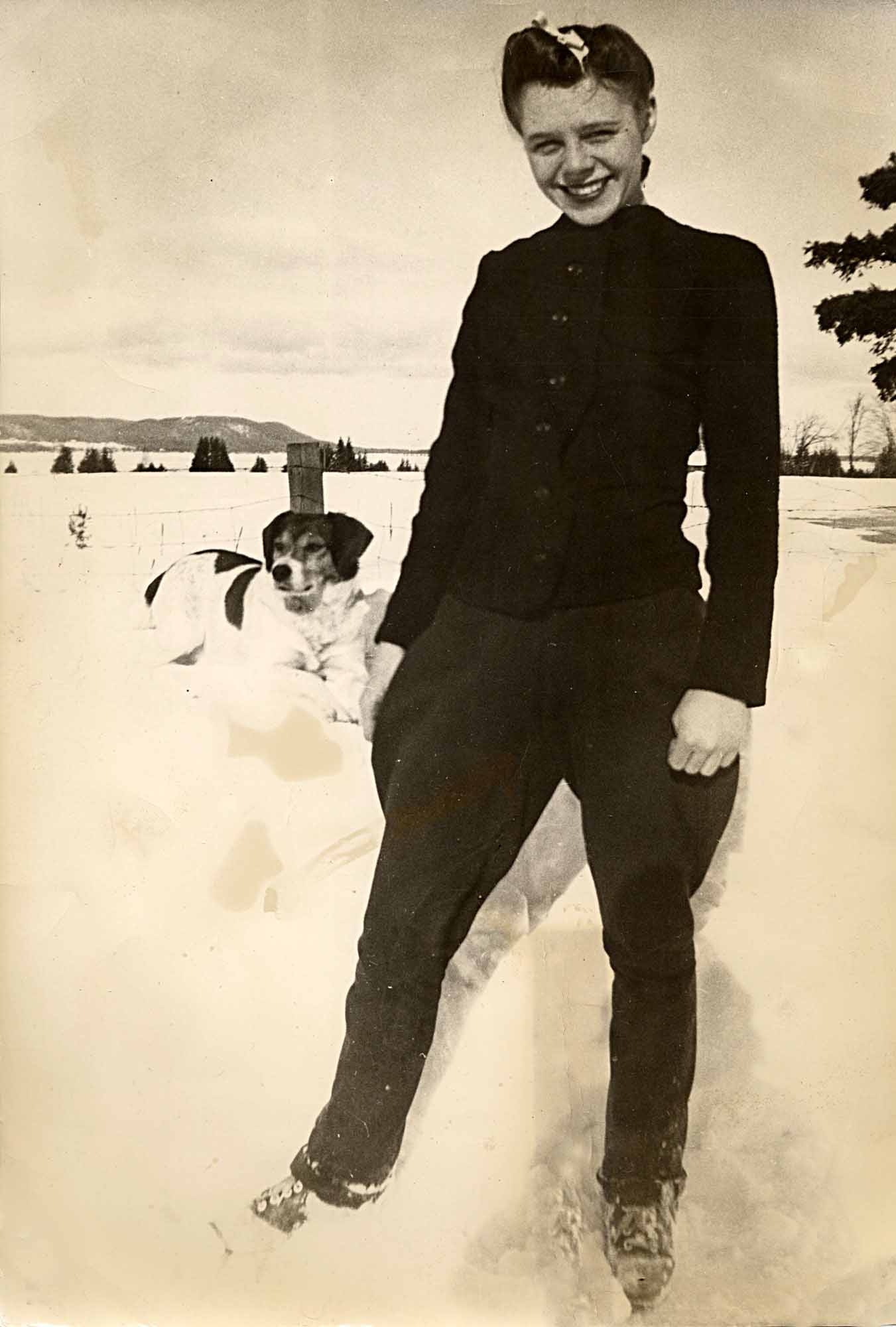
15-year-old Dottie Lanham, her companion Jerry, and the view from their Burdickville home: Glen Lake and Alligator Hill (now part of Sleeping Bear Dunes National Lakeshore), 1939.
Dottie was born on Christmas Day, 1924—a fourth-generation citizen of Burdickville, the small village along the southeast shore of Glen Lake. She grew up in Burdickville, married a man from Burdickville, and lived the rest of her life in and around Burdickville. She raised two children there, helped run a business there, and continued til the end to help care for and preserve Burdickville’s historic Old Settlers Picnic Ground. Plainly, Dottie knew and loved Burdickville and the surrounding area.
In 1997 Dottie was named Leelanau County Woman of the Year, based on her years of community service. During recent times she spent many hours preserving the history of Burdickville and surrounding areas. She made her large collection of family photographs available for digital preservation, and spent many hours providing related information.
A book based largely on Dottie’s photos and oral history interviews (but also including pages about others from the surrounding community) can be viewed HERE. Excerpts from her oral history interviews and those of others are available HERE.
Thanks to Tom Van Zoeren for this month’s “Celebrate the People,” honoring a true crusader for local history and nature conservation. VanZoeren is a retired Sleeping Bear Dunes Park Ranger, who now works to preserve Port Oneida history. All of the oral history interviews, their transcripts, and related photos that have been collected have been donated to the public domain and are available in digital form at the Glen Lake Library (Empire) or from Tom. He welcomes your questions, comments, and further Port Oneida information (via email atVZOralHistory.com).
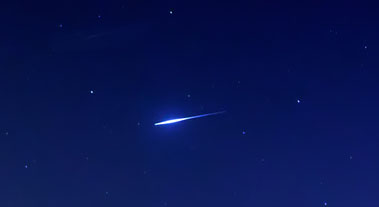
Last year’s meteor fall in Chelyabinsk, Russia had a counterpart in Leelanau County a hundred thirty-five years ago. The Grand Traverse Herald January 30, 1879 edition tells the story:
The meteor pictured here is much dimmer than the 1879 meteorite that struck Lake Leelanau. (Image of The Quadrantids meteor shower December 2011. Image courtesy of Luis Argerich, https://www.flickr.com/photos/lrargerich/.)
About half past 2 o’clock Tuesday morning, an enormous meteor passed over this region. The accounts given by the few who saw it are so conflicting that it is difficult to settle upon anything definite in regard to its direction or apparent size. We have had it coming from every point of the compass and straight up and down: it varied in size from a pint bowl to a hogshead; it struck in the bay and it struck all along the shore; it traveled “as fast as a horse could trot,” and it “flew like lightning.” We didn’t see it ourselves. We were asleep, as all good editors should be at that time in the morning. Those who did see it were evidently too startled to observe it closely. What is known is that it was an immense ball of fire, and that the darkness was made light as noonday, and that a terrible explosion followed its appearance—or disappearance, no one seems to know which. The night watchman at Hannah, Lay & Co., says that he saw it explode and that it flew into minute pieces like star dust. (The one thing that all agree upon is the explosion. This was heard with equal clearness and with like effect at Mayfield, thirteen miles south of this place and at Williamsburg, twelve miles east. We have not heard from other directions. The effect was of an earthquake shock. The houses were shaken, windows shook and dishes rattled upon the shelves. A swaying motion seemed to be given to the buildings as an upheaval and settling back. If the meteor had not been seen it would have been thought an earthquake shock. It was a big thing any way and that fellow that was close by when it fell or exploded must have thought “something dropped.”
A watchman, most likely the Hannah and Lay Company employee mentioned above, provided a more detailed description of the meteor’s passage to the editor of the Herald, Thomas T. Bates. Somehow, his notes turned up in the Report of the 49th Meeting of the British Association for the Advancement of Science (1879) in an article called Report of Observations of Luminous Meteors.
Was on watch, passing from due west to east; saw a great light; turned quickly, and saw a ball of fire over my right shoulder; turned to left and watched until it disappeared; when first seen it appeared about as high as ordinary rain-clouds; appeared to me larger than full moon; full moon looks to me to be 18 or 20 inches in diameter; meteor appeared to pass me, and move out of sight at about the rate of speed a descending rocket has after its explosion; had a good chance to see it plainly; just after passing me a singular thing occurred; a ring of fire seemed to peel off the meteor itself, and this followed the ball of fire out of sight, but dropped a little behind it; it was perfectly distinct, and appeared to be hollow, for I could see a dark centre. Everything was as light as day. I looked at my watch as it disappeared; it was just 28 minutes after 2 o’clock. I passed on my beat, and shortly the terrific explosion came. It shook and jarred everything around. I immediately looked at my watch, and it was 32 minutes after 2.
From this account and others, Professor Kirkwood of the British Association for the Advancement of Science, commenting about the event, drew the following conclusions: The fireball first came in sight nearly 100 miles over a point about 30 miles S.W. of Great Traverse City and disappeared about 26 miles above a point about 42 miles N.E. by eastwards from that town. The whole visible track was 124 miles, and its projection on the earth’s surface 66 miles in length from a direction S.W. by S. towards N.E. by N. Of the time of flight, which was described as several seconds, and of the real velocity, except that the observations indicate a rather slow motion, nothing definite can be affirmed. (The author goes on to speculate that the meteor may be related to the ‘Cancrid’ meteor systems which occur in the months of December, January, and February.)
In 1879 there were few inhabitants living in the Grand Traverse area, this fact explaining why, outside the Herald, little note was made of the meteor in other publications of the time. Surely, an event that lit up the night sky as “light as noonday” while producing an explosion loud enough to “shake houses” would have aroused the interest of larger populations living in Chicago or Detroit. Newspaper editors there would have written about it in order to answer questions of readers. However, there is no apparent mention of the meteor in the Detroit Free-Press or the Chicago newspapers.
A more precise word than “meteor” for this event is “fireball”. Nowadays that term refers to a very bright meteor of magnitude -4 or better, brighter than the planet Venus. They are relatively common, the Earth receiving several thousand a day, most over oceans, mountains, deserts and other inhabited regions. Very few reach a size large enough for a fragment to impact Earth and even fewer that light up the sky as if at midday, producing an explosive thunderclap.
Another term used to describe fireballs is “bolide”, the word connoting an extremely bright fireball, one that explodes, often leaving fragments on the surface of the Earth. Even bigger than a bolide is a “superbolide”, a meteor with a brightness more than -17 (the sun has a magnitude of -26). If the 1879 account describing the meteor as brighter than the noonday sun is not an exaggeration, the Traverse area certainly encountered a superbolide.
The Grand Traverse Herald was not through describing the meteor. After penning the above article, editor Bates later talked to R. S. Bassett, a local fisherman, who offered a first-hand account. Bates continues:
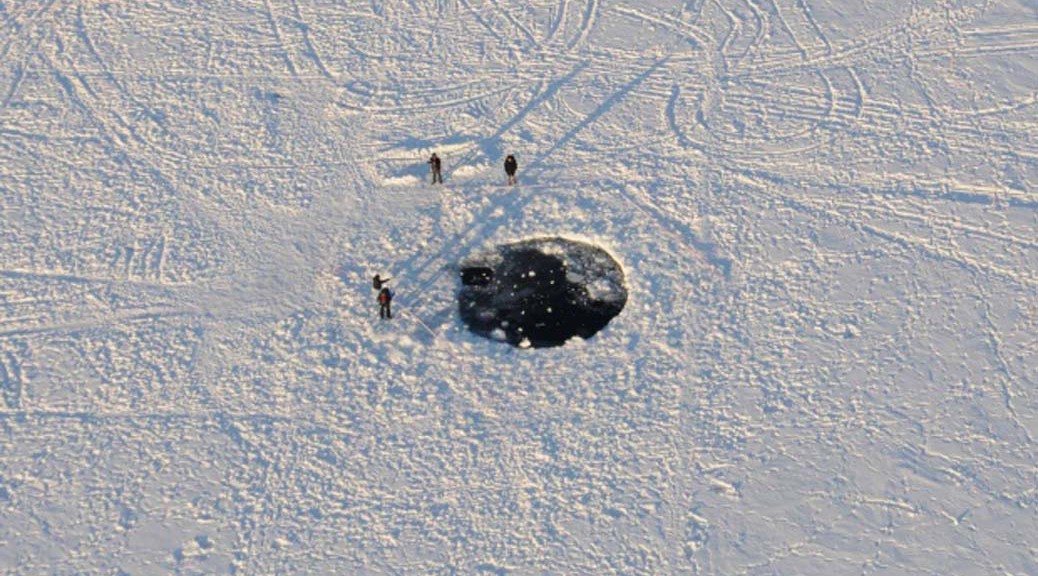
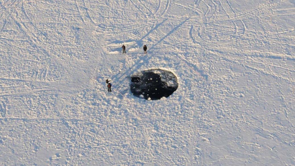
We have just seen Mr. R. S. Bassett, who has a fishing shanty within a few rods of Fouch’s dock at the head of Carp Lake, seven miles northwest of this place. Mr. Bassett was awake and saw the flash and was almost immediately deafened by the report of the explosion. The next morning a large hole, fifty feet or more in diameter, was discovered in the ice about 600 feet from shore. The ice was solid in this spot the day before. For a long distance around the surface was cracked and broken and the ice around the hole itself, being twelve or fifteen inches in thickness, had the appearance of being driven down. The water at this spot is only eight or ten feet deep and the bottom of the lake is soft and muddy.
Carp Lake is an early name for Lake Leelanau; Fouch’s dock is at the extreme southern end. The community of Fouch, consisting of a few cabins and cottages, can be found on the oldest plat maps of the area. Clearly, a meteorite, perhaps more than one, lies in shallow water in the lake—and we know approximately where it is. Not only that, with a hole in the ice approximately fifty feet in diameter, we can make guesses about how big it is.
This image is of a the recent meteorite fall, which occurred in Russia in 2013. Photographer Eduard Kalinin, Canadian Broadcasting Corp.
One of the fragments of the meteorite that struck Chelyabinsk, Russia, in 2013 also struck the frozen surface of a lake. It left a hole about 23-26 feet in diameter, from which a five-foot long meteorite was pulled some time after the event occurred. If the Lake Leelanau meteorite left a hole twice as big, it may have an even larger fragment–though such size estimations are difficult to predict, since it is possible—even likely—that the fragment broke up into smaller pieces upon impact.
Would modern imaging techniques reveal the under-lake location of the 1879 meteorite? Even if located, could such an object be easily brought to the surface? The Chelyabinsk meteorite weighed 1250 pounds before it broke apart into three pieces. How much more would an object that produced a fifty-foot hole in the ice weigh? We do not know the answers to these questions—but wouldn’t it be fun to find out?
It’s early on a clear, sunny morning in mid-April. Lake Michigan is calm and the water looks smooth as glass. Hold on a second, it is glass! That’s a common result in this season, when waves are absent and temperature drops to freezing overnight. The outboard motor starts cutting through the nearly inch-thick skim ice. I throttle back because I’m frightened. There seems a real possibility that a planing boat could lift itself right on over the surface of the thin ice. That could spell some sort of disaster!
An imagined news report says, “16 foot aluminum puck with airborne, roaring outboard motor, skimming along ice, hits weak spot, then noses in on impact and slips under ice. Body found trapped beneath ice.”
Better to slow down. The sound of ice cracking is like breaking plate glass windows, and I begin to wonder, could really sharp ice sheets puncture an aluminum boat? Directly behind the boat are room-sized, jagged, transparent sheets sticking out of the water at various angles, and as I look further back there is a black path that I have cut in the ice. It’s very easy to see where I opened-up the motor (straight black line) and, where I got worried (the many course corrections cause zig-zags).
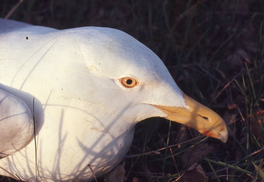
Why am I doing this? It’s nesting season for herring gulls. I’m heading for Bellows Island, sometimes called Gull Island. There, I have permission of the island’s owners, the Leelanau Conservancy, to continue my long-term studies begun as student field trips over thirty years ago. We started by studying the non-verbal communications systems of herring gulls worked out by Nobel Laureate, Niko Tinbergen.
Generations of my students will recall the video of Tinbergen with his thick Dutch accent proclaiming, as he strikes an offensive clenched fist pose, “When I do this, you know exactly what I mean.” He did that to show that certain signals have universal meaning. His interpretations of gull sign language are still widely accepted as definitive basic communication among vertebrates, and his conclusions also have many applications to human behaviors. For example, smiling to express a friendly attitude is universally accepted among humans. Or, a crying baby reveals discomfort and elicits motherly behavior. We instinctively understand these signals, and so too, the gulls have also evolved their own precise set of instinctive signals.
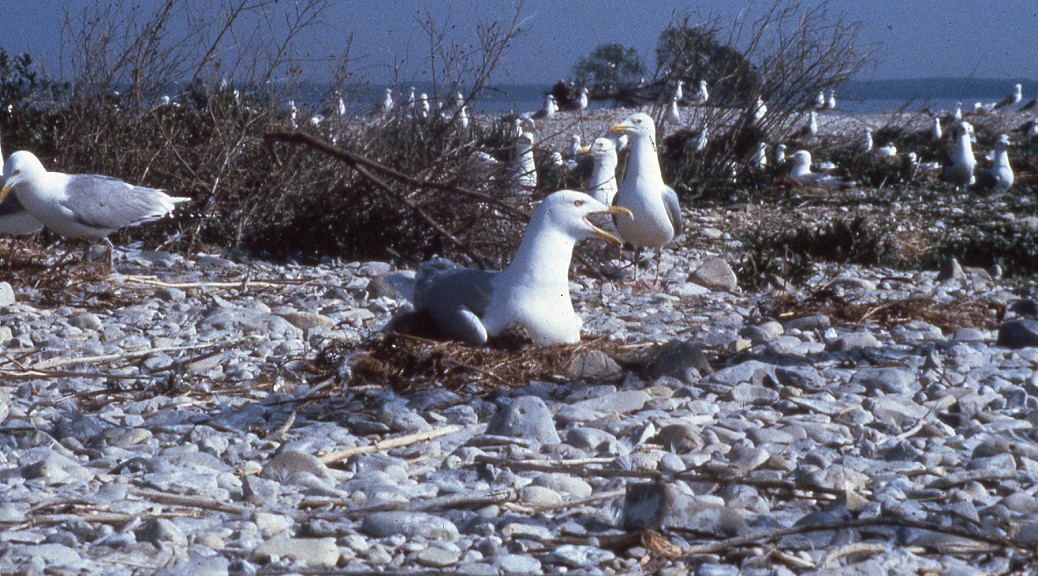
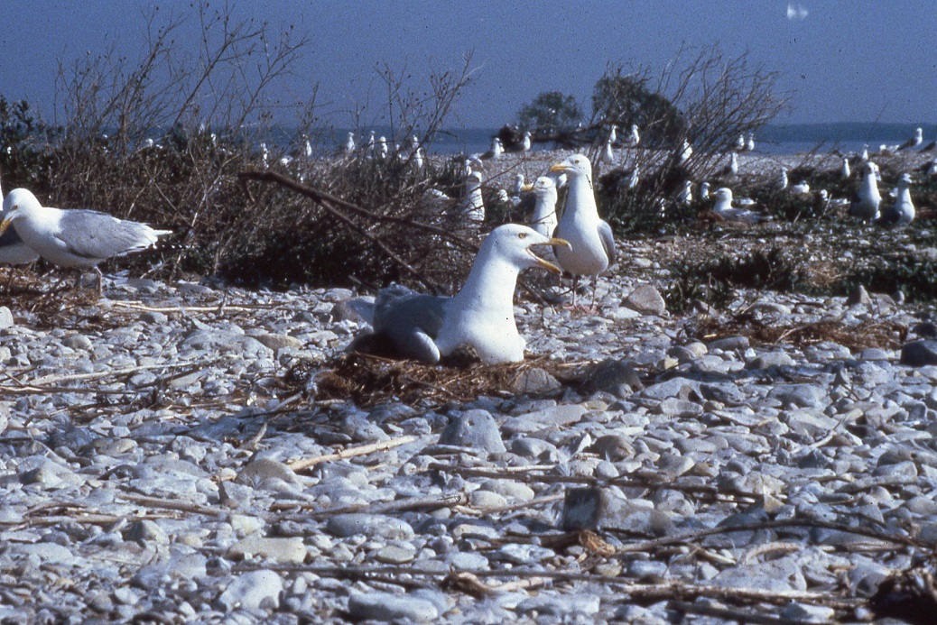
The sole inhabitants of Bellows Island, also known as Gull Island, busily nesting.
Gulls are highly territorial, meaning that they defend a small area, around their nests. Gulls have special threat postures that signal to possible intruders, but define the territorial boundaries to their mate. It is with aggressive behavioral encounters between strangers that gulls communicate each pair’s boundaries to the rest of the colony. Ironically, it is acts of aggression that make a cooperative and happy colony. That is, as long as territories are recognized and respected, there is peace, order and calm in the colony. Through threatened and occasionally overt aggression, to twist the poet’s phrase, “good neighbors make good fences”, even if the fences are invisible and symbolic as in the case of the gulls.
The processes of pair formation and courtship has its own signals of love and pairing. The formation of the pair, or the engagement party, is usually celebrated when the male regurgitates his last meal to share with his mate. She must be well fed to ensure viable eggs, and the gesture of sharing his meal signals the pair bonding together symbolically. Occasionally, a male that has just decided to “get engaged” changes his mind and re-ingests the food himself, thus, calling off the engagement. It may be nothing more than the fact that he is hungry, but it represses the pair bond until such time as he can share fully.
Chick rearing also has its own unique signals. The chicks learn to beg for food by pecking at a special orange spot on the adult’s bill. A pecking signal from the chick at the spot on the bill leads the adult to bring up food for the chick. Tinbergen called such specialized signals “sign stimuli.” Parents also communicate their territorial boundaries to their chicks. If a chick strays into another territory, that chick is in danger of being attacked by the adult pair in that territory. Such attacks lead to severe injury or death to the stray chick. Strays that are killed are often eaten by the neighboring territorial adults.
The state of organization and benefits of nesting in a colony have prompted some to describe a colony as “Gull City.” Indeed a colony benefits from social communication beyond the benefits necessary for individuals to function. Signals recognized by the masses are complete with penalties for transgressors and rewards for obedient citizens. Gulls communicate the location of food sources by watching the success of others. They synchronize their nesting cycles through day length and social behavior, which leads to laying eggs on about the same day. The degree of synchrony in egg-laying is a good measure of the social stability and behavioral cohesiveness of “Gull City.” Large numbers of gulls nest together to overwhelm potential predators. Gulls choose isolated island sites for their colonies because such islands lack ground based predators such as foxes, raccoons, skunks and weasels. Occasionally, colonies nearer the mainland are visited by owls or hawks that can kill large numbers of both adults and chicks or a fox may gain access to an island over winter ice. Initially a fox in a gull colony may find a rich food supply of adults, eggs or chicks, but when the gulls are done nesting in late June or July, the fox had better learn to swim quickly, if it wants to continue eating.
My students and I were curious about other aspects of the gulls’ lives, such as: When they leave the colony where do they go? Are the sex ratios even? Do they return to their hatching colony? What ages are the nesting gulls? As we began to answer these questions still others popped up. It was only a short time until we were putting numbered, aluminum bands on gull chicks to find the answers to these and other questions. We had to know the “who” about the gulls before we could answer questions about “how” and “why.” Banding was the best way to do this. We used U.S. Geological Survey Bands that weigh less than one-tenth of a percent of the bird’s body-weight. That seems similar to humans wearing jewelry. Dangers to chicks from other adult gulls, while we were banding, were monitored carefully, and all humane protocols were subscribed to. All of this was done under Federal and Michigan permits issued to me. I had been trained during a summer internship with Frances Hamerstrom in Wisconsin and two summers with Edward Balfour in Scotland. I have since qualified as a trainer of new banders, and been approved by veterinary animal care and use committees at two research institutions.
Bellows Island, southern-most herring gull colony in this part of Lake Michigan, is a bastion against the onslaught of increasing numbers of smaller gulls, the ring-billed gulls. Ring-bills are the nuisance birds begging and eating garbage around fast-food outlets and parks. The ring-bills often out-compete the larger herring gulls at other nesting sites, because of their social structure, close nesting habit, and increased ability to thrive on a generalists diet augmented by human refuse and agriculture. Herring gulls are more specialized and less generalists in their food habits, and thrive primarily from dead fish or water-related scavenging. In recent years, parts of Bellows Island have been usurped over by another fish-eating bird, the Double-crested Cormorant. I will leave cormorant discussions for another time.
Herring gulls from Bellows Island travel long distances in winter, mostly in their first three years. Later, as adults, they winter closer to home. Many bands of young birds have been returned from throughout the Great Lakes region. That is: New York to Northern Wisconsin, and south to Ohio and Illinois. A few seem to wander north into Ontario and Quebec. Often the location of a leg band, found during the nesting season, is the site of another nesting colony. Many more of our bands have turned up at distant nesting sites than the reverse. That seems to point to Bellows Island serving as a “source” of new reproductive gulls rather than as a “sink” by donating excess reproduction from Bellows Island to other localities with space for newly recruited breeders.
Dozens of bands have been returned from southern states and the Gulf of Mexico in the winter. A noteworthy Bellows Island band return came from the mouth of the Plano River in the Central American country, Honduras. The report came attached with an interesting story communicated by Dr. Miklos Udvardy, of California State University at Sacramento, who, while on a research expedition, had bartered the band from a native. According to Udvardy, the native was wearing the band as personal jewelry, and when asked what kind of bird it came from, the native answered that he didn’t know, but the bird tasted very good.
I don’t begrudge the native his taste for wild game. Rather, I have greater concern for his health, because of the toxic contamination borne by Great Lakes herring gulls. Even though the level of toxic contamination in gulls has been declining in recent years, some of it is still present. At one point in the 1960s, Dr. James Ludwig, then of the University of Michigan, found that Bellows Island was among the highest in contamination for herring gull eggs that he tested. At that time, the hatchability of the eggs from Bellows Island was very low. Ludwig is convinced, and has written and spoke extensively, that there was a linkage between toxics and infertility in the gulls. Drs. Gary Shugart and Mary Fitch, in the mid 1980s, found a distinct shortage of male gulls on Bellows Island. They think that this unbalanced sex ratio is what caused large numbers of females to nest with other females. Of course, such pairings usually produced infertile eggs, unless one of the females had previously mated with a male. This same shortage of males caused other females to make nests side-by-side in a single male gull’s territory. This trio usually produced chicks from only one of the sets of eggs with the second female becoming a helper in raising chicks from the successful nest. Un-balanced sex ratios may also be linked to toxic concentrations. We don’t know. But, these chemicals are known to be powerful disrupters of body functions, and reproduction. Some toxics have been shown to have a feminizing action on embryos in the egg. While it is distinctly unlawful to kill a gull with a gun, mass killing through reproductive disruption most often goes unpunished because its perpetrators are too difficult to track down with certainty.
For the past few years, I have been taking advantage of our past banding work by studying the large number of banded gulls returning as adults to nest on Bellows Island. I read the bands with strong binoculars early in the nesting cycle, before chicks are hatched to minimize my disturbance in the colony. Or, when I locate a banded bird, I use a simple, safe trapping technique. I release the bird quickly, after a short time for weighing, measuring and reading its band. So far, all but one of the approximately seventy five bands read from adults at Bellows Island, have been hatched there. The one foreigner came from a hatching colony near Alpena. So, we know now that our gulls come home to nest.
But there is much more that the bands can tell. Previously banded, nesting herring gulls on Bellows Island average seven-and-one- half years of age. They never start nesting before four years of age, and we have recorded eight nesters between ten and fifteen years, three between fifteen and twenty, and two over twenty with the oldest being twenty-four. The bands wear off as the gulls age. Band-loss due to abrasion and chemical weathering is the greatest source of error in our studies. It is highly probable that many of the gulls nesting on Bellows Island are well over twenty years old, but have lost the leg-band that would prove it. The band on the twenty-four-year-old was paper thin, and ready to drop off.
This gull politely sits, allowing us a good view of its eye color. The author is able to tell the age of gulls from afar, as their eye color changes as they age.
Another obvious change with age in herring gulls is the gradual lightening of their eye color. The chicks start out with a dark brown eye, the eye becomes grayish sometime in its first winter, but by the time of first breeding it has become a bright yellow. The yellow fades, and becomes pale and almost white with flecks in later years. We can also separate males from females visually because males are larger, have different mating behaviors than females, and seem to be leaders in territorial defenses.
What good is it to know this? It helps immensely to be able to age and sex the birds without bands. Just by looking in their eye from a distance, or telling their sex by their size and behavior could help our studies a great deal. As anyone studying populations of animals or humans will explain, age and sex are the two most important factors to understanding dynamics of species groups.
Going to Bellows Island is not for everybody. In fact the Leelanau Conservancy, owners of the island, prohibits access without their permission. The ruins of the old house there are extremely unsafe. The chicks can receive severe damage, and even be killed by neighboring adults when they are frightened out of their parents’ territories. Such an occurrence damages the colony’s reproduction and stability, lasting on into subsequent years. This is often the innocent result of uninformed and unknowing visitors. A camera club from a neighboring state frequently held an annual outing there in past years. The timing was usually correct to catch the chicks at their most photogenic stage. Despite my warnings, they always left a carnage of dead chicks, due to their disrespect for the gull territories. Occasionally, dead chicks found after the camera club visit, or after a severe June storm, were ones that we had banded earlier. Other people finding banded, dead chicks naturally blamed us, quite unfairly. Thankfully, the photographers seem to have ended their half-day excursions. In 1996, I wrote a management plan for the Leelanau Conservancy detailing cautionary procedures for people accessing Bellow Island, assuming they had obtained the Conservancy’s permission.
Author’s student Scott Thomasma was injured after a gull swooped down on him. Hard hats are now “de rigueur” for the author’s visits.
I always wear a hard-hat for protection when entering the gull colony. One of my students once received a nasty gash in his head from being raked by the beak of a gull swooping down on him at forty miles-per-hour. Additionally, there are certain bird-to-soil respiratory pathogens which are known to inhabit the soils of similar sites. The putrefying whitewash, occasional dead gulls, standing puddles of well-fertilized, stagnant water and regurgitated fish from thousands of gull chicks make a fertile breeding ground for several kinds of bacteria and fungi. I, my children and several generations of students probably test positive for such organisms without having clinical symptoms. This may be no worse than we might have sustained by entering a chicken coop, or a church, or other old building with a pigeon roost in its attic. But, be forewarned.
The danger of infection is only for a few weeks in late spring or early summer when the spores are airborne, and then only if you are right in the gull nesting area. The danger of infection is practically zero for someone watching from the distance of a boat, which I recommend. Each year since the Leelanau Conservancy purchased the island, Kathy Firestone and I have led a trip to observe the nesting gulls and discuss the history of the island from the Inland Seas schoolship. The cacophony, and unpleasantness of aerial fecal material experienced while actually in the gull colony can be turned into enjoyment from the distance of the ship’s deck with refreshments in hand. We would welcome your participation.
For me, it is many early mornings of hooking up a boat and trailer, the vagaries of weather on the lake, the endurance of tons of whitewash from above, and the deafening cry of hundreds of flying gulls. It is wonderful. Yes, you’ve got to love this work, because its rewards only come years later in the analysis of data and finding out what makes this “Gull City” tick. My banded birds are still coming back year-after-year, and I want to be there to document the intricacies of their lives. To the many students and friends, who made this study possible, I owe much. Perhaps, continuing it is a tribute to them. This research is on-going and will continue.
Bill Scharf is Professor Emeritus at Northwestern Michigan College where he led students on scientific study trips on Lake Michigan islands for 27 years. He holds an undergraduate degree from the University of Wisconsin Stevens Point, and Masters and Ph.D. from the University of Minnesota. He has studied harriers in Wisconsin and Orkney, Scotland, colonial nesting seabirds and migrating songbirds on the Great Lakes, and for 4 years after his NMC retirement, was Associate Director of the Biological Station at the University of Nebraska. While in Nebraska he wrote the Birds of North America account of the Orchard Oriole as well as studies on islands in the Platte River. He returned to Michigan to direct the Whitefish Point Bird Observatory, and currently resides in Traverse City.
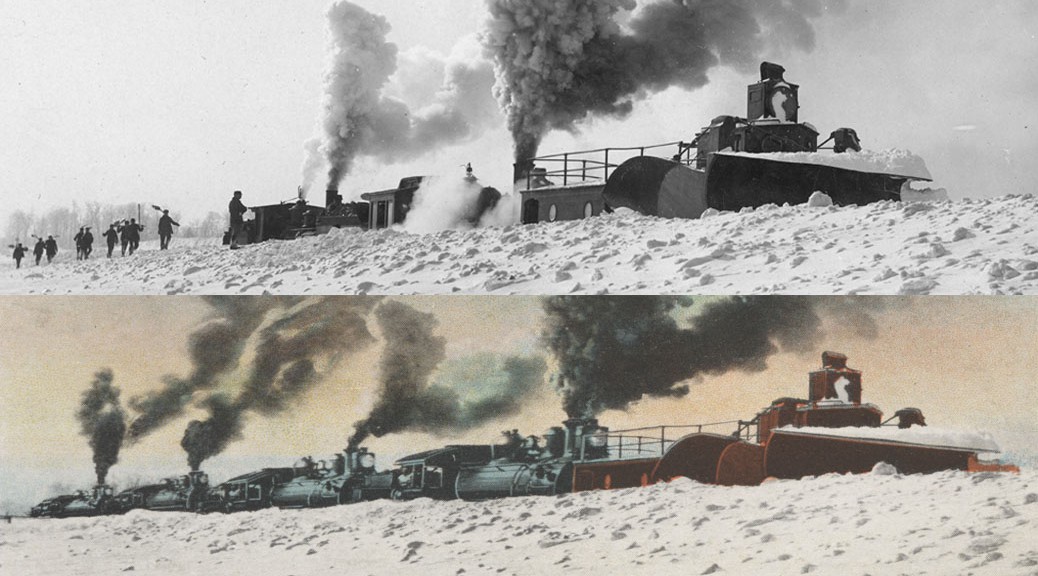
Orson W. Peck (1875-1954) was a famed photographer and postcard maker from Traverse City. One of the hallmarks of his work is Photoshop-like manipulation of film processing, that playfulness often exaggerating features of the scene he was portraying. Here are two photos, one probably borrowed from a fellow postcard maker Edward Beebe (1871-1945), which shows two engines laboring to remove snow from railroad tracks running through Leelanau County. Peck’s version shows no fewer than four engines working just has hard to accomplish the same feat. Then as now, a picture is no guarantee of the truth.
Explore the creative world of early-20th century postcard making, in Jack Hobey’s “Wish You Were Here: The Edward Beebe Story,” available for checkout at Traverse Area District Library. Have your librarian put a copy on hold today!
Ed. Note: The following is adapted from the “Images & Recollections from Port Oneida” series of books produced by Tom VanZoeren in partnership with the Friends of Sleeping Bear Dunes. The books are based on oral histories and photos collected from natives of the farming community, which is now preserved as a Rural Historic District within Sleeping Bear Dunes National Lakeshore. The books are available at area bookstores and through VZOralHistory.com.
The early beginnings of the Werner family in America are now misty—but around 1854 Frederick and Margretha Werner left their crowded, oppressive homeland of Hanover (now a part of Germany) and sailed to the New World with several small children. Arriving in New York, the Werners purchased 202 acres of Port Oneida land, sight-unseen, for 75 cents/acre. They then sailed up the Great Lakes to South Manitou Island to spend the winter. In the spring the young family crossed the Manitou Passage, climbed the steep shoreline bluff, and surveyed their piece of primeval forest. The land was rolling, and included a hilltop that looked over the surrounding lands and waters; but it also included some level ground that promised good crops. The Werners began the task of establishing a home in the wilderness, a half-mile down the coast from the only other white settlers in the area, Margretha’s brother Carsten Burfiend and his family.
Frederick built a small log cabin in a sheltered spot near the bluff above the lake. He then began clearing the virgin forest for a farm. The details of their lives can only be imagined; but it’s told that the family lost three children to pneumonia during the first years in Port Oneida. During following years Margretha bore more children to total 14. Five did not survive childhood, and rest in the family graveyard overlooking the lake.
Among the trials of life on the Great Lakes frontier, early settlers faced raids by the renegade Mormon cult of King James Jesse Strang. Jack Barratt, great-grandson of Margretha’s brother Carsten, told this tale: “The Mormons—when they were on the rampage—they arrived one day at Port Oneida; and my great-grandfather was gone, and only my great-grandmother and the children were home. She took all of the kids upstairs, and there was a trapdoor—I remember this trapdoor at the head of the stairs that came down over the stairway—and she piled all the dressers and the beds and everything she could get on the door so they couldn’t come upstairs. But they took food out of the kitchen and everything they wanted, and before they left, they slashed all the fishing nets that were out on the drying reels, and they took an ax and they put holes in the bottom of the boat.”
Of course, a wilderness pioneer has little means for precisely determining property lines, and after 15 years building a farmstead, the Werners were informed by their neighbor to the north, Thomas Kelderhouse, that their home was on the wrong side of the line. The Werners had to disassemble their hard-built home and farm, and relocate 1/4 mile southwest to the location seen here. There are no foundation remains left to mark the original home site. Great-grandson Charlie Miller believes it was constructed on a base of logs.
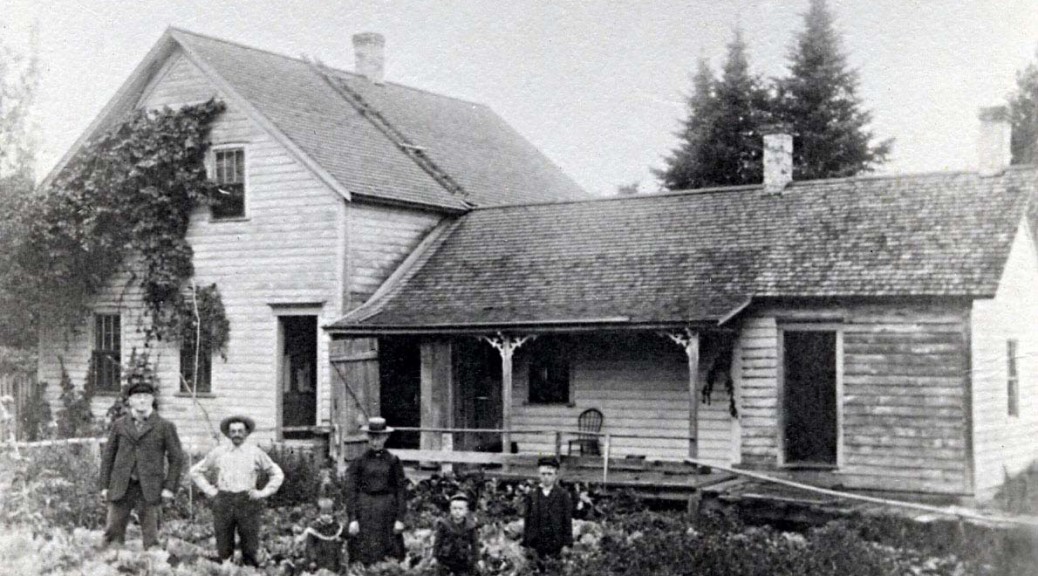
By the time of this earliest family photo, a half-century after arriving in Port Oneida, the Werners’ daughter Margaret had married, and her husband, John Miller, had taken over farm operations. Here they pose in front of their home; L-R, they are pioneer Frederick Werner; his son-in-law John Miller; daughter (Mr. Miller’s wife) Margaret; the Millers’ daughter Annie; their son Charlie; and John Miller’s son by a previous marriage, John. Pioneer Margretha had died five years earlier.
Like most Port Oneida men of his time, John Miller spent his winters working in the logging woods to earn precious cash. An accident there left him with a wooden leg on which to work his farm. Adding to the family’s difficulties, his wife suffered from mental illness. Grandson Charlie Miller recalls, “She liked to bite my sister’s arm. She got put away for a while. Twice she got put away at the state place in Traverse.”
The original log cabin on this site was eventually added onto and covered with clapboard siding, but remained within the walls of the one-story portion of the house seen here. The old house is gone now, but Charlie believes that the tree just peeking above the roof to the left of the larger spruces is the huge cedar that can still be seen south of the end of Miller Road, along the way to the old barn.
VanZoeren is a retired Sleeping Bear Dunes Park Ranger, who now works to preserve Port Oneida history. All of the oral history interviews, their transcripts, and related photos that have been collected have been donated to the public domain and are available in digital form at the Glen Lake Library (Empire) or from Tom. He welcomes your questions, comments, and further Port Oneida information (via email at VZOralHistory.com).
Locally-produced digital magazine featuring nature and local history from the Grand Traverse Region.